
Porongurup National Park is a national park in the Great Southern region of Western Australia. It covers 26.21 square kilometres (10.12 sq mi), and is 360 kilometres (220 mi) southeast of Perth and 40 kilometres (25 mi) north of Albany.

Stirling Range National Park is a national park in the Great Southern region of Western Australia, approximately 337 kilometres (209 mi) south-east of Perth.

The Shire of Plantagenet is a local government area in the Great Southern region of Western Australia, managed from the town of Mount Barker, 360 kilometres (224 mi) south of Perth and 50 kilometres (31 mi) north of Albany. The shire covers an area of 4,792 square kilometres (1,850 sq mi) and includes the communities of Narrikup, Rocky Gully, Kendenup and Porongurup.

Mount Barker is a town and locality on Albany Highway and the administrative centre of the Shire of Plantagenet in the Great Southern region of Western Australia. At the 2021 census, Mount Barker had a population of 2,855.

Castle Rock is a tourist attraction in the Porongurup Range in the Great Southern region of Western Australia and is renowned for its fauna and flora. The rock formation was once named "Alfred's Castle" and until 2012 was plagued as being discovered by Alfred Meadows Gillam. Alfred Meadows Gillam "established a transport business at Katanning and pioneered the transporting of provisions to Mt. Malcolm and Eastern Goldfields by the turn of the century, using wagons and camel teams before the railway was built".

The Granite Belt is an area of the Great Dividing Range in the Darling Downs region of Queensland and the New England region of New South Wales, Australia. The Granite Belt is centred on the town of Stanthorpe. The cool, high country of the granite belt is located on Queensland's southern border. It is the northernmost part of the New England Tablelands.

The Australian wine industry is one of the world's largest exporters of wine, with approximately 800 million out of the 1.2 to 1.3 billion litres produced annually exported to overseas markets. The wine industry is a significant contributor to the Australian economy through production, employment, export, and tourism.

Snake River Valley is Idaho's first American Viticultural Area (AVA) that encompasses an area in southwestern Idaho and two counties in eastern Oregon. The area was established on April 9, 2007 by the Alcohol and Tobacco Tax and Trade Bureau (TTB), Treasury after reviewing the petition submitted by Idahoan vintners of the Snake River Valley, the Idaho Grape Growers and Wine Producers Commission, and the Idaho Department of Commerce and Labor, collectively acting as “petitioner” to establish the 8,263 square miles viticultural area named "Snake River Valley." For wines to bear the "Snake River Valley" label, at least 85% of the grapes used for production must be grown in the designated area, which includes the southwestern Idaho counties of Ada, Adams, Boise, Canyon, Elmore, Gem, Gooding, Jerome, Owyhee, Payette, Twin Falls, and Washington, and the Eastern Oregon counties of Malheur and Baker. The appellation, when established, was resident to 15 wineries and 46 vineyards with 1,800 acres (728 ha) under vine.
North Yuba is an American Viticultural Area (AVA) located in Yuba County, California, United States about 70 miles (113 km) north of Sacramento. It was established on August 30, 1985 by the Bureau of Alcohol, Tobacco, Firearms and Explosives (ATF), Treasury after approving the submitted petition by Karl Werner and James R. Bryant, officers of Renaissance Vineyard and Winery, Inc. in Oregon House. They petitioned ATF for the establishment of a viticultural area to be named "North Yuba.”

Howard Park Wines are Margaret River and Great Southern wine specialists and a family-owned winery owned by the Burch family, which is responsible for such brands as Howard Park, MadFish, and Marchand & Burch. With an established winery based in Margaret River, Western Australia and vineyards in the Great Southern, the Burch family are the first Australians to gain ownership in the production of a French Burgundian Grand Cru.

Western Australian wine refers to wine produced in Australia's largest state, Western Australia. Although the state extends across the western third of the continent, its wine regions are almost entirely situated in the cooler climate of its south-western tip. Western Australia produces less than 5% of the country's wine output, but in quality terms it is very much near the top, winning 30 percent of the country's medals.

The Great Southern wine region is in Western Australia's Great Southern region. It comprises an area 200 kilometres (120 mi) from east to west and over 100 kilometres (62 mi) from north to south, and is Australia's largest wine region.

Gibraltar Rock is a granite outcrop in the Porongurup National Park, south of Perth, in Western Australia. From the rock, which is 640 metres high, Albany and the Great Southern Ocean can be seen. Since the 1970s, the Rock, along with some other local peaks, has become a popular venue for rock climbers.
Tourist Drives in Western Australia are routes through areas of scenic or historic significance, designated by route markers with white numbers on a brown shield. Tourist Drives were introduced into Western Australia while Eric Charlton was the state government Minister for Transport in the 1990s. The 28 numbered routes collectively traverse more than 2,000 kilometres (1,200 mi) across the state. In addition to the Tourist Drives, there are unnumbered routes such as the Golden Pipeline Heritage Trail, and local governments may designate and maintain local scenic drives, generally unnamed and unnumbered.

Plantagenet Wines is an Australian winery based at Mount Barker, in the Great Southern wine region of Western Australia. It includes Bouverie Vineyard in Denbarker, the first commercial vineyard to be planted in the region.

Castle Rock Estate is an Australian winery based at Porongurup, in the Great Southern wine region of Western Australia and owned and operated by the Diletti family. According to prominent Australian wine writer James Halliday, it has an exceptionally beautifully sited and immaculately maintained vineyard, winery and cellar door sales area with sweeping vistas from the Porongurups.
Takalarup is a locality of the Shire of Plantagenet in the Great Southern region of Western Australia. The Stirling Range National Park forms its northern border and the Kalgan River runs through the south-west of the locality. The Chillinup Nature Reserve is located within Takalarup, as is a small section of the South Stirling Nature Reserve.
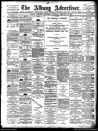
The Albany Advertiser, also published as the Australian Advertiser and the Albany Advertiser and Plantagenet and Denmark Post, is a biweekly English language newspaper published for Albany and the Great Southern region in Western Australia.

Acacia leioderma also commonly known as the Porongurup wattle is a species of wattle which is endemic to an area in the lower Great Southern region of Western Australia centered on Albany.

Chester Pass Road is a 163-kilometre (101 mi) long road that passes through the Stirling Range between Nyabing and Albany in the Great Southern region of Western Australia. It passes close to the access road to the base of Bluff Knoll.


