
The Shire of Cranbrook is a local government area in the Great Southern region of Western Australia, about 92 kilometres (57 mi) north of Albany and about 320 kilometres (200 mi) south-southeast of the state capital, Perth. The Shire covers an area of 3,277 square kilometres (1,265 sq mi), and its seat of government is the town of Cranbrook.

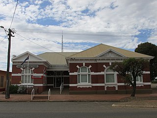
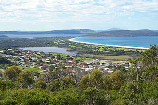
The Shire of Jerramungup is a local government area in the Great Southern region of Western Australia, about 180 kilometres (112 mi) northeast of Albany and about 440 kilometres (273 mi) southeast of the state capital, Perth. The Shire covers an area of 6,507 square kilometres (2,512 sq mi) with Bremer Bay its largest town. The seat of government is the town of Jerramungup.
The Shire of Ravensthorpe is a local government area in the Great Southern region of Western Australia, about halfway between the city of Albany and the town of Esperance and about 530 kilometres (329 mi) southeast of the state capital, Perth. The Shire covers an area of 13,551 square kilometres (5,232 sq mi), and its seat of government is the town of Ravensthorpe.
Boscabel is a town and locality in the Shire of Kojonup, Great Southern region of Western Australia, located north of Kojonup. The Albany Highway passes through the locality, but not the townsite, from north to south.
Jingalup is a town and locality in the Shire of Kojonup, Great Southern region of Western Australia. Jingalup is located between the towns of Kojonup and Cranbrook, on Murrin Brook, which is a tributary of the Tone River. The locality is home to the Jingalup and South Jingalup Nature Reserves.

William Bay is a rural locality of the Shire of Denmark in the Great Southern region of Western Australia, on the shore of the Southern Ocean. The South Coast Highway runs through William Bay from east to west. The entire coastline of William Bay is covered by the William Bay National Park, with both the locality and national park sharing its name with the bay of the Southern Ocean.
Reinscourt is a semi-rural locality of the City of Busselton in the South West region of Western Australia, located on the Vasse River in the south-east of Busselton. The southern border of the locality is formed by the Bussell Highway.

Lowden is a rural locality of the Shire of Donnybrook–Balingup in the South West region of Western Australia. The Preston River and the Donnybrook–Boyup Brook Road run through the centre of the locality from east to west.
Broke is a rural locality of the Shire of Manjimup in the South West region of Western Australia, stretching along the coastline of the Southern Ocean. The South Western Highway forms the north-eastern border of the locality. Most of the locality as covered by national park, predominantly the D'Entrecasteaux National Park, except for the far east, which is covered by the Walpole-Nornalup National Park. The large Broke Inlet lies in the centre of Broke while, in the east, the locality lies on the shore of the Nornalup Inlet.
Collins is a rural locality of the Shire of Manjimup in the South West region of Western Australia. The South Western Highway forms the north-eastern border of the locality while the Vasse Highway runs along its north-western one. The Warren River forms the entire eastern and southern border of Collins. Small sections of the Sir James Mitchell and Gloucester National Park are also located within the locality.

The suburb of Albany is the central business district of the City of Albany in the Great Southern region of Western Australia. The suburb is bounded by the Princess Royal Harbour to the south. The southern terminus of the Albany Highway is located within the suburb, at York Street.

Port Albany is a suburb of the City of Albany in the Great Southern region of Western Australia. The suburb is bounded by the Princess Royal Harbour to the south and King George Sound to the east and is home to the Port of Albany. To the south of Port Albany, the Ataturk Channel, which connects Princess Royal Harbour with King George Sound, separates it from Vancouver Peninsula.
Seppings is a suburb of the City of Albany in the Great Southern region of Western Australia. The suburb is bounded by the King George Sound to the east and home to Lake Seppings and surrounding wetlands. It also contains the south-western half of the Albany Golf Course. Only the area along the northern border of the suburb and a stretch along Middleton Beach are built up with houses.

Youngs Siding is a town and locality of the City of Albany in the Great Southern region of Western Australia. It borders the Wilson Inlet to the west and the South Coast Highway runs through the locality west to east.
Marbelup is a townsite and locality of the City of Albany in the Great Southern region of Western Australia. The South Coast Highway runs through the locality west to east while the Great Southern Railway passes through it from north to south. The Marbelup Nature Reserve surrounds the remaining gazetted townsite, just 4,052 square metres (43,620 sq ft) in size, on three sides but no town actually exists at location.

Torndirrup is a locality of the City of Albany in the Great Southern region of Western Australia. Torndirrup is on a peninsula of the same name and surrounded on three sides by water, with the Southern Ocean in the south and east and the King George Sound in the north-east. It also borders Princess Royal Harbour in the north-west. The entirety of Torndirrup National Park is located within Torndirrup and only small sections of the locality are not part of the national park.
Millbrook is a locality of the City of Albany in the Great Southern region of Western Australia. The King River forms the south-western border of the locality. The Mill Brook runs through the locality from north to south before flowing into the King River at its southern border. The Mill Brook Nature Reserve however is located further upstream, in the locality of Green Valley.
Walmsley is a locality of the City of Albany in the Great Southern region of Western Australia. Chester Pass Road forms the western boundary of Walmsley.
Beaufort River is a rural locality of the Shire of Woodanilling in the Great Southern region of Western Australia. The Albany Highway runs through the locality from north to south, while the Beaufort River runs forms much of its eastern and northern border. A small southern part of the Beaufort Bridge Nature Reserve is located in the north of the locality.
Parryville is a rural locality of the Shire of Denmark in the Great Southern region of Western Australia, on the shore of the Southern Ocean. The South Coast Highway runs through the north of Parryville, and the Owingup and Quarram Nature Reserves are both partially located in Parryville.


