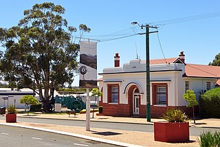
The Shire of Kent is a local government area in the Great Southern region of Western Australia, about 320 kilometres (200 mi) southeast of Perth, the state capital. The Shire covers an area of 5,634 square kilometres (2,175 sq mi) and its seat of government is the town of Nyabing. The area produces grains such as wheat, barley and legumes.

The Shire of Kojonup is a local government area in the Great Southern region of Western Australia, about 250 kilometres (155 mi) southeast of the state capital, Perth, along Albany Highway. The Shire covers an area of 2,932 square kilometres (1,132 sq mi) and its seat of government is the town of Kojonup.

The Shire of Gnowangerup is a local government area in the Great Southern region of Western Australia, about 120 kilometres (75 mi) north of Albany and about 370 kilometres (230 mi) southeast of the capital, Perth. The Shire covers an area of 4,268 square kilometres (1,648 sq mi), and its seat of government is the town of Gnowangerup.

Broomehill East is a rural locality of the Shire of Broomehill–Tambellup of the Great Southern region of Western Australia, adjacent to the town of Broomehill. The Great Southern Highway and the Great Southern Railway, for the most part, form the western border of the locality. The majority of the gazetted townsite of Peringillup and parts of the Peringillup Nature Reserve are located within Broomehill East.
Wansbrough is a rural locality of the Shire of Broomehill–Tambellup in the Great Southern region of Western Australia. The Great Southern Highway and the Great Southern Railway run through the locality from north to south, while the Gordon River forms its north-eastern boundary. The Wansbrough and the Beejenup Nature Reserves are fully located in the locality, while the far northern end of the Balicup Lake Nature Reserve protrudes into the south of Wansbrough. The small eastern part of the gazetted townsite of Pootenup is located in Wansbrough, while the western part is located in Cranbrook, with the border running parallel to the railway line.
Lake Toolbrunup is a rural locality of the Shire of Broomehill–Tambellup in the Great Southern region of Western Australia. The Anderson Lake and the Three Swamps Nature Reserves are located within Lake Toolbrunup.
Kenmare is a rural locality of the Shire of Woodanilling in the Great Southern region of Western Australia. The Beaufort River forms much of the western border of the locality, which reaches as far west as Albany Highway in two places. The Martinup, Murapin, Miripin and Wardering Lake Nature Reserves are all located in the north of Kenmare, while the Wingedine Nature Reserve is located in the south.
Carrolup is a rural locality of the Shire of Katanning in the Great Southern region of Western Australia. The small Carrolup Nature Reserve is located within Carrolup, on the Carrolup River, which flows through the locality from east to west.
South Glencoe is a rural locality of the Shire of Katanning in the Great Southern region of Western Australia. The Johns Well Nature Reserve is located within South Glencoe, as is a small part of the unnamed WA24282 Nature Reserve.

Ewlyamartup is a rural locality of the Shire of Katanning in the Great Southern region of Western Australia. Katanning Airport, Lake Ewlyamartup and the southern end of the Coblinine Nature Reserve are located in Ewlyamartup, while Ewlyamartup Creek runs through it.
Coyrecup is a rural locality of the Shire of Katanning in the Great Southern region of Western Australia. The Coyrecup Nature Reserve, centred around Coyrecup Lake, is located within Coyrecup.
Toompup is a rural locality of the Shire of Gnowangerup in the Great Southern region of Western Australia. Toompup borders the townsite of Borden and Chester Pass Road in the west and the townsite of Ongerup in the north-east. The Toompup Nature Reserve is located within Toompup.

Kebaringup is a town and locality of the Shire of Gnowangerup in the Great Southern region of Western Australia. Kebaringup borders the townsite of Borden to the south-east, while the Pallinup River forms much of its southern border. The Chirelillup Nature Reserve is located within Kebaringup.

Pallinup is a rural locality of the Shire of Gnowangerup in the Great Southern region of Western Australia. Pallinup borders the townsite of Gnowangerup to the east, while the Pallinup River runs through the south-west of the locality. Gnowangerup Airport is also located in Pallinup.
Jackitup is a rural locality of the Shire of Gnowangerup in the Great Southern region of Western Australia. It borders the townsite of Gnowangerup in the south-west of the locality, with the Gnowangerup golf course being in Jackitup.

North Stirlings is a rural locality of the Shire of Gnowangerup in the Great Southern region of Western Australia. It borders Stirling Range National Park to the south. All of Formby Nature Reserve and the eastern part of the Camel Lake Nature Reserve are located within the south of North Stirlings.

Magitup is a rural locality of the Shire of Gnowangerup in the Great Southern region of Western Australia. It borders the townsite of Borden in the north-east. The Pallinup River forms much of its northern border, while Chester Pass Road forms its eastern boundary.
Nalyerlup is a rural locality of the Shire of Gnowangerup in the Great Southern region of Western Australia. Chester Pass Road forms the western border of Nalyerlup.
Monjebup is a rural locality of the Shire of Gnowangerup in the Great Southern region of Western Australia. The Pallinup River forms the southern border of Monjebup. The Greaves Road Nature Reserve is located in the south-west of Monjebup, while the Monjebup Reserve is located in the north.
Mills Lake is a rural locality of the Shire of Gnowangerup in the Great Southern region of Western Australia. Mills Lake borders the townsite of Ongerup in the south-west. The No.2 Rabbit-proof fence once passed through the north-east of the locality.


