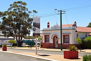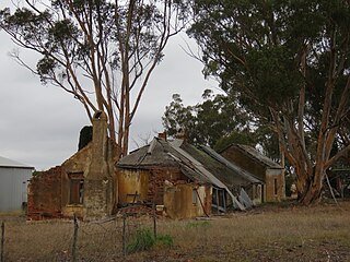
The Shire of Kent is a local government area in the Great Southern region of Western Australia, about 320 kilometres (200 mi) southeast of Perth, the state capital. The Shire covers an area of 5,634 square kilometres (2,175 sq mi) and its seat of government is the town of Nyabing. The area produces grains such as wheat, barley and legumes.

The Shire of Gnowangerup is a local government area in the Great Southern region of Western Australia, about 120 kilometres (75 mi) north of Albany and about 370 kilometres (230 mi) southeast of the capital, Perth. The Shire covers an area of 4,268 square kilometres (1,648 sq mi), and its seat of government is the town of Gnowangerup.

The Shire of Cranbrook is a local government area in the Great Southern region of Western Australia, about 92 kilometres (57 mi) north of Albany and about 320 kilometres (200 mi) south-southeast of the state capital, Perth. The Shire covers an area of 3,277 square kilometres (1,265 sq mi), and its seat of government is the town of Cranbrook.

The Shire of Jerramungup is a local government area in the Great Southern region of Western Australia, about 180 kilometres (112 mi) northeast of Albany and about 440 kilometres (273 mi) southeast of the state capital, Perth. The Shire covers an area of 6,507 square kilometres (2,512 sq mi) with Bremer Bay its largest town. The seat of government is the town of Jerramungup.

The Shire of Katanning is a local government area in the Great Southern region of Western Australia, about 170 kilometres (106 mi) north of Albany and about 290 kilometres (180 mi) southeast of the state capital, Perth. The Shire covers an area of 1,518 square kilometres (586 sq mi), and its seat of government is the town of Katanning.

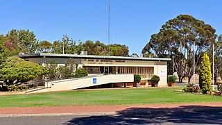
The Shire of Broomehill-Tambellup is a local government area in the Great Southern region of Western Australia, 320 kilometres (200 mi) south-southeast of the state capital, Perth. The Shire covers an area of 2,609.1 square kilometres (1,007.4 sq mi), and its seat of government is the town of Tambellup. It came into existence in 2008 through the amalgamation of the former Shire of Broomehill and Shire of Tambellup.
Jingalup is a town and locality in the Shire of Kojonup, Great Southern region of Western Australia. Jingalup is located between the towns of Kojonup and Cranbrook, on Murrin Brook, which is a tributary of the Tone River. The locality is home to the Jingalup and South Jingalup Nature Reserves.

Broomehill East is a rural locality of the Shire of Broomehill–Tambellup of the Great Southern region of Western Australia, adjacent to the town of Broomehill. The Great Southern Highway and the Great Southern Railway, for the most part, form the western border of the locality. The majority of the gazetted townsite of Peringillup and parts of the Peringillup Nature Reserve are located within Broomehill East.
Bobalong is a rural locality of the Shire of Broomehill–Tambellup in the Great Southern region of Western Australia. The Great Southern Highway, the Great Southern Railway and the Gordon River all run through the locality from north to south.
Moonies Hill is a rural locality of the Shire of Broomehill–Tambellup in the Great Southern region of Western Australia. The Gordon River forms the south-eastern border of the locality. In the north-east, it borders the townsite of Tambellup.
Dartnall is a rural locality of the Shire of Broomehill–Tambellup in the Great Southern region of Western Australia. The Great Southern Highway and the Great Southern Railway form the far western border of the locality.
Lake Toolbrunup is a rural locality of the Shire of Broomehill–Tambellup in the Great Southern region of Western Australia. The Anderson Lake and the Three Swamps Nature Reserves are located within Lake Toolbrunup.
Carrolup is a rural locality of the Shire of Katanning in the Great Southern region of Western Australia. The small Carrolup Nature Reserve is located within Carrolup, on the Carrolup River, which flows through the locality from east to west.
South Glencoe is a rural locality of the Shire of Katanning in the Great Southern region of Western Australia. The Johns Well Nature Reserve is located within South Glencoe, as is a small part of the unnamed WA24282 Nature Reserve.
Marracoonda is a rural locality of the Shire of Katanning in the Great Southern region of Western Australia. The Great Southern Highway runs through the locality from its north-western corner to the eastern border.

Ewlyamartup is a rural locality of the Shire of Katanning in the Great Southern region of Western Australia. Katanning Airport, Lake Ewlyamartup and the southern end of the Coblinine Nature Reserve are located in Ewlyamartup, while Ewlyamartup Creek runs through it.
Coyrecup is a rural locality of the Shire of Katanning in the Great Southern region of Western Australia. The Coyrecup Nature Reserve, centred around Coyrecup Lake, is located within Coyrecup.
Toompup is a rural locality of the Shire of Gnowangerup in the Great Southern region of Western Australia. Toompup borders the townsite of Borden and Chester Pass Road in the west and the townsite of Ongerup in the north-east. The Toompup Nature Reserve is located within Toompup.

Kebaringup is a town and locality of the Shire of Gnowangerup in the Great Southern region of Western Australia. Kebaringup borders the townsite of Borden to the south-east, while the Pallinup River forms much of its southern border. The Chirelillup Nature Reserve is located within Kebaringup.

Pallinup is a rural locality of the Shire of Gnowangerup in the Great Southern region of Western Australia. Pallinup borders the townsite of Gnowangerup to the east, while the Pallinup River runs through the south-west of the locality. Gnowangerup Airport is also located in Pallinup.


