
The Shire of Kojonup is a local government area in the Great Southern region of Western Australia, about 250 kilometres (155 mi) southeast of the state capital, Perth, along Albany Highway. The Shire covers an area of 2,932 square kilometres (1,132 sq mi) and its seat of government is the town of Kojonup.

The Shire of Woodanilling is a local government area in the Great Southern region of Western Australia, about 30 kilometres (19 mi) south of Wagin and about 260 kilometres (162 mi) south-southeast of the state capital, Perth. The Shire covers an area of 1,129 square kilometres (436 sq mi), and its seat of government is the town of Woodanilling.
Nyabing is a small town and locality in the Great Southern region of Western Australia. The name is of Aboriginal origin and is thought to derive from the Aboriginal word "ne-yameng", which is the name of an everlasting flower Rhodanthe manglesii. It is one of two localities in the Shire of Kent, the other being Pingrup, covering the east of the shire.
Pingrup is a small town and locality in the Great Southern region of Western Australia. It is one of two localities in the Shire of Kent, the other being Nyabing, covering the west of the shire.
Jingalup is a town and locality in the Shire of Kojonup, Great Southern region of Western Australia. Jingalup is located between the towns of Kojonup and Cranbrook, on Murrin Brook, which is a tributary of the Tone River. The locality is home to the Jingalup and South Jingalup Nature Reserves.
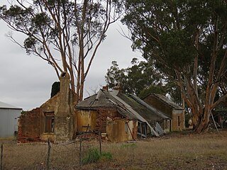
Muradup is a small town and locality in the Shire of Kojonup, Great Southern region of Western Australia. Muradup is located between Kojonup and Boyup Brook, and is situated along the Balgarup River. The Narlingup Nature Reserve is located in the west of Muradup.
Broomehill East is a rural locality of the Shire of Broomehill–Tambellup of the Great Southern region of Western Australia, adjacent to the town of Broomehill. The Great Southern Highway and the Great Southern Railway, for the most part, form the western border of the locality. The majority of the gazetted townsite of Peringillup and parts of the Peringillup Nature Reserve are located within Broomehill East.
Wansbrough is a rural locality of the Shire of Broomehill–Tambellup in the Great Southern region of Western Australia. The Great Southern Highway and the Great Southern Railway run through the locality from north to south, while the Gordon River forms its north-eastern boundary. The Wansbrough and the Beejenup Nature Reserves are fully located in the locality, while the far northern end of the Balicup Lake Nature Reserve protrudes into the south of Wansbrough. The small eastern part of the gazetted townsite of Pootenup is located in Wansbrough, while the western part is located in Cranbrook, with the border running parallel to the railway line.
Lake Toolbrunup is a rural locality of the Shire of Broomehill–Tambellup in the Great Southern region of Western Australia. The Anderson Lake and the Three Swamps Nature Reserves are located within Lake Toolbrunup.
Kenmare is a rural locality of the Shire of Woodanilling in the Great Southern region of Western Australia. The Beaufort River forms much of the western border of the locality, which reaches as far west as Albany Highway in two places. The Martinup, Murapin, Miripin and Wardering Lake Nature Reserves are all located in the north of Kenmare, while the Wingedine Nature Reserve is located in the south.
Carrolup is a rural locality of the Shire of Katanning in the Great Southern region of Western Australia. The small Carrolup Nature Reserve is located within Carrolup, on the Carrolup River, which flows through the locality from east to west.
South Glencoe is a rural locality of the Shire of Katanning in the Great Southern region of Western Australia. The Johns Well Nature Reserve is located within South Glencoe, as is a small part of the unnamed WA24282 Nature Reserve.
Woogenellup, sometimes also spelled Woogenilup, is a rural locality of the Shire of Plantagenet in the Great Southern region of Western Australia. The eastern border of Woogenellup is formed by Chester Pass Road, while the southern boundary of the Stirling Range National Park forms its northern border. The Kalgan River runs through the locality from north-west to south-east, and the Kalgan Plains Nature Reserve is located within Woogenellup, south of the river.
Perillup is a rural locality of the Shire of Plantagenet in the Great Southern region of Western Australia. The Muir Highway passes through the locality from west to east while the Kent River passes through its north before forming much of its western border. Most of the locality south of the highway is taken up by the Mount Roe National Park while, to the north of the highway, the Randell Road and the unnamed WA11343 Nature Reserves are located.
Forest Hill is a rural locality of the Shire of Plantagenet in the Great Southern region of Western Australia. The Muir Highway passes through the locality from west to east, as does the Hay River. The Pardelup, Pardelup Road, Kwornicup Lake and Wamballup Nature Reserves are located within Forest Hill. Pardelup Prison Farm is also located within Forest Hill.
Orchid Valley is a rural locality of the Shire of Kojonup in the Great Southern region of Western Australia. The Tone River forms the south-eastern border of the locality. The Mettabinup Nature Reserve is located within Orchid Valley.
Cherry Tree Pool is a rural locality of the Shire of Kojonup in the Great Southern region of Western Australia. The Carrolup River forms much of its northern border. The Birdwood and Cherry Tree Pool Nature Reserves and the Kojonup Reserve are located within Cherry Tree Pool, as is an unnamed nature reserve.
Toompup is a rural locality of the Shire of Gnowangerup in the Great Southern region of Western Australia. Toompup borders the townsite of Borden and Chester Pass Road in the west and the townsite of Ongerup in the north-east. The Toompup Nature Reserve is located within Toompup.
Monjebup is a rural locality of the Shire of Gnowangerup in the Great Southern region of Western Australia. The Pallinup River forms the southern border of Monjebup. The Greaves Road Nature Reserve is located in the south-west of Monjebup, while the Monjebup Reserve is located in the north.

Lowlands Nature Reserve is located in the Swan Coastal Plain bioregion of Western Australia, on the Serpentine River. While local signage and operational guidelines identify it as Lowlands Nature Reserve, official maps refer to the nature reserve as Unnamed WA51784 Nature Reserve.

