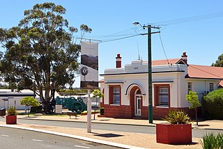
The Shire of Plantagenet is a local government area in the Great Southern region of Western Australia, managed from the town of Mount Barker, 360 kilometres (224 mi) south of Perth and 50 kilometres (31 mi) north of Albany. The shire covers an area of 4,792 square kilometres (1,850 sq mi) and includes the communities of Narrikup, Rocky Gully, Kendenup and Porongurup.

Cranbrook is a small town in the Shire of Cranbrook in the Great Southern region of Western Australia between Katanning, Kojonup and Mount Barker, situated 320 km south of Perth. It is billed as "The Gateway to the Stirlings", referring to the nearby Stirling Range National Park. At the 2006 census, Cranbrook had a population of 280.

Narrikup is a small town and locality of the Shire of Plantagenet in the Great Southern region of Western Australia. Narrikup is located between Albany and Mount Barker. At the 2006 census, Narrikup had a population of 515.

The Shire of Gnowangerup is a local government area in the Great Southern region of Western Australia, about 120 kilometres (75 mi) north of Albany and about 370 kilometres (230 mi) southeast of the capital, Perth. The Shire covers an area of 4,268 square kilometres (1,648 sq mi), and its seat of government is the town of Gnowangerup.

The Shire of Capel is a local government area in the South West region of Western Australia, taking in the land between the cities of Bunbury and Busselton about 200 kilometres (124 mi) south of the state capital, Perth. The Shire covers an area of 557.6 square kilometres (215.3 sq mi), and its seat of government is the town of Capel.

The Shire of Cranbrook is a local government area in the Great Southern region of Western Australia, about 92 kilometres (57 mi) north of Albany and about 320 kilometres (200 mi) south-southeast of the state capital, Perth. The Shire covers an area of 3,277 square kilometres (1,265 sq mi), and its seat of government is the town of Cranbrook.

Rocky Gully is a small town and locality of the Shire of Plantagenet in the Great Southern region of Western Australia. A large part of the south of the locality is covered by the Mount Roe National Park. Additionally, the Tootanellup Nature Reserve is also located within Rocky Gully.
South Stirling is a townsite and locality of the City of Albany in the Great Southern region of Western Australia. The entirety of the townsite is now located within the South Stirling Nature Reserve. it is located 75 kilometres (47 mi) north-east of Albany. At the 2021 census, it had a population of 22. It is situated at the foot of the Stirling Range. Other close small towns are Mount Barker, Wellstead, and Manypeaks.
Jingalup is a town and locality in the Shire of Kojonup, Great Southern region of Western Australia. Jingalup is located between the towns of Kojonup and Cranbrook, on Murrin Brook, which is a tributary of the Tone River. The locality is home to the Jingalup and South Jingalup Nature Reserves.
Green Valley is a locality of the City of Albany in the Great Southern region of Western Australia. The Albany Highway forms the western border of the locality.
Palmdale is a rural locality of the City of Albany in the Great Southern region of Western Australia. The Kalgan River forms the western boundary of the locality, with the Granite Hill Nature Reserve stretching along the river in the north of Palmdale.
Napier is a rural locality of the City of Albany in the Great Southern region of Western Australia. The Kalgan River forms the north-eastern boundary of the locality, with the Granite Hill Nature Reserve stretching along the river in this section. The Napier Nature Reserve is also located within Napier. Chester Pass Road passes through Napier from south to north.
Broomehill West is a rural locality of the Shire of Broomehill–Tambellup of the Great Southern region of Western Australia, adjacent to the town of Broomehill. The Great Southern Highway and the Great Southern Railway, for the most part, form the eastern border of the locality. A small part of the gazetted townsite of Peringillup and a major part of the Peringillup Nature Reserve are located within Broomehill West.

Broomehill East is a rural locality of the Shire of Broomehill–Tambellup of the Great Southern region of Western Australia, adjacent to the town of Broomehill. The Great Southern Highway and the Great Southern Railway, for the most part, form the western border of the locality. The majority of the gazetted townsite of Peringillup and parts of the Peringillup Nature Reserve are located within Broomehill East.
Wansbrough is a rural locality of the Shire of Broomehill–Tambellup in the Great Southern region of Western Australia. The Great Southern Highway and the Great Southern Railway run through the locality from north to south, while the Gordon River forms its north-eastern boundary. The Wansbrough and the Beejenup Nature Reserves are fully located in the locality, while the far northern end of the Balicup Lake Nature Reserve protrudes into the south of Wansbrough. The small eastern part of the gazetted townsite of Pootenup is located in Wansbrough, while the western part is located in Cranbrook, with the border running parallel to the railway line.
Lake Toolbrunup is a rural locality of the Shire of Broomehill–Tambellup in the Great Southern region of Western Australia. The Anderson Lake and the Three Swamps Nature Reserves are located within Lake Toolbrunup.
South Glencoe is a rural locality of the Shire of Katanning in the Great Southern region of Western Australia. The Johns Well Nature Reserve is located within South Glencoe, as is a small part of the unnamed WA24282 Nature Reserve.
Coblinine is a rural locality of the Shire of Katanning in the Great Southern region of Western Australia. The Coblinine Nature Reserve, situated along the Coblinine River, is located in Coblinine.
Woogenellup, sometimes also spelled Woogenilup, is a rural locality of the Shire of Plantagenet in the Great Southern region of Western Australia. The eastern border of Woogenellup is formed by Chester Pass Road, while the southern boundary of the Stirling Range National Park forms its northern border. The Kalgan River runs through the locality from north-west to south-east, and the Kalgan Plains Nature Reserve is located within Woogenellup, south of the river.
Forest Hill is a rural locality of the Shire of Plantagenet in the Great Southern region of Western Australia. The Muir Highway passes through the locality from west to east, as does the Hay River. The Pardelup, Pardelup Road, Kwornicup Lake and Wamballup Nature Reserves are located within Forest Hill. The Pardelup Prison Farm is also located within Forest Hill.


