Coomooroo, South Australia

Last updated

Coomooroo
South Australia
Australia South Australia location map.svg
Red pog.svg
Coomooroo
Coordinates 32°37′S138°28′E / 32.62°S 138.46°E / -32.62; 138.46 [1]
Population13 (SAL 2021) [2]
Postcode(s) 5431 [1]
LGA(s)
State electorate(s) Stuart [1]
Federal division(s) Grey [1]
Localities around Coomooroo:
Hammond Hammond
Eurelia
Eurelia
Amyton
Morchard
Coomooroo Walloway
Orroroo
Morchard Morchard
Pekina
Orroroo
FootnotesAdjoining localities [1]

Coomooroo is a rural locality in the Mid North region of South Australia, approximately 3 hours' drive north of Adelaide. [1] With a population of 13 as of 2021, Coomooroo is now considered a ghost town. [3]

Contents

Most of Coomooroo lies within the District Council of Orroroo Carrieton. However, a small section on its western end lies within the District Council of Mount Remarkable. The Orroroo Carrieton section consists of a diagonal rural strip of the cadastral Hundred of Coomooroo separating the towns of Morchard and Walloway, with narrow strips of the Hundreds of Eurelia and Pinda at its north-western end. [1]

History

Hundred of Coomooroo, 1878 (22921898492).jpg

Coomooroo is situated on the traditional lands of the Ngadjuri people. The Ngadjuri have been largely overlooked in the histories of colonization and the subsequent dispossession from their traditional lands. [4]

The locality derives its name from the Hundred of Coomooroo, which Governor Anthony Musgrave named in 1875 after a word meaning "small food seeds" in an unknown Aboriginal language. [5] While the area was informally known as Poverty Corner, it was formally named Coomooroo at the request of the District Council of Mount Remarkable. [6] In 1882, newly-opened Hundreds, including portions of the Hundred of Coomooroo, were put up for sale. [7]

The settlement process in the Upper North of South Australia is an intriguing case study of the economic and social changes brought about by land reform legislation in the 1860s. Within a decade, an extensive area of pastoral land was transformed into agricultural use, making it one of the most remarkable instances of its kind in Australia. [8]

Coomooroo lies just north of Goyder's Line, which marks the boundary of land suitable for cropping due to rainfall levels. North of Goyder's Line, the annual rainfall is generally insufficient to support crops, limiting the land to grazing purposes. Despite some development efforts in the region, adverse conditions repeatedly hindered progress. As early as 1876, the South Australian Register reported on the challenges faced by settlers in Coomooroo due to unfavorable weather conditions. [9]

Morchard and Coomooroo 125 Year Commemoration Plaque Morchard and Coomooroo 125 Year Plaque.jpg
Morchard and Coomooroo 125 Year Commemoration Plaque

The Coomooroo School opened its doors in 1881 and remained in operation until its closure in 1917. [5] The residents petitioned for a post office, but ultimately one was established in nearby Morchard instead. [10] At different points in the town history, Coomoroo had community organisations such as an Agricultural Board, a dog coursing club, [11] cricket club, and tennis club. [12] Notably, one Coomooroo resident, Robert Wilfred Robertson, was killed in action in World War 1 and is commemorated at the Australian War Memorial. [13]

In 1976, a book titled "Reflections: The story of the Morchard District and the Hundred of Coomooroo" was compiled in conjunction with the centenary celebrations of Morchard and Coomooroo. [14] Additionally, in 2001, a plaque commemorating 125 years of European settlement in Morchard and Coomooroo was erected in nearby Morchard. [15]

Landmarks

The historic Pekina Run Ruins, located at the south-eastern tip of Coomooroo, are listed on the South Australian Heritage Register. [16] The Pekina Run ruins are significant as the relatively well-preserved remains of an early and large homestead complex of the 1840s, completely abandoned and allowed to fall into ruin after the Strangways land resumptions of the 1870s.

Related Research Articles

Tarcowie is a town in South Australia. Tarcowie is an aboriginal word meaning "torrential waters". It was named by Governor Musgrave on 20 May 1875.

<span class="mw-page-title-main">Orroroo, South Australia</span> Town in South Australia

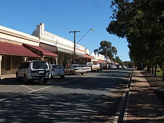
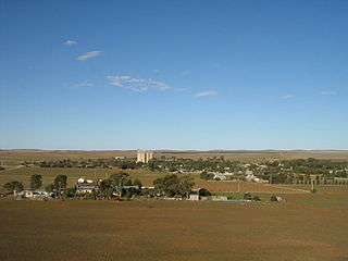
Orroroo is a town in the Yorke and Mid North region of South Australia. At the 2016 census, the locality of Orroroo had a population of 610 while its urban centre had a population of 537. The Wilmington-Ucolta Road passes through here, intersecting with the RM Williams Way which leads to the Birdsville and Oodnadatta Tracks. The Peterborough–Quorn railway line extended from Peterborough to Orroroo also in 1881 and Quorn in 1882, connecting with the new Central Australia Railway from Port Augusta. These railways have now been abandoned. Orroroo is situated near Goyder's Line, a line drawn up in 1865 by Surveyor General Goyder which he believed indicated the edge of the area suitable for agriculture.

<span class="mw-page-title-main">District Council of Orroroo Carrieton</span> Local government area in South Australia

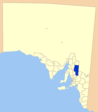
The District Council of Orroroo Carrieton is a local government area in the Yorke and Mid North region of South Australia. The principal towns are Orroroo and Carrieton; it also includes the localities of Belton, Black Rock, Coomooroo, Erskine, Eurelia, Johnburgh, Minburra, Pekina, Walloway, Yalpara and Yanyarrie, and part of Cradock, Hammond, Moockra, Morchard, Tarcowie and Yatina.

<span class="mw-page-title-main">Carrieton</span> Town in South Australia

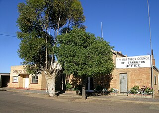
Carrieton is a small town situated in the Flinders Ranges of South Australia. It is located between the towns of Orroroo to the south and Cradock to the north.

<span class="mw-page-title-main">District Council of Mount Remarkable</span> Local government area in South Australia

The Mount Remarkable District Council is a local government area located between the top of the Spencer Gulf and the base of the Southern Flinders Ranges in South Australia. The district encompasses a wide variety of towns, including coastal ports and agricultural centres. The economy of the district council is largely based on agriculture.

<span class="mw-page-title-main">Regional Council of Goyder</span> Local government area in South Australia

The Regional Council of Goyder is a local government area located in the Mid North region of South Australia. The council area is reliant on agriculture as a mainstay of its economy, with manufacturing and tourism also becoming prominent. The council seat is at Burra. A branch office is at Eudunda.

<span class="mw-page-title-main">Eurelia</span> Town in South Australia

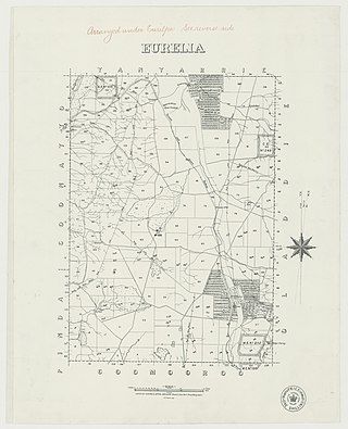
Eurelia is a town and locality in the Australian state of South Australia located on the east side of the Flinders Ranges about 264 kilometres (164 mi) north of the state capital of Adelaide and about 20 kilometres (12 mi) from the municipal seat of Orroroo.

<span class="mw-page-title-main">Yatina</span> Town in South Australia

Yatina is a town and locality in the Australian state of South Australia located on the RM Williams Way about 222 kilometres (138 mi) north of the state capital of Adelaide and about 31 kilometres (19 mi) and 21 kilometres (13 mi) respectively from the municipal seats of Jamestown and Orroroo.

Pekina is a town and locality in the Mid North region of South Australia. The town is located in the District Council of Orroroo Carrieton local government area, 270 kilometres (170 mi) north of the state capital, Adelaide. At the 2006 census, Pekina and the surrounding area had a population of 172. The name of the town is thought to derive from the Aboriginal word for "creek water".

Newcastle was an electoral district of the House of Assembly in the Australian state of South Australia from 1884 to 1902 and again from 1915 to 1956.

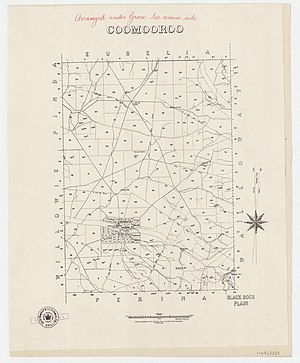
The District Council of Orroroo was a local government area in South Australia, centred on the town of Orroroo. It was gazetted on 5 January 1888 under the provisions of the District Councils Act 1887 and included all the land defined by the hundreds of Black Rock Plain, Coomooroo, Erskine, Pekina, and Walloway in the County of Dalhousie.

<span class="mw-page-title-main">District Council of Carrieton</span> Local government area in South Australia

The District Council of Carrieton was a local government area in South Australia, centred on the town of Carrieton from 1888 until 1997.

Belton is a rural locality in South Australia, located in the District Council of Orroroo Carrieton. It is traversed by the Carrieton-Barata Road, the Carrieton-Belton Road and the Weira Creek. The locality was established on 26 April 2013 in respect to “the long established local name.”

<span class="mw-page-title-main">Walloway, South Australia</span> Locality on the former Peterborough–Quorn railway line in South Australia

Walloway is a locality in the Australian state of South Australia located about 255 kilometres (158 mi) north of the state capital of Adelaide and about 10 kilometres (6.2 mi) north of the municipal seat of Orroroo.

<span class="mw-page-title-main">County of Dalhousie (South Australia)</span> Cadastral in South Australia

The County of Dalhousie is one of the 49 cadastral counties of South Australia in straddling the Mid North and Flinders Ranges regions. It was proclaimed in 1871 by Governor James Fergusson and was named for Fergusson's father-in-law James Broun-Ramsay, 1st Marquess of Dalhousie.

Erskine is a locality in the Australian state of South Australia located about 250 kilometres (160 mi) north of the state capital of Adelaide and about 22 kilometres (14 mi) north-east of the municipal seat in Orroroo.

<span class="mw-page-title-main">Yalpara, South Australia</span> Suburb of District Council of Orroroo Carrieton, South Australia

Yalpara is a locality in the Australian state of South Australia located about 265 kilometres (165 mi) north of the state capital of Adelaide and about 29 kilometres (18 mi) north-east of the municipal seat in Orroroo.

Moockra is a locality in the Australian state of South Australia located on the eastern side of the Flinders Ranges about 274 kilometres (170 mi) north of the state capital of Adelaide and about 47 kilometres (29 mi) north-east and 36 kilometres (22 mi) south-east respectively of the municipal seats of Melrose and Quorn.

<span class="mw-page-title-main">Johnburgh, South Australia</span> Suburb of District Council of Orroroo Carrieton, South Australia

Johnburgh is a former town and a locality in the Australian state of South Australia located on the eastern side of the Flinders Ranges about 275 kilometres (171 mi) north of the state capital of Adelaide and about 32 kilometres (20 mi) north-east of the municipal seat of Orroroo.

Yanyarrie is a locality in the Australian state of South Australia located on the eastern side of the Flinders Ranges about 289 kilometres (180 mi) north of the state capital of Adelaide and about and 45 kilometres (28 mi) north of the municipal seat of Orroroo.

References

  1. 1 2 3 4 5 6 7 "Search result(s) for Coomooroo, 5431". Location SA Map Viewer. Government of South Australia. Retrieved 16 February 2016.
  2. Australian Bureau of Statistics (28 June 2022). "Coomooroo (Suburb and Locality)". Australian Census 2021 QuickStats. Retrieved 28 June 2022.  OOjs UI icon edit-ltr-progressive.svg
  3. "Ghost Towns of South Australia's Upper North | Cya On The Road". audio-tours.cyaontheroad.com. Retrieved 10 June 2023.
  4. "Decolonizing archaeological theory and practice", Indigenous Archaeologies, Routledge, pp. 29–39, 10 November 2004, retrieved 10 June 2023
  5. 1 2 State Library of South Australia (10 June 2023). "Place Names of South Australia" (PDF).
  6. "Search result(s) for Coomooroo, 5431". Property Location Browser. Government of South Australia. Archived from the original on 12 October 2016. Retrieved 17 February 2016.
  7. "Newly opened country lands for selection November 14th 1882 [cartographic material] : Coomooroo ." State Library of South Australia. Retrieved 10 June 2023.
  8. Department for Environment and Water (10 June 2023). "Heritage of the Upper North" (PDF).
  9. "COOMOOROO, September 22". South Australian Register. 30 September 1876. Retrieved 10 June 2023.
  10. "MEETING AT COOMOOROO". Adelaide Observer. 30 June 1877. Retrieved 10 June 2023.
  11. "COOMOOROO MEETING". Petersburg Times. 19 July 1912. Retrieved 10 June 2023.
  12. "COOMOOROO". Quorn Mercury. 8 August 1919. Retrieved 10 June 2023.
  13. "Robert Wilfred Robertson". www.awm.gov.au. Retrieved 10 June 2023.
  14. Morchard District Centenary Book Committee, ed. (1976). Reflections: the story of the Morchard District and the Hundred of Coomooroo. Morchard, S.A: Morchard District Centenary Book Committee. ISBN   978-0-9597326-0-3.
  15. Monument Australia (10 June 2023). "125 Years of Morchard & Hundred of Coomooroo".
  16. "Pekina Run Ruins (designated place of archaeological significance)". South Australian Heritage Register. Department of Environment, Water and Natural Resources. Retrieved 19 March 2016.