Corners, Missouri

Last updated

Corners, Perry County, Missouri
Map of Missouri highlighting Perry County.svg
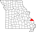
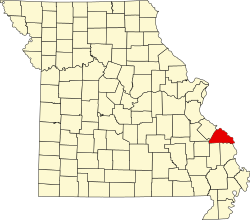
Location of Perry County, Missouri
Coordinates: 37°39′23″N90°06′39″W / 37.65639°N 90.11083°W / 37.65639; -90.11083
Country United States
State Missouri
County Perry
Township St. Mary's
Elevation
[1]
804 ft (245 m)
Time zone UTC-6 (Central (CST))
  Summer (DST) UTC-5 (CDT)
ZIP code
63775
Area code 573
GNIS feature ID739934 [1]

Corners is an unincorporated community in Saint Mary's Township in Perry County, Missouri, United States. [2] Corners is situated in the southwest corner of Perry County, near the St. Francois County line, northwest of Yount. [3] The name is presumed to have been derived from its location in the corner of Perry County, as with Crossroads. [2]

Related Research Articles

<span class="mw-page-title-main">Yount, Missouri</span> Unincorporated settlement in the American state of Missouri

Yount is an unincorporated settlement in Saint Mary's Township in Perry County, Missouri.

<span class="mw-page-title-main">Highland, Missouri</span> Unincorporated settlement in the American state of Missouri

Highland is an unincorporated community in Cinque Hommes Township in Perry County, Missouri, United States.

<span class="mw-page-title-main">Millheim, Missouri</span> Unincorporated settlement in the American state of Missouri

Millheim is an unincorporated settlement in Cinque Hommes Township in Perry County, Missouri, United States.

<span class="mw-page-title-main">Shawneetown, Missouri</span> Unincorporated community in the American state of Missouri

Shawneetown is an unincorporated community in Shawnee Township in northern Cape Girardeau County, Missouri, United States. It is located twenty miles north of Cape Girardeau and is part of the Cape Girardeau–Jackson, MO-IL Metropolitan Statistical Area.

<span class="mw-page-title-main">Eureka, Perry County, Missouri</span> Unincorporated community in the American state of Missouri

Eureka is an unincorporated community in Cinque Hommes Township in Perry County, Missouri, United States. Eureka lies approximately eight miles east of Perryville, and about one mile east of Longtown. Eureka was named after the nearby school.

<span class="mw-page-title-main">Schalls, Missouri</span> Unincorporated community in the American state of Missouri

Schalls is an unincorporated community in Union Township in Perry County, Missouri, United States. Schalls is situated in the north-central corner of Perry County. A post office was maintained from 1886 through 1910. The community was named after Maritz Schall, a pioneer stock dealer and farmer.

<span class="mw-page-title-main">Pointrest, Missouri</span> Abandoned village in Missouri, United States

Pointrest was an unincorporated community in Bois Brule Township in Perry County, Missouri, United States.

<span class="mw-page-title-main">Buchanan, Missouri</span> Unincorporated community in Missouri, United States

Buchanan is an unincorporated community in the southern part of Filmore Township in Bollinger County, Missouri, United States. The community lies approximately 18 miles southwest of Marble Hill and was named after James Buchanan, the fifteenth president of the United States, who served in office from 1857 to 1861. A post office was established in 1857 and remained in operation until 1940.

<span class="mw-page-title-main">Castor, Missouri</span> Unincorporated community in Missouri, United States

Castor is an unincorporated community in the northwestern part of Filmore Township in Bollinger County, Missouri, United States. Castor is situated on the Castor River and is located approximately 16 miles west of Marble Hill.

<span class="mw-page-title-main">Dongola, Missouri</span> Unincorporated community in the American state of Missouri

Dongola is an unincorporated community in the southern part of Liberty Township in Bollinger County, Missouri, United States. The community is located nine miles south of Marble Hill on Missouri Route 51.

<span class="mw-page-title-main">Drum, Missouri</span> Unincorporated community in the American state of Missouri

Drum is an unincorporated community in the eastern part of Liberty Township in Bollinger County, Missouri, United States. The community was named for the Drum family, who were prominent pioneers. A post office operated between the years 1893–1916.

<span class="mw-page-title-main">Glennon, Missouri</span> Unincorporated community in Missouri, United States

Glennon is an unincorporated community in the eastern part of Liberty Township in Bollinger County, Missouri, United States.

<span class="mw-page-title-main">Greenbrier, Missouri</span> Unincorporated community in Missouri, United States

Greenbrier is an unincorporated community in the southeastern part of Wayne Township in Bollinger County, Missouri, United States. The name Greenbrier been attributed as being due to the vegetation growing in the area, particularly blackberry and other green briers. The community was situated along the branch railroad which connected Brownwood in Stoddard County to Zalma. A post office was in operation between the years 1889–1957.

<span class="mw-page-title-main">Hahn, Missouri</span> Unincorporated community in the American state of Missouri

Hahn is an unincorporated community in the part of Wayne Township in Bollinger County, Missouri, United States. The community was established in 1895 and was named for Daniel Hahn, who settled in 1805 on the creek which also bears his name. The Hahns were one of the early families who settled in the area. A post office was in operation between 1895–1954.

<span class="mw-page-title-main">Laflin, Missouri</span> Unincorporated community in Missouri, United States

Laflin is an unincorporated community in the southeastern part of Lorance Township in Bollinger County, Missouri, United States. The community is on the Crooked Creek floodplain at the end of Missouri Route U. Marble Hill is approximately 4.5 miles to the northwest.

<span class="mw-page-title-main">Lixville, Missouri</span> Unincorporated community in Missouri, United States

Lixville is an unincorporated community in the northeastern part of Whitewater Township in the northeast part of Bollinger County, Missouri, United States. Lixville lies seven miles northeast of Alliance. An early pioneer to settle in the area of Lixville was a German immigrant named Henry Lix. The community was officially established in 1897 and was named for the first post master, Louis W. Lix. A post office was in operation between the years 1895–1945.

<span class="mw-page-title-main">Lodge, Missouri</span> Unincorporated community in Missouri, United States

Lodge is an unincorporated community in the western part of Lorance Township in Bollinger County, Missouri, United States. A post office was in service between 1880 and 1942.

<span class="mw-page-title-main">Mayfield, Missouri</span> Unincorporated community in the American state of Missouri

Mayfield is an unincorporated community in the central part of Scopus Township in Bollinger County, Missouri, United States, approximately 4.5 miles west of the Cape Girardeau County line.

<span class="mw-page-title-main">Shrum, Missouri</span> Unincorporated community in the American state of Missouri

Shrum is an unincorporated community in the southeastern part of Crooked Creek Township in Bollinger County, Missouri, United States. Shrum, which lies 5 1/2 miles east of Bessville, was established in 1900, and the community was named for a local landowner, Nicholas Shrum. The community's post office was in operation between the years of 1898–1937.

<span class="mw-page-title-main">Tallent, Missouri</span> Unincorporated community in the American state of Missouri

Tallent is an unincorporated community in the northern part of Crooked Creek Township in Bollinger County, Missouri, United States. Tallent lies 4 1/2 miles southwest of Patton, and was named for Reverend George W. Tallent, who was a local minister and school commissioner. A post office was established here in 1902, and operated until 1935.

References

  1. 1 2 U.S. Geological Survey Geographic Names Information System: Corners, Missouri
  2. 1 2 State Historical Society of Missouri: Perry County http://shs.umsystem.edu/manuscripts/ramsay/ramsay_perry.html
  3. A Directory of Towns, Villages, and Hamlets Past and Present of Perry County, Missouri "A Directory of Towns, Villages, and Hamlets of Missouri". Archived from the original on November 3, 2013. Retrieved November 26, 2013.