Seventy-Six, Missouri

Last updated
Seventy-Six, Missouri
Map of Missouri highlighting Perry County.svg
Location of Perry County, Missouri
Coordinates: 37°43′12″N89°36′44″W / 37.72000°N 89.61222°W / 37.72000; -89.61222 Coordinates: 37°43′12″N89°36′44″W / 37.72000°N 89.61222°W / 37.72000; -89.61222
Country United States
State Missouri
County Perry
Township Brazeau
Elevation
[1]
367 ft (112 m)
Time zone UTC-6 (Central (CST))
  Summer (DST) UTC-5 (CDT)
ZIP code
63775
Area code(s) 573
FIPS code 29-66782 [2]
GNIS feature ID726217 [1]

Seventy-Six was an unincorporated community in Brazeau Township in eastern Perry County, Missouri, United States. It was located fourteen miles east of Perryville, ninety miles south of Saint Louis, and lay directly on the Mississippi River. [3]

Contents

Etymology

A number of theories abound to where the name Seventy-Six originates from. One theory tells of an 1844 flood where a steamboat captain who had been sent to the site to rescue the people reported that he had made 76 landings. Another theory concerns a steamboat captain who had quit swearing and had acquired the habit of exclaiming "That beats all 76," when he was vexed. He used the expression so often at that landing that the steamboat men had got into the habit of calling it Seventy-Six. Another possible explanation is that the landing is the 76th landing after leaving St. Louis. Yet another theory exists that the Government River Commission numbered the river landings and this was No. 76 from the head of the navigable waters. [4] Another story explaining the origin of the name has it that the first captain to land his boat at the site was celebrating his 76th birthday.

According to steamboat captain John Wilkinson, who was to later found the town, the name of the community came from an unfortunate accident when he struck a snag and sank his vessel just outside the nearby landing in 1886, and since it happened to be the seventy-sixth landing on the voyage, the town was named for the catastrophe. [5] Legend has it that Mr. Wilkinson printed a board on the opposite bank "76 LDG" from which the town took its name. [6]
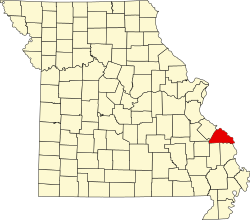
History

The small community of Seventy-Six originated as a river landing for steamboats on the Mississippi River. John Wilkinson, an immigrant from Yorkshire, England, came to the US around 1816 when his parents immigrated to Philadelphia, Pennsylvania. He and his father invested in a riverboat called The Laurel and became involved in the shipping trade. The first trip from Louisville, Kentucky to Alton, Illinois went well. However, the return trip met with disaster when the ship sank a few miles from what would later be known as Seventy-Six, Missouri. Wading ashore after the accident, his only possession being the clothes he wore, he was said to have exclaimed: "Here is where I lost it and here is where I'll get it back."

A shanty was constructed from the wreckage of the Laurel and Wilkinson immediately became a dealer in cord wood, which was the only fuel used at that time to power river steamboats. His business started off by simply hauling wood using a hand sled in the winter and a wheelbarrow in the summer. Over time he used small boats to take wood by water, eventually acquiring oxen and wagon to move the wood. Eventually, Wilkinson became one of the largest landowners in the area. An island in the Mississippi - Wilkinson Island - was named after him; however, this island lies on the right side of the Mississippi River on the "Illinois" side.

The main economic activity in Seventy-Six was the riverboat landing and the sale of cord wood. The community was also home to two schools. "Union School" was attended by white children, while black children attended a separate school. The community also featured a general store "The G.S. Hatch Store", the Hatch Grain Company, fruit orchards, a stockyard, a saloon, a hotel, a post office (1880-1957), and a train depot. [6] Eventually ownership of most of the land on which the community sat had passed to G.S. Hatch, who not only ran the general store, but also operated the boat landing, a large timber operation, owned an 800-acre tract of land including the fruit orchard, and had practically the whole population of Seventy-Six in his employ. [7]

Seventy-Six was also home to Shiloh Evangelical-Lutheran Church which had been organized in 1857 by Jonathan Crimminger and was affiliated with the Evangelical-Lutheran Synod of Southern Illinois. Presbyterian church services were held on the second floor of the G.S. Hatch General Store and were conducted by Reverend James Valentine Worsham, who rode by horse from Old Appleton. Baptisms were held in a creek about a mile outside of Seventy-Six.

In 1903, the St. Louis–San Francisco Railway built a railroad along the river which made river traffic less lucrative. Trains stopped twice a day - 11:00 a.m. and 4:30 p.m. every day. The rail service also attracted the attention of Jack "Quail Hunter" Kennedy - the last of the Jesse James gang. In October, 1922, Jack Kennedy and his accomplices robbed the St. Louis-San Francisco train just outside Seventy-Six. The target of the train robbery were packages of money earmarked for a bank in Memphis, Tennessee. However, one of Kennedy's accomplices was an undercover Federal Marshall. The conductor, engineer and firemen on the train were aware of the planned robbery. Kennedy and one of his accomplices were shot dead during the attempted getaway.

Following numerous floods and a sharp decline in river transport, the community eventually disappeared. By 1940 the community had a population of only 35 people. In 1957 the post office closed. [6] In the late 1950s what was left of the community depopulated. Today, forest and farmland cover the spot where Seventy-Six once stood.

Conservation department

In 1990, the Missouri Department of Conservation incorporated the area into the Seventy-Six Conservation Area, which is used as a demonstration area for forest and wildlife management techniques. The conservation area also includes the Wilkinson Walking Trail. [8]

Geography

Seventy-Six was located along the Mississippi River at the end of Missouri Route D due west of "Mile 90". Although the Mississippi River forms the border between most of Missouri and Illinois, this particular section of the Mississippi is actually surrounded by Missouri on both sides. Wilkinson Island, which is shared by both Missouri and Illinois, [9] lies on the east side of the Mississippi River. [10]

Related Research Articles

Mississippi River Major river in the United States

The Mississippi River is the second-longest river and chief river of the second-largest drainage system on the North American continent, second only to the Hudson Bay drainage system. From its traditional source of Lake Itasca in northern Minnesota, it flows generally south for 2,340 miles (3,770 km) to the Mississippi River Delta in the Gulf of Mexico. With its many tributaries, the Mississippi's watershed drains all or parts of 32 U.S. states and two Canadian provinces between the Rocky and Appalachian mountains. The main stem is entirely within the United States; the total drainage basin is 1,151,000 sq mi (2,980,000 km2), of which only about one percent is in Canada. The Mississippi ranks as the fourteenth-largest river by discharge in the world. The river either borders or passes through the states of Minnesota, Wisconsin, Iowa, Illinois, Missouri, Kentucky, Tennessee, Arkansas, Mississippi, and Louisiana.

Quincy, Illinois City in Illinois, United States

Quincy, known as Illinois's "Gem City", is a city in and the county seat of Adams County, Illinois, United States, located on the Mississippi River. The 2020 census counted a population of 39,463 in the city itself, down from 40,633 in 2010. As of July 1, 2015, the Quincy Micro Area had an estimated population of 77,220. During the 19th century, Quincy was a thriving transportation center as riverboats and rail service linked the city to many destinations west and along the river. It was Illinois' second-largest city, surpassing Peoria in 1870. The city has several historic districts, including the Downtown Quincy Historic District and the South Side German Historic District, which display the architecture of Quincy's many German immigrants from the late 19th century.

Cairo, Illinois City in Illinois, United States

Cairo is the southernmost city in Illinois and the county seat of Alexander County.

Grand Tower, Illinois City in Illinois, United States

Grand Tower is a city in Jackson County, Illinois, United States. The population was 605 at the 2010 census. The town gets its name from Tower Rock, a landmark island in the Mississippi River.

Kaskaskia, Illinois Village in Illinois, United States

Kaskaskia is a village in Randolph County, Illinois. Having been inhabited by indigenous peoples, it was settled by France as part of the Illinois Country. It was named for the Kaskaskia people. Its population peaked at about 7,000 in the 18th century, when it was a regional center. During the American Revolutionary War, the town, which by then had become an administrative center for the British Province of Quebec, was taken by the Virginia militia during the Illinois campaign. It was designated as the county seat of Illinois County, Virginia, after which it became part of the Northwest Territory in 1787. Kaskaskia was later named as the capital of the United States' Illinois Territory, created on February 3, 1809. In 1818, when Illinois became the 21st U.S. state, the town briefly served as the state's first capital until 1819, when the capital was moved to more centrally located Vandalia.

Hannibal, Missouri City in Missouri, United States

Hannibal is a city along the Mississippi River in Marion and Ralls counties in the U.S. state of Missouri. According to the 2010 U.S. Census, the population was 17,916, making it the largest city in Marion County. The bulk of the city is in Marion County, with a tiny sliver in the south extending into Ralls County.

<i>Sultana</i> (steamboat) 19th-century American steamboat that sank on the Mississippi River in 1865

Sultana was a commercial side-wheel steamboat which exploded and sank on the Mississippi River on April 27, 1865, killing 1,168 people in what remains the worst maritime disaster in United States history.

Kaskaskia River

The Kaskaskia River is a tributary of the Mississippi River, approximately 325 miles (523 km) long, in central and southern Illinois in the United States. The second largest river system within Illinois, it drains a rural area of farms, as well as rolling hills along river bottoms of hardwood forests in its lower reaches. The lower reaches of the river have been canalized to allow barge traffic.

<i>Belle of Louisville</i>

Belle of Louisville is a steamboat owned and operated by the city of Louisville, Kentucky, and moored at its downtown wharf next to the Riverfront Plaza/Belvedere during its annual operational period. The steamboat claims itself the "most widely traveled river steamboat in American history." Belle of Louisville's offices are aboard Mayor Andrew Broaddus, and also appears on the list of National Historic Landmarks.

American Bottom Flood plain of the Mississippi River in Illinois

The American Bottom is the flood plain of the Mississippi River in the Metro-East region of Southern Illinois, extending from Alton, Illinois, south to the Kaskaskia River. It is also sometimes called "American Bottoms". The area is about 175 square miles (450 km2), mostly protected from flooding in the 21st century by a levee and drainage canal system. Immediately across the river from St. Louis, Missouri, are industrial and urban areas, but many swamps and the major Horseshoe Lake are reminders of the Bottoms' riparian nature. This plain served as the center for the pre-Columbian Cahokia Mounds civilization, and later the French settlement of Illinois Country. Deforestation of the river banks in the 19th century to fuel steamboats had dramatic environmental effects in this region. The Mississippi River between St. Louis and the confluence with the Ohio River became wider and more shallow, as unstable banks collapsed into the water. This resulted in more severe flooding and lateral changes of the major channel, causing the destruction of several French colonial towns, such as Kaskaskia, which relocated; Cahokia, and St. Philippe, Illinois.

Wittenberg, Missouri

Wittenberg is an unincorporated community in Brazeau Township in eastern Perry County, Missouri, United States. It is located on the Mississippi River, 14 miles (23 km) southeast of Perryville. Wittenberg is situated in the Brazeau Bottoms on Brazeau Creek opposite Grand Tower, Illinois, and Tower Rock, the latter a landmark island in the Mississippi River.

Meyer, Illinois Unincorporated community in Illinois, United States

Meyer is an unincorporated community in Adams County, Illinois, United States. It has a population of approximately 10 full-time residents as of mid-2009, due to the flood of 2008. The community is part of the Quincy, IL–MO Micropolitan Statistical Area. It is the westernmost community in Illinois.

Steamboats of the Mississippi Overview of the role of steamboats in the 19th-century development of the Mississippi River

Steamboats played a major role in the 19th-century development of the Mississippi River and its tributaries, allowing practical large-scale transport of passengers and freight both up- and down-river. Using steam power, riverboats were developed during that time which could navigate in shallow waters as well as upriver against strong currents. After the development of railroads, passenger traffic gradually switched to this faster form of transportation, but steamboats continued to serve Mississippi River commerce into the early 20th century. A small number of steamboats are still used for tourist excursions in the 21st century.

Bois Brule Township, Perry County, Missouri Civil Township in Missouri, United States

Bois Brûlé is one of the eight townships located in Perry County, Missouri, in the United States of America.

Bois Brule Bottom

The Bois Brule Bottom is an alluvial floodplain in Bois Brule Township in Perry County, Missouri stretching between Bois Brule Creek to the west and the Mississippi River to the east.

Brazeau Bottom

The Brazeau Bottom is an alluvial floodplain, also called a 'flat', extending along the Mississippi River in Perry County, Missouri.

Pointrest, Missouri Abandoned village in Missouri, United States

Pointrest was an unincorporated community in Bois Brule Township in Perry County, Missouri, United States.

Seventy-Six Conservation Area, Perry County, Missouri

The Seventy-Six Conservation Area is located in eastern Perry County, Missouri at the end of Route D, approximately four miles northeast of Brazeau. The Missouri Conservation Department created this area in 1990 with the purchase of an 818-acre farm from a private landowner.

Red Rock Landing Conservation Area, Perry County, Missouri

Red Rock Landing Conservation Area is located in eastern Perry County, Missouri at the end of County Road 350, approximately ten miles east of Perryville, Missouri. The Missouri Conservation Department created this area in November 1994 with the purchase of 554-acres along the Mississippi River.

Neelys Landing, Missouri unincorporated community in Missouri, United States

Neely's Landing or Neelys Landing is an unincorporated community in Shawnee Township in northern Cape Girardeau County, Missouri, United States. It is located seventeen miles north of Cape Girardeau and is part of the Cape Girardeau–Jackson, MO-IL Metropolitan Statistical Area.

References

  1. 1 2 U.S. Geological Survey Geographic Names Information System: Seventy-Six, Missouri
  2. Hometown Locator: Missouri "Archived copy". Archived from the original on 2013-07-08. Retrieved 2013-07-07.CS1 maint: archived copy as title (link)
  3. Roadside Thoughts: Seventy-Six "Archived copy". Archived from the original on 2013-07-08. Retrieved 2013-07-07.CS1 maint: archived copy as title (link)
  4. Southeast Missourian: Seventy-Six, Missouri: Even number, odd name http://www.semissourian.com/blogs/pavementends/entry/33475/
  5. Robert L. Ramsay (1952). Our Storehouse of Missouri Place Names. ISBN   9780826205865.
  6. 1 2 3 Wichern.org Seventy-Six Missouri http://www.wichern.org/towns/76.htm
  7. Southeast Missourian Newspaper, May 17, 2002 https://news.google.com/newspapers?nid=1893&dat=20020517&id=1XxFAAAAIBAJ&sjid=PMcMAAAAIBAJ&pg=4929,2521700
  8. The Missouri Department of Conservation: Seventy-Six Conservation Area "Archived copy". Archived from the original on 2013-11-04. Retrieved 2013-07-07.CS1 maint: archived copy as title (link)
  9. U.S. Geological Survey Geographic Names Information System: Wilkinson Island
  10. Altenburg, MO, 7.5 Minute Topographic Quadrangle, USGS, 1947, (1990 rev.)