Giboney, Missouri

Last updated
Giboney, Missouri
Abandoned village
Map of Missouri highlighting Perry County.svg
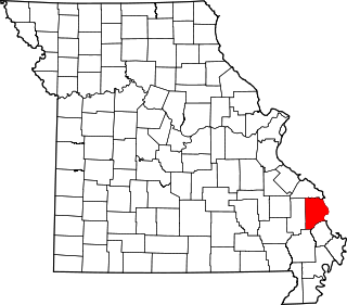
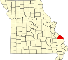
Location of Perry County, Missouri
Coordinates: 37°48′17″N89°59′26″W / 37.80472°N 89.99056°W / 37.80472; -89.99056 Coordinates: 37°48′17″N89°59′26″W / 37.80472°N 89.99056°W / 37.80472; -89.99056
Country United States
State Missouri
County Perry
Township Saline
Elevation 512 ft (156 [1]  m)
Time zone Central (CST) (UTC-6)
  Summer (DST) CDT (UTC-5)
ZIP code 63775
Area code(s) 573
FIPS code 29-26945 [2]
GNIS feature ID 740869 [3]

Giboney was an unincorporated community in Saline Township in Perry County, Missouri. [4]

Saline Township, Perry County, Missouri Civil Township in Missouri, United States

Saline Township is one of the eight townships located in Perry County, Missouri, in the United States of America.

Perry County, Missouri County in the United States

Perry County is a county located in the southeastern portion of the U.S. state of Missouri. As of the 2010 census, the population was 18,971. Its county seat is Perryville. The county was officially organized on November 16, 1820 from Ste. Genevieve County and was named after Oliver Hazard Perry, a naval hero of the War of 1812.

Giboney was situated just west of Brewer in Saline Township in the northwest part of Perry County, situated along the south Fork Saline Creek and state route NN. It was a station on the Saline Valley Line. The community may have been named for the railroad executive Louis Houck's wife, Mary H. Giboney. [5] [6]

Brewer, Missouri Unincorporated community and census-designated place in Missouri, United States

Brewer is an unincorporated community and census-designated place in Saline Township and northwest of Perryville, Missouri.

The Giboney station on Old Lead Road was located between the Brewer and Minnith stations of the Cape Girardeau Northern Railway, which ran from Ancell (Cape Girardeau & Thebes Bridge Terminal) to Farmington, Missouri. [7] Louis Houck built the Cape Girardeau & Chester Railroad in 1905, later the Cape Girardeau Northern Railroad, but it floundered due to financial difficulties that led to bankruptcy. Service was limited to stations only in Cape Girardeau by about 1925. [8]

Ancell is an extinct town in the northeast corner of Kelso Township, Scott County, in the U.S. state of Missouri. It was named for Pashal Ancell, a pioneer citizen, but was first known as Glenn. It is now part of Scott City, Missouri. Scott City is a consolidation of the formerly separate towns of Fornfelt, Ancell and Illmo, Missouri. These towns arose in association with the building and operation of railroads that passed through the area and all incorporated around the same time. Fornfelt, then known as Edna, incorporated in 1905. Illmo, on the Missouri side of a bridge linking Illinois and Missouri, incorporated in 1906. Ancell, just to the west of Illmo, incorporated in 1907. In 1960, Ancell merged with Fornfelt and formed Scott City. Illmo merged into Scott City in 1980. A post office called Ancell was established in 1912 and remained in operation until this merger. Ancell Cemetery is 5 miles south of Scott City.

Farmington, Missouri City in Missouri, United States

Farmington is a city in St. Francois County located 72 miles (116 km) southwest of St. Louis in the Lead Belt region in Missouri in the United States. As of the 2010 census, the population was 16,240. It is the county seat of St. Francois County. Farmington was established in 1822 as Murphy's Settlement, named for William Murphy of Kentucky who first visited the site in 1798. When St. Francois County was organized, the town was briefly called St. Francois Court House and later renamed to Farmington.

The village was about 26.5 miles from the Mississippi River. [9]

Related Research Articles

Cape Girardeau County, Missouri County in the United States

Cape Girardeau County is a county located in the southeastern part of the U.S. state of Missouri; its eastern border is formed by the Mississippi River. As of the 2010 U.S. Census, the population was 75,674. The county seat is Jackson, the first city in the US to be named in honor of President Andrew Jackson. Officially organized on October 1, 1812, the county is named after Ensign Sieur Jean Baptiste de Giradot, an official of the French colonial years. The "cape" in the county's name is named after a former promontory rock overlooking the Mississippi River; this feature was demolished during railroad construction.

Zalma, Missouri Village in Missouri, United States

Zalma, once known as Bollinger's Mill, is a town on the banks of the winding Castor River at a point where the river makes a horseshoe bend in southern Bollinger County in southeast Missouri. When the railroad moved to town, the name Bollinger's Mill was changed to Zalma, after railroad worker Zalma Block. Zalma is also said to come from a Native American word meaning "the end." As of the 2010 U.S. Census, Zalma had a population of 122.

Cape Girardeau, Missouri City in Missouri, United States

Cape Girardeau is a city in Cape Girardeau county in the U.S. state of Missouri. It is located approximately 115 miles (185 km) southeast of St. Louis and 175 miles (282 km) north of Memphis. As of the 2017 United States Census Bureau estimates, the city's population was 39,151, making it the 17th-largest city in Missouri, and the largest city in Southeast Missouri. An emerging college town, it is the home of Southeast Missouri State University.

Brazeau, Missouri Unincorporated community in Missouri, United States

Brazeau is an unincorporated community in southeastern Perry County, Missouri.

Burfordville, Missouri unincorporated community in Missouri, United States

Burfordville is an unincorporated community in western Cape Girardeau County, Missouri, United States, on the banks of the Whitewater River. It is located five miles west of Jackson on Route 34. Bufordville is part of the Cape Girardeau–Jackson, MO-IL Metropolitan Statistical Area.

National Weather Service Paducah is a weather forecast office responsible for monitoring weather conditions for 58 counties in the states of Kentucky, Illinois, Indiana and Missouri. The Paducah office is relatively new compared to others, having been built in 1984. The office is in charge of weather forecasts, warnings and local statements as well as aviation weather. It is also equipped with a WSR-88D (NEXRAD) radar, and an Automated Surface Observing System (ASOS) that greatly increase the ability to forecast.

Cinque Hommes Township, Perry County, Missouri Civil Township in Missouri, United States

Cinque Hommes is one of the eight townships located in Perry County, Missouri, in the United States of America.

Capes on the Mississippi River

The term cape has a different tradition of usage in the American Midwest along the Mississippi River. The middle Mississippi River Valley once formed part of the French Colonies of Quebec and Louisiana, also referred to as Upper Louisiana (Haute-Louisiane) or the Illinois Country. The Illinois Country also included the left bank of the Mississippi River in present-day Missouri.

Claryville, Missouri Unincorporated Community in Missouri, United States

Claryville is an unincorporated community in Bois Brule Township in Perry County, Missouri. It is located twelve miles northeast of Perryville, sixty-three miles south of Saint Louis, and lies directly on the Mississippi River.

Brazeau Township, Perry County, Missouri Civil Township in Missouri, United States

Brazeau is one of the eight townships located in Perry County, Missouri, in the United States of America.

Bois Brule Bottom

The Bois Brule Bottom is an alluvial floodplain in Bois Brule Township in Perry County, Missouri stretching between Bois Brule Creek to the west and the Mississippi River to the east.

Shawneetown, Missouri unincorporated community in Missouri, United States

Shawneetown is an unincorporated community in Shawnee Towhship in northern Cape Girardeau County, Missouri, United States. It is located twenty miles north of Cape Girardeau and is part of the Cape Girardeau–Jackson, MO-IL Metropolitan Statistical Area.

Cinque Hommes Creek stream in Perry County, Missouri, United States of America

Cinque Hommes Creek is a tributary of the Mississippi River flowing through Perry County, Missouri.

Apple Creek (Mississippi River) stream originating in Missouri

Apple Creek is a stream that rises in western Perry County, Missouri and empties into the Mississippi River, forming the boundary between Perry and Cape Girardeau counties.

Brazeau Creek is a stream flowing through Perry County, Missouri and emptying into the Mississippi River.

Saline Creek (Mississippi River) river in the United States of America

Saline Creek is a creek that rises in western Ste. Genevieve County and flows east briefly passing through a portion of northern Perry County before emptying into an offshoot of the Mississippi River north of St. Mary across from Kaskaskia Island.

Starlanding, Missouri Abandoned village in Missouri, United States

Starlanding was an unincorporated community in Brazeau Township in Perry County, Missouri.

Neelys Landing, Missouri unincorporated community in Missouri, United States

Neely's Landing or Neelys Landing is an unincorporated community in Shawnee Township in northern Cape Girardeau County, Missouri, United States. It is located seventeen miles north of Cape Girardeau and is part of the Cape Girardeau–Jackson, MO-IL Metropolitan Statistical Area.

References

  1. "Giboney, Missouri". Roadsidethoughts.com. Retrieved November 26, 2013.
  2. "Giboney, MO". lat.long.com. Retrieved November 26, 2013.
  3. "Giboney, MO". eachtown.com. Retrieved November 26, 2013.
  4. "State Historical Society of Missouri: Perry County" . Retrieved November 26, 2013.
  5. Arthur Paul Moser (ed.). "A Directory of Towns, Villages, and Hamlets Past and Present of Perry County, Missouri". Archived from the original on November 3, 2013. Retrieved November 26, 2013.
  6. "Giboney, Missour". Landmarkhunter.com. Retrieved November 26, 2013.
  7. "Missouri Railroads: Passenger Stations and Stops" (PDF). p. 15. Archived from the original (PDF) on December 3, 2013. Retrieved November 26, 2013.
  8. Robert Barnes. "Abandoned Railes: The Cape Girardeau Northern Railroad". AbandonedRailroads.com. Retrieved November 26, 2013.
  9. "Cities Distance to Mississippi River". University of Minnesota. Retrieved November 26, 2013.