
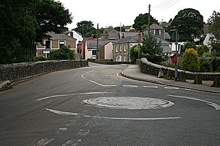
Rock is a coastal fishing village in Cornwall, England, United Kingdom. It is opposite Padstow on the north-east bank of the River Camel estuary. The village is in the civil parish of St Minver Lowlands about 4 miles (6.4 km) north-west of Wadebridge.
Mylor Bridge is a village in Cornwall, England, United Kingdom. It is in Mylor civil parish at the head of Mylor Creek, about five miles north of Falmouth.

Lesnewth is a civil parish and village in Cornwall, England, United Kingdom. It is about six miles east of Tintagel Head and two miles east of Boscastle.
Portwrinkle is a small coastal village in south-east Cornwall, England, United Kingdom. It is at the western end of Whitsand Bay five miles (8 km) south-west of Saltash.

Michaelstow is a civil parish and village in north Cornwall, England, United Kingdom. The village is about three miles (4.8 km) south of Camelford. The hamlets of Fentonadle, Trevenning and Treveighan are in the parish.
Bodelva is a hamlet in south Cornwall, England, UK, in the civil parish of St Blaise. It is about 1 mile (1.6 km) west of St Blazey. Bodelva is the location of the Eden Project, opened in 2001, a horticultural visitor attraction built in a china clay quarry.

Fraddam is a village in west Cornwall, England, United Kingdom. It is two miles (3 km) southeast of Hayle. It is in the civil parish of Gwinear-Gwithian

Carlyon is one of four new civil parishes created on 1 April 2009 for the St Austell area of south Cornwall, England, United Kingdom.
Boleigh is a hamlet southeast of St Buryan in west Cornwall, England, UK. The Newlyn School artist, Samuel Birch, later known as Lamorna Birch came to Cornwall in 1892, initially staying at Boleigh Farm.

Brea is a village in Cornwall, England, UK, between the towns of Camborne and Redruth. It is in the civil parish of Carn Brea and consists of Brea, Lower Brea, and Higher Brea. A small stream, the Red River, flows through the village and a hill, Carn Brea dominates the landscape to the east, along with its monument to Francis Basset.
Bridge is a village in Cornwall, England, United Kingdom. It is about 1 km east of Portreath.

Carnon Downs is a village in Cornwall, England, United Kingdom. It is about three miles southwest of Truro on the A39 Truro to Falmouth road.

Garras is a village in the parish of Mawgan-in-Meneage, in west Cornwall, England, UK.
Gwills is a hamlet in the parish of Colan, Cornwall, England. According to the Post Office the population at the 2011 census was included in the civil parish of Gunwalloe

Kehelland is a hamlet northwest of Camborne in west Cornwall, England.
Mongleath is a hamlet in the parish of Budock, Cornwall, England.
Pengegon is a residential area east of Camborne, Cornwall, England, which has a fish and chip shop, a playground and memorial to local teen Shakira Pellow. From 2013 to 2021, Pengegon was included in the Camborne Treslothan division on Cornwall Council. After boundary changes at the 2021 local elections, it was placed in the new Four Lanes, Beacon and Troon division.

Stennack is a hamlet southwest of Troon in west Cornwall, England, United Kingdom.

