
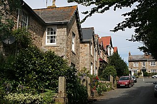
Towednack is a churchtown and civil parish in Cornwall, England, United Kingdom. The parish is bounded by those of Zennor in the west, Gulval in the south, Ludgvan in the west and south, and St Ives and the Atlantic Ocean in the north and east. The church is about two miles (3 km) from St Ives and six miles (10 km) from Penzance.

Ludgvan is a civil parish and village in Cornwall, England, UK, 2+1⁄2 miles (4 km) northeast of Penzance. Ludgvan village is split between Churchtown, on the hill, and Lower Quarter to the east, adjoining Crowlas. For the purposes of local government, Ludgvan elects a parish council every four years; the town elects a member to Cornwall Council under the Ludgvan division.
Gulval is a village in the civil parish of Penzance, in Cornwall, England. Although historically a parish in its own right, Gulval was incorporated into the parishes of Ludgvan, Madron and Penzance in 1934, and is now considered to be a suburb of Penzance. Gulval still maintains its status as an ecclesiastical parish and parts of the village church date back to the 12th-century. Together with Heamoor, Gulval still retains its status as an electoral ward. The ward population at the 2011 census was 4,185.

Long Rock is a village in west Cornwall, England, United Kingdom. It is approximately 1 mile (1.6 km) east of Penzance and 1 mile (1.6 km) west of Marazion in the civil parish of Ludgvan. The village is named after the tidal Long Rock just offshore at grid reference SW498308. Long Rock is on the shore of Mount's Bay at the centre of the three-mile beach which stretches from Penzance to Marazion. The beach is backed by a seawall along which runs the main line railway and the South West Coast Path.

Kelynack (from Cornish: Kelynek is a settlement in west Cornwall, England, UK.

Lelant or Uny Lelant is a village in the civil parish of St Ives in, west Cornwall, England, UK. It is on the west side of the Hayle Estuary, about 2+1⁄2 miles (4.0 km) southeast of St Ives and one mile (1.6 km) west of Hayle. The village is part of the Lelant and Carbis Bay ward on Cornwall Council, and also the St Ives Parliamentary constituency. The birth, marriage, and death registration district is Penzance. Its population at the 2011 census was 3,892 The South West Coast Path, which follows the coast of south west England from Somerset to Dorset passes through Lelant, along the estuary and above Porth Kidney Sands.

New Mill is a small settlement in west Cornwall, England. It is approximately 2 miles (3.2 km) north of Penzance on the road to Gurnard's Head.

Tregavarah is a small hamlet in the parish of Madron in west Cornwall, England, U K. It is approximately 2 miles west of Penzance. Tregavarah Downs is nearby.

Gurnard's Head is a prominent headland on the north coast of the Penwith peninsula in Cornwall, England. The name is supposed to reflect that the rocky peninsula resembles the head of the gurnard fish.
Amalveor is a hamlet in West Penwith, Cornwall, England, United Kingdom at grid reference SW 482 375. The hamlet is 3 miles south-west of St Ives. It is in the civil parish of Towednack.

Four Lanes is a village in west Cornwall, England, United Kingdom approximately 3 miles (4.8 km) south of Redruth at grid reference SW 689 386 in the civil parish of Carn Brea.

St Pinnock is a hamlet and civil parish in southeast Cornwall, England, United Kingdom, 3 miles (5 km) south-west of Liskeard. Other settlements in the parish include East Taphouse, and Penfrane, containing 421 inhabitants. The parish church, dedicated to St Pynnochus (Winnoc), is located at OS Grid Ref SX200630.
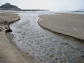
The Red River which discharges into the sea to the west of Marazion is one of two watercourses in Cornwall in southwest England, UK, which share this name.

Catchall is a hamlet in the civil parish of Sancreed in west Cornwall, England, UK. Catchall is 1 mile (1.6 km) south-east of Sancreed at around 310 feet (94 m) above sea level at the junction of the B3283 with the A30 main road. Catchall is probably from the name of a 19th-century public house which at that time was an important road junction.

Grumbla is a hamlet in the parish of Sancreed, Cornwall, England, UK.

Kenneggy Downs is a hamlet on the A394, in the civil parish of Breage, between the towns of Helston and Penzance in Cornwall, UK. It is 5 miles (8.0 km) east of Penzance. Kenegy is Cornish for bogs.

Higher Ninnes and Lower Ninnes are hamlets, south of Mulfra Hill in the civil parish of Madron in west Cornwall, England, UK.

Relubbus is a hamlet in the parish of St Hilary, west Cornwall, England. It is on the B3280 road between Townshend and Goldsithney; the River Hayle runs through Relubbus.

Rose-an-Grouse is a hamlet in the civil parish of St Erth in west Cornwall, England. It is on the A30 road, east of Canon's Town, and St Erth railway station is on the southern side of the hamlet.

Lanyon is a hamlet in the parish of Madron in Cornwall, England, UK. It is situated on a north facing slope on the Madron to Morvah road. The nearest town is Penzance 4 miles (6.4 km) to the south.

