Dakhla, Western Sahara

Last updated

Dakhla
الداخلة
Dakhla, Western Sahara (11).jpg
Western Sahara relief location map.jpg
Red pog.svg
Dakhla
Location in Western Sahara
Africa relief location map.jpg
Red pog.svg
Dakhla
Dakhla (Africa)
Coordinates: 23°43′N15°57′W / 23.717°N 15.950°W / 23.717; -15.950
Non-self-governing territory Western Sahara
Claimed byFlag of Morocco.svg  Kingdom of Morocco
Flag of the Sahrawi Arab Democratic Republic.svg  Sahrawi Arab Democratic Republic
Controlled byFlag of Morocco.svg  Kingdom of Morocco
Region Dakhla-Oued Ed-Dahab
Province Oued Ed-Dahab
Area
  Total301.45 km2 (116.39 sq mi)
Population
 (2014) [1]
  Total106,277
  Density350/km2 (910/sq mi)
Time zone UTC+1

Dakhla (Arabic : الداخلة) is a city in the disputed territory of Western Sahara, [2] currently occupied by Morocco. [3] [4] It is the capital of the claimed Moroccan administrative region Dakhla-Oued Ed-Dahab. It has a population of 106,277 [1] and is on a narrow peninsula of the Atlantic Coast, the Río de Oro Peninsula, about 550 km (340 mi) south of Laayoune.

Contents

History

Mosque in Dakhla Mezquita en Dajla (Sahara Occidental).jpg
Mosque in Dakhla

Early history

Rio de Oro was settled in the twelfth century by the Oulad Delim, an Arab Bedouin tribe of South Arabian descent that emigrated from Yemen. Dakhla was expanded by Spanish settlers during the expansion of their empire. The Spanish interest in the desert coast of Western Africa's Sahara arose as the result of fishing carried out from the nearby Canary Islands by Spanish fishers and as a result of the Barbary pirates menace.[ citation needed ]

Spanish fishers were seal fur hunters, traders, and whalers along the Saharan coast from Dakhla to Cabo Blanco from 1500 to the present, engaging in whaling for Humpback whales and their calves, mostly around Cape Verde, and the Gulf of Guinea in Annobón, São Tomé and Príncipe islands through 1940. These fishing activities had a negative impact on wildlife, causing the disappearance or endangering of many species, particularly marine mammals and birds. [5] [6]

Spanish colonization

The Spaniards established whaling stations with some cod fishing and trading. In 1881, a dock was anchored off the coast of the Río de Oro Peninsula to support the work of the Canarian fishing fleet.[ citation needed ] However, it was not until 1884 that Spain formally founded the watering place as Villa Cisneros, in the settlement dated in 1502 by Papal bull. It was included in the enclaves conceded to the Spanish to the east of the Azores islands. Upon arriving in Rio de Oro in 1884 to establish their first coastal factories, the Spanish were forced to deal with the Oulad Delim, a Sahrawi Arab tribe that controlled the entirety of Rio de Oro and a strip of land in Mauritania extending from Nouadhibou to Idjlil. [7] In 1884, the settlement of Villa Cisneros was promoted by the Spanish Society of Africanists and funded by the government of Canovas del Castillo. [8] In the same year, the Oulad Delim attacked the trading post and looted its stores before the Spanish issued a royal decree that placed the coast from Cape Bojador to Cape Blanc under Spanish colonization. By 1886, Spanish colonial authority was extended 150 miles inland. The Spanish reached an agreement with a sheikh of the local Oulad Delim two years later. [9]

Early Spanish provisional settlement in the Rio de Oro Peninsula during the exploratory works led by Emilio Bonelli (published in January 1885 in La Ilustracion Espanola y Americana). Trabajos de la Sociedad Espanola de Africanistas. Establecimiento provisional en la Peninsula de Rio de Oro. de fotografia remitida por el senor Bonelli.jpg
Early Spanish provisional settlement in the Río de Oro Peninsula during the exploratory works led by Emilio Bonelli (published in January 1885 in La Ilustración Española y Americana ).

The Spanish military, along with the Spanish Africanist Emilio Bonelli, claimed the coast between Cape Bojador and Cabo Blanco for Spain, founding three settlements on the Saharan coast: one in Villa Cisneros, named in honour of Francisco Cardinal Jiménez de Cisneros (1436–1517), the Spanish prelate who was the Grand Inquisitor during the Spanish Inquisition; and another in Cabo Blanco for seal hunting, which was given the name of Medina Gatell; and another in Angra de Cintra with the name of Puerto Badia, in honour of the Arabist and adventurer Domingo Badia. Bonelli got the native inhabitants of the peninsula de Río de Oro to sign an agreement that placed them under the "protection" of the Kingdom of Spain. Due to the presence of the three new settlements, in December 1884 the Spanish Government officially informed the main colonial powers assembled at the Berlin Conference that the Spanish Crown was in possession of the territory lying between Cape Bojador and Cape Blanco.

During the colonial period, Spanish authorities made Dakhla the capital of the province of Río de Oro, one of the two regions of what was known as Spanish Sahara. They built a military fortress and a modern Catholic church. A prison camp also existed at the fort during the Spanish Civil War at which writers such as Pedro García Cabrera were imprisoned.

The fort at Villa Cisneros in 1930 ETH-BIB-Festung und Flugzeugschuppen von Villa Cisneros-Tschadseeflug 1930-31-LBS MH02-08-1005.tif
The fort at Villa Cisneros in 1930

During the 1960s, the Francoist State also built Dakhla Airport, one of the three paved airports in Western Sahara. It was from Dakhla, then known as Villa Cisneros, that on 12 January 1976, General Gomez de Salazar became the last Spanish soldier to depart what until that moment had been the colony of the Spanish Sahara; faced with Moroccan and Mauritanian pressure, Spanish authorities decided to give up the territory peacefully, instead of undertaking a fight that they believed they could win but would have cost many lives on all sides. Between 1975 and 1979, Dakhla was the provincial capital of the Mauritanian province of Tiris al-Gharbiyya, as Mauritania annexed the southern portion of Western Sahara. Dakhla Airport is used as a civilian airport and by Royal Air Maroc. The 3000 m runway can accommodate a Boeing 737 or smaller aircraft.[ citation needed ] The passenger terminal covers 670 m2 and is capable of handling up to 55,000 passengers per year.[ citation needed ]

Moroccan occupation

Dakhla was occupied by Spain from the late 19th century to 1975, when power was then relinquished to a joint administration between Morocco and Mauritania. [10] There was a United Nations-sponsored ceasefire in 1991, but as recently as 2006, most UN member states have refused to recognise Moroccan sovereignty in the area. [10]

In 2020, the Gambia, [11] Guinea, [12] Djibouti, [13] Liberia, [14] Burkina Faso, [15] Equatorial Guinea, [16] Guinea-Bissau, [17] and the Democratic Republic of the Congo [18] opened consulates in Dakhla.

Economy

Tourism and sports

Windsurfer and the Dragon Island in the background Dakhla Trip 1409.JPG
Windsurfer and the Dragon Island in the background

Dakhla's main economic activity is fishing and tourism. In recent years the town has become a centre for aquatic sports, such as kitesurfing, windsurfing and surf casting, [10] [19] and is known as a centre for water sports. [20]

Golfo de Cintra and the Mauritanian Banc d'Arguin National Park are located in the south.

Oil

A United States firm Kosmos Energy and its United Kingdom counterpart Cairn Energy began searching for oil in Western Sahara in early 2015. [21] [10] [22]

Oyster industry

Oyster farming by hand is a traditional practice in Dakhla. [10] Oysters are first sold to people and businesses in Dakhla, then to restaurants in cities like Marrakesh or Casablanca, and then any left are sold to Europe. [10] In April 2015, Vice Media reported that oysters had recently begun to be exported to high-end European restaurants. [10]

Climate

Dakhla has a mild desert climate (BWh) according to the Köppen climate classification. Dakhla receives an average 33 mm (1.3 in) of precipitation per year. The temperature averages around 17.4 °C (63.3 °F) during January, Dakhla's coldest month and around 23.0 °C (73.4 °F) during September, its warmest month. The temperature seems to be moderated by the Canary Current.

Climate data for Dakhla, Western Sahara
MonthJanFebMarAprMayJunJulAugSepOctNovDecYear
Record high °C (°F)33.0
(91.4)
33.9
(93.0)
37.0
(98.6)
37.2
(99.0)
42.0
(107.6)
36.0
(96.8)
38.9
(102.0)
39.0
(102.2)
41.8
(107.2)
39.6
(103.3)
37.0
(98.6)
31.6
(88.9)
42.0
(107.6)
Mean daily maximum °C (°F)20.9
(69.6)
22.7
(72.9)
23.7
(74.7)
23.3
(73.9)
24.0
(75.2)
24.8
(76.6)
25.7
(78.3)
26.5
(79.7)
27.4
(81.3)
26.6
(79.9)
25.1
(77.2)
22.5
(72.5)
24.4
(75.9)
Daily mean °C (°F)18.1
(64.6)
18.4
(65.1)
20.0
(68.0)
19.2
(66.6)
19.9
(67.8)
20.7
(69.3)
21.9
(71.4)
22.7
(72.9)
23.0
(73.4)
22.6
(72.7)
20.8
(69.4)
18.7
(65.7)
20.5
(68.9)
Mean daily minimum °C (°F)13.3
(55.9)
13.8
(56.8)
14.7
(58.5)
14.9
(58.8)
15.8
(60.4)
16.7
(62.1)
17.5
(63.5)
18.3
(64.9)
18.8
(65.8)
18.0
(64.4)
16.6
(61.9)
14.5
(58.1)
16.1
(61.0)
Record low °C (°F)8.5
(47.3)
8.8
(47.8)
10.0
(50.0)
10.0
(50.0)
11.0
(51.8)
11.1
(52.0)
10.0
(50.0)
13.0
(55.4)
12.0
(53.6)
9.0
(48.2)
8.0
(46.4)
7.2
(45.0)
7.2
(45.0)
Average precipitation mm (inches)2.3
(0.09)
2.8
(0.11)
1.0
(0.04)
0.0
(0.0)
0.4
(0.02)
0.0
(0.0)
1.4
(0.06)
2.1
(0.08)
10.9
(0.43)
6.3
(0.25)
2.6
(0.10)
9.8
(0.39)
39.7
(1.56)
Average precipitation days (≥ 0.1 mm)0.91.00.60.50.70.20.30.81.80.91.31.610.7
Average relative humidity (%)70777575787981828077767377
Mean monthly sunshine hours 254.2245.8275.9276.0306.9291.0266.6272.8249.0254.2240.0241.83,174.2
Mean daily sunshine hours 8.28.78.99.29.99.78.68.88.38.28.07.88.7
Source: Deutscher Wetterdienst [23]

Nature and ecology

Rocky and sandy shores of Dakhla Dakhla, Western Sahara.jpg
Rocky and sandy shores of Dakhla

Like most areas in Western Sahara, Dakhla and vicinity areas are very poor in vegetation and are mostly covered by the Sahara Desert. Unlike on land however, sea waters are or had been very rich in sea life due to the highly productive Current System of Canary flowing offshore and the renown Nouadhibou upwelling which is located nearby as well. These environmental factors provide excellent conditions for local fisheries, and result in strong local biodiversity for birds in particular. For these reasons, there has been a UNESCO proposal to create the "Dakhla National Park". [24]

Birds

Dakhla Peninsula and Cintra Bay are some of the most important wintering grounds for birds especially for waders. [25] The greater flamingo is one of the most iconic birds in the region and there are numerous others known to migrate or inhabit. Some of these are; pelican, great cormorant, gulls (slender-billed, Audouin's, black-backed), larks (sparrow, bar-tailed), terns (little, Caspian, royal, Sandwich), black wheatear, western reef heron, marsh harrier, sparrowhawk, lesser kestrel, laughing dove, great spotted cuckoo, little swift, hoopoe, rock martin, cricket longtail, oystercatcher, bar-tailed godwit, pharaoh eagle owl, and red-knobbed coot. [26] [27] [28]

Bald ibis and buttonquail are also rare on today's Western Sahara.

Several species such as golden nightjar, Sudan golden sparrow, hooded vulture, dark chanting goshawk, speckled pigeon, African mourning dove, blue-naped mousebird, Kordofan lark, red-chested swallow, chestnut-bellied starling, African swallow-tailed kite, tawny eagle, slender-billed curlew, demoiselle crane, Arabian bustard, ostrich, lappet-faced vulture, helmeted guineafowl are seemingly locally rare or extinct, or rather visitors of vagrants.

Mammals

Terrestrial animals are less diverse than birds, including Ruppell's fox, fennec fox, caracal, hyena, camel, gazelles, addaxes, hares, hedgehog variants, fat sand rat, lesser Egyptian jerboa, bats, and others. Barbary lion and hartebeest became extinct, and possibly local cheetah and North African elephant as well.

The calm, sheltered water of the Dakhla Bay was once an ideal habitat for various forms of marine life, including marine mammals. Most of the local animals such as Mediterranean monk seals and whales (mostly North Atlantic right whales) have disappeared due to histories of slaughter and exploitation like in Cintra Bay. Atlantic gray whales were likely to be seen along the coast before extinction. [29]

On the other hand, monk seals are showing slow but certain recoveries and Ras Nouadhibou holds the world's most notable colony for this species. [30] Nowadays, very small, remnant groups of bottlenose dolphins and Atlantic humpback dolphins are the only marine mammals still seen regularly in Dakhla Bay while there are occasional visits by some other species including orcas [31] while cetaceans like minke, [32] or sei, pilot whales, beaked whales, and dolphins are more common in offshore waters in today's Western Sahara. [33] [34] [35]

Reptiles and others

Other than mammals, limited varieties of terrestrial reptiles, amphibians, arthropods are present here including lizards, smooth snake, Brongersma's toad, and yellow-tailed scorpion. Sea turtles are also present in the Dakhla region. [36]

Larger fish like groupers, seabasses or croakers inhabit along the coasts. Dakhla and Cintra Bay areas are considered to be spawning grounds for local sardines. [37]

Twin towns – sister cities

Dakhla is twinned with:

Related Research Articles

<span class="mw-page-title-main">Geography of Western Sahara</span> Land features of Western Sahara

Western Sahara is a territory in Northern Africa, bordered by the North Atlantic Ocean, Morocco proper, Algeria, and Mauritania. Geographic coordinates: 24°30′N13°00′W

Transport in Western Sahara is very limited by sea, road and air with camels being the primary means of transportation in the desert area. Road transport by buses remain the major mode of transportation. The longest conveyor belt in the world is 100 kilometres (62 mi) long, from the phosphate mines of Bu Craa to the coast south of Laayoune. The belt moves about 2,000 metric tons of rock containing phosphate every hour from the mines to El-Aaiun, where it is loaded and shipped.

<span class="mw-page-title-main">Political status of Western Sahara</span>

Western Sahara, formerly the Spanish colony of Spanish Sahara, is a disputed territory claimed by both the Kingdom of Morocco and the Popular Front for the Liberation of the Saguia el Hamra and Rio de Oro, which is an independence movement based in Tifariti and Bir Lehlou. The Annexation of Western Sahara by Morocco took place in two stages, in 1976 and 1979, and is considered illegal under international law.

<span class="mw-page-title-main">Sahrawis</span> People living in the western Sahara desert

The Sahrawis, or Sahrawi people, are an ethnic group native to the western part of the Sahara desert, which includes the Western Sahara, southern Morocco, much of Mauritania, and along the southwestern border of Algeria. They are of mixed Hassani Arab and Sanhaji Berber descent, as well as West African and other indigenous populations.

<span class="mw-page-title-main">Spanish Sahara</span> Former Spanish territory of Western Sahara

Spanish Sahara, officially the Spanish Possessions in the Sahara from 1884 to 1958, then Province of the Sahara between 1958 and 1976, was the name used for the modern territory of Western Sahara when it was occupied and ruled by Spain between 1884 and 1976. It had been one of the most recent acquisitions, as well as one of the last remaining holdings, of the Spanish Empire, which had once extended from the Americas to the Spanish East Indies.

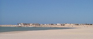
Cape Bojador is a headland on the west coast of Western Sahara, at 26° 07' 37"N, 14° 29' 57"W, as well as the name of the large nearby town with a population of 42,651. The name of the surrounding province also derives its name from the cape.

<span class="mw-page-title-main">Río de Oro</span> Territory of Western Sahara

Río de Oro was, with Saguia el-Hamra, one of the two territories that formed the Spanish province of Spanish Sahara after 1969; it had been taken as a Spanish colonial possession in the late 19th century. Its name seems to come from an east–west river which was supposed to have run through it. The river was thought to have largely dried out – a wadi, as the name indicates – or have disappeared underground.

<span class="mw-page-title-main">Banc d'Arguin National Park</span> Mauritanian National Park

The Banc d'Arguin National Park of Bay of Arguin lies in Western Africa on the west coast of Mauritania between Nouakchott and Nouadhibou and is the former mouth of the Tamanrasset River. The World Heritage Site is a major site for migratory birds and breeding birds, including flamingos, pelicans and terns. Much of the breeding is on sand banks including the islands of Tidra, Niroumi, Nair, Kijji and Arguim. The surrounding waters are some of the richest fishing waters in western Africa and serve as nesting grounds for the entire western region.

<span class="mw-page-title-main">Southern Provinces</span> Term used by Morocco for Western Sahara

The Southern Provinces or Moroccan Sahara are the terms utilized by the Moroccan government to refer to the disputed territory of Western Sahara. These designations encompass the entirety of Western Sahara, which spans three of Morocco's 12 top-level administrative regions. The term "Southern Provinces" is frequently used on Moroccan state television.

<span class="mw-page-title-main">Tiris al-Gharbiyya</span> Area of Western Sahara

Tiris al-Gharbiyya was the name for the area of Western Sahara under Mauritanian control between 1975 and 1979.

<span class="mw-page-title-main">Oulad Delim</span>

The Oulad Delim are a Bedouin Sahrawi tribe of Arab descent which originated in Yemen. They are descended from Delim bin Hassan, who was from the Ma'qili tribe of Beni Hassan which settled in the Sahara in the 12th century. They were formerly considered of Hassane status i.e. part of the ruling warrior stratum. The Oulad Delim speak Hassaniya Arabic, a Bedouin dialect which is very close to pure classical Arabic. They traditionally live in the southern regions of Western Sahara, especially around the city of Dakhla. They are also found in Morocco in the region of Rabat, Marrakech, Sidi Kacem and El Jadida, where their ancestors received lands from the Moroccan sultans for their participation in warfare, as a Guich tribe, as well as in Mauritania in the region between Nouadhibou and Idjil.

<span class="mw-page-title-main">Ras Nouadhibou</span> Peninsula

Ras Nouadhibou is a 60-kilometre (37 mi) peninsula or headland divided by the border between Mauritania and Western Sahara on the African coast of the Atlantic Ocean. It is internationally known as Cabo Blanco in Spanish or Cap Blanc in French.

The Oulad Tidrarin is a Sahrawi tribe of Arab origin. They speak Hassaniya Arabic. They are Muslims, belonging to the Maliki school of Sunni Islam. They live mainly in Western Sahara but also in Morocco and Mauritania.

Cintra Bay or the Gulf of Cintra is a large, half-moon shaped bay on the coast of Río de Oro province, Western Sahara. It is located about 120 km (75 mi) south of Dakhla. Its coastline is sparsely populated, and the environment is mostly wild and undeveloped. Originally called "St. Cyprian's Bay", it was renamed after Captain Gonçalo de Sintra, a 15th-century Portuguese explorer who was thought to have met his death in the bay during an unauthorized, unsuccessful slave raid.

<span class="mw-page-title-main">Sahrawi Arab Democratic Republic–Spain relations</span> Bilateral relations

Sahrawi Arab Democratic Republic–Spain relations are the current and historical relations between the Sahrawi Arab Democratic Republic and Spain.

<span class="mw-page-title-main">Emilio Bonelli</span> Spanish military officer

Don Emilio Bonelli y Hernando was a Spanish military officer, author, explorer, colonial administrator and Africanist.

<span class="mw-page-title-main">Morocco–Western Sahara border</span> International border

The Morocco–Western Sahara border is 444 kilometres (276 mi) in length and runs from Atlantic Ocean in the west, to the tripoint with Algeria in the east. The border has existed purely in a de jure sense since Morocco's annexation of Western Sahara in 1976–1979.

<span class="mw-page-title-main">Mauritania–Western Sahara border</span> International border

The Mauritania–Western Sahara border is 1,564 kilometres (972 mi) in length and runs from the tripoint with Algeria in the north-east to the Atlantic Ocean in the south-west.

<span class="mw-page-title-main">Algeria–Western Sahara border</span> International border

The Algeria–Western Sahara border is 41 kilometres (25 mi) in length and runs from the tripoint with Morocco in the north to the tripoint with Mauritania in the south.

References

  1. 1 2 "POPULATION LÉGALE DES RÉGIONS, PROVINCES, PRÉFECTURES, MUNICIPALITÉS, ARRONDISSEMENTS ET COMMUNES DU ROYAUME D'APRÈS LES RÉSULTATS DU RGPH 2014" (in Arabic and French). Haut Commissariat au Plan. 8 April 2015. Retrieved 29 September 2017.
  2. "Western Sahara: a 'peaceful solution' to conflict is possible, says UN envoy" . Retrieved 27 June 2021.
  3. "A/RES/35/19 - E - A/RES/35/19". Question of Western Sahara. p. 214. Retrieved 8 April 2021.
  4. Christian Walter; Antje von Ungern-Sternberg; Kavus Abushov (5 June 2014). Self-Determination and Secession in International Law. OUP Oxford. p. 264. ISBN   978-0-19-100692-0.
  5. "FIS - Noticias en Breve - EN BREVE - la flota de arrastre del Golfo de Cádiz vuelve este martes a faenar tras 45 días de parada biológica". Archived from the original on 28 May 2020. Retrieved 24 March 2012.
  6. Dr. Pedro González de la Fe. "EVOLUCIÓN DE LA ACTIVIDAD DE LA FLOTA PESQUERA CON BASE EN CANARIAS EN EL BANCO SAHARIANO DESDE LOS ACUERDOS – TRIPARTITOS DE 1975 HASTA LA ACTUALIDAD" (PDF). Retrieved 19 December 2014.{{cite journal}}: Cite journal requires |journal= (help)
  7. Gaudio, Attilio (1978). Le Dossier de la Mauritanie (in French). Nouvelles Editions Latines. p. 282. ISBN   978-2-7233-0035-3.
  8. McKenna A. (2011), McKenna A. (ed.), The History of Northern Africa (book), The Rosen Publishing Group, p. 167, ISBN   9781615303182 , retrieved 19 December 2014
  9. Jensen, Erik (2005). Western Sahara: Anatomy of a Stalemate. Lynne Rienner Publishers. p. 24. ISBN   978-1-58826-305-6.
  10. 1 2 3 4 5 6 7 "Oysters Are Served with Politics in the Disputed Western Sahara". 13 April 2015.
  11. "Sahara: Gambia Opens Consulate in Dakhla, Dealing another Hard Blow to Polisario". Sahara News. 7 January 2020.
  12. "Sahara: Guinea Opens Consulate in Dakhla, Another Diplomatic Setback for Polisario". Sahara News. 17 January 2020.
  13. "The Republic of Djibouti Opens Consulate General in Dakhla". diplomatie.ma. 28 February 2020.
  14. "Liberia Officially Opens Consulate in Morocco's Dakhla". Morocco World News. 12 March 2020.
  15. "Burkina Faso Opens Consulate General in Morocco's Dakhla". Morocco World News. 23 October 2020.
  16. "Equatorial Guinea Inaugurates Consulate General in Morocco's Dakhla". Morocco World News. 23 October 2020.
  17. "Guinea-Bissau Opens Consulate General in Morocco's Dakhla". Morocco World News. 23 October 2020.
  18. "Western Sahara: DR Congo Opens Consulate General In Dakhla". Morocco World News. 19 December 2020.
  19. Graham. 2014. Surf Dakhla Archived 27 September 2018 at the Wayback Machine Mowgli Adventures Retrieved on 20 December 2014
  20. Teller, Matthew (3 September 2010). "Hot spots: What's new in the Middle East". The Guardian.
  21. "Kosmos Energy: On Hydrocarbon Exploration Offshore Western Sahara" (PDF). Kosmos Energy. February 2014.
  22. "Operations Western Sahara". Archived from the original on 9 April 2015. Retrieved 15 April 2015.
  23. "Klimatafel von Dakhla (Villa Cisneros) / Westsahara (Dem. Arab. Rep. Sahara)" (PDF). Baseline climate means (1961-1990) from stations all over the world (in German). Deutscher Wetterdienst. Retrieved 6 November 2018.
  24. HELIOPHORA WILDLIFE Retrieved on 20 December 2014
  25. Rufino R.; Neves R.; Pina J.P. (1998). "Wintering waders in Dakhla Bay, Western Sahara" (PDF). Wader Study Group Bulletin. 87: 26–29. Retrieved 26 December 2014.
  26. Punkbirder (Team Desert Storm) 2010 Western Sahara January 2010 Archived 27 September 2018 at the Wayback Machine Retrieved on 20 December 2014
  27. Smith S. 2014 11 February 2014 – Some Colour Ringed Audouin's Gulls Retrieved on 20 December 2014
  28. Smith S. 2014 10 February 14 – Back On The Road To Nowhere Retrieved on 20 December 2014
  29. Hunter, E.; Stander, M.; Kossmann, J.; Chakraborty, S.; Prince, S.; Peters, S.; Loedolff, Bianke (2020). "Toward the identification of a phytocannabinoid-like compound in the flowers of a South African medicinal plant (Leonotis leonurus)". BMC Research Notes. 13 (1): 522. doi: 10.1186/s13104-020-05372-z . PMC   7653773 . PMID   33172494. S2CID   226292238.
  30. Johnson M.W.; Karamanlidis A.A.; Dendrinos P.; Larrinoa D.F.P.; Gazo M.; González M.L.; Güçlüsoy H.; Pires R.; Schnellmann M. "Mediterranean Monk Seal Fact Sheet". The Monachus Guardian. Retrieved 19 December 2014.
  31. Notarbartolo di Sciara G.; Politi E.; Bayed A.; Beaubrun P.C. & Knowlton A. (1998). Donovan P.G. (ed.). "A Winter Cetacean Survey off Southern Morocco, With a Special Emphasis on Right Whales" (PDF). The Annual Report of the International Whaling Commission - 48: 547–551. Archived from the original (PDF) on 2 October 2013. Retrieved 19 December 2014.
  32. WAEREBEEK V.K.; ANDRE M.; SEQUEIRA M.; MARTIN V.; ROBINEAU D.; COLLET A.; NDIAYE E.P.V. "Spatial and temporal distribution of the minke Whale, Balaenoptera acutorostrata (Lacépede, 1804), in the southernnortheast Atlantic Ocean and the Mediterranean Sea, With reference to stock identity" (PDF). J. Cetacean Res. Manage. L(3): 223–237. Retrieved 21 December 2014.
  33. Walsh D. (2006). "Sei Whale". Greenpeace. p. the DaveWalshPhoto.com. Archived from the original on 8 December 2012. Retrieved 19 December 2014.
  34. White R. (2013). "At Sea, from Senegal to Western Sahara – 17 April 2013 – National Geographic Explorer". Lindblad Expeditions – National Geographic. Retrieved 19 December 2014.
  35. EXPÓSITO G. C.; QNINBA A. (2010). "Observations de Tortues, d'Oiseaux et de Mammifères marins au large des côtes atlantiques marocaines durant l'automne 2010" (PDF). Bulletin de l'Institut Scientifique, Rabat, Section Sciences de la Vie. 32 (2): 129–132. Archived (PDF) from the original on 27 February 2015. Retrieved 27 February 2015.
  36. Tiwari M.; Aksissou M.; Semmoumy S.; Ouakka K. (2006). "Sea Turtle Surveys in Southern Morocco (Plage Blanche – Porto Rico) in July 2006" (PDF). A Report to the Institut National de Recherche Halieutique, Casablanca, Kingdom of Morocco. Archived from the original (PDF) on 19 December 2014. Retrieved 19 December 2014.
  37. "Fishery Audit Report Checklist" (PDF). Associazione Friend of the Sea. Archived from the original (PDF) on 20 July 2014. Retrieved 27 December 2014.{{cite journal}}: Cite journal requires |journal= (help)
  38. 1 2 "Twinning Agreement between Dakhla, Italian City of Vibo Valentia". Maghreb Arabe Presse . 14 March 2022. Retrieved 15 March 2022.

23°42′29″N15°56′44″W / 23.70806°N 15.94556°W / 23.70806; -15.94556