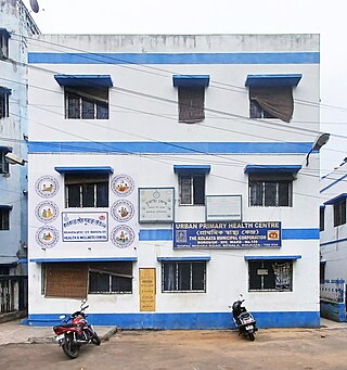
Behala is a locality of South West Kolkata in Kolkata district in the Indian state of West Bengal. Behala is a part of Kolkata Municipal Corporation area. It is broadly spread across Ward Nos. 118, 119, 120, 121, 122, 123, 124, 125, 126, 127, 128, 129, 130, 131 and 132 of the Kolkata Municipal Corporation and is divided into two Vidhan Sabha constituencies: Behala Paschim and Behala Purba. Behala, Parnasree, Thakurpukur, Haridevpur and Sarsuna police stations serve this area under the South West Division of Kolkata Police also known as Behala Division.

Parnasree Pally is an upscale residential area located in Behala, a locality in southern Kolkata, India. It was incorporated into the Kolkata Municipal Corporation in 1985. The name "Parnasree" translates to "beauty of the leaves" in English. Previously known as Halderbagan, it is believed that the Halders were associated with the Sabarna Roy Chowdhury family. The name "Parnasree" was coined by the late Asoke Ratan Mazumder when he became a member of the cooperative society established for the rehabilitation of refugees during the Partition of India in 1947.

Sarsuna is a neighborhood of South West Kolkata in West Bengal, India. It is a part of the greater Behala region and can be reached via Chowrasta or through Barisha. It is a predominantly Bengali neighborhood, though its fast becoming a cosmopolitan place. It is bordered by Barisha in the east and Maheshtala to the west.

Joka is a locality in South Kolkata, West Bengal, India. It is a part of greater Behala region. This place is mostly known for Indian Institute of Management Calcutta and ESIC Medical College and Hospital.

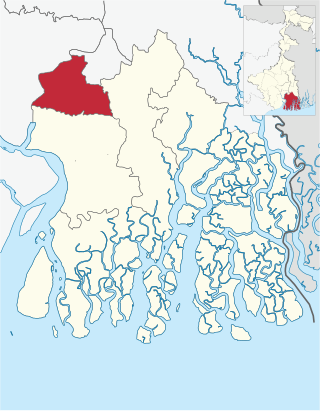
Alipore Sadar subdivision is an administrative subdivision of the South 24 Parganas district in the Indian state of West Bengal.

Bansdroni is a locality of South Kolkata in West Bengal, India. It is a part of the Kolkata Municipal Corporation and the Kolkata Police jurisdiction area.
Shakuntala Park is a neighborhood / township in South West Kolkata which lies in the greater Behala region on Biren Roy Road (West). The area falls under Sarsuna pincode area.
Ward No. 80, Kolkata Municipal Corporation is an administrative division of Kolkata Municipal Corporation in Borough No. 9, covering parts of Kidderpore, Garden Reach, Tikiapara, Alipore Mint Colony, Taratala neighbourhoods in South Kolkata, in the Indian state of West Bengal.
Ward No. 114, Kolkata Municipal Corporation {ওয়ার্ড নম্বর ১১৪, কলকাতা পৌরসংস্থা} is an administrative division of Kolkata Municipal Corporation in Borough No. 11, surrounding all around this region are Bansdroni, Paschim Putiary, Kudghat, Haridevpur(partly), Rajpur Sonarpur(partly)(Rania 30 feet) Ramkantapur(under Behala Purba, pincode-7000104)(partly) as nearby of all the above. This Region is located in the south of the Tolly's Nullah in the city of Kolkata of the state of West Bengal of the country of India .This area is covered to Purba Putiary area.
Ward No. 116, Kolkata Municipal Corporation is an administrative division of Kolkata Municipal Corporation in Borough No. 13, covering parts of Tollygunge Circular Road neighbourhoods in the Indian state of West Bengal.
Ward No. 117, Kolkata Municipal Corporation is an administrative division of Kolkata Municipal Corporation in Borough No. 13, covering parts of Tollygunge Circular Road neighbourhoods in the Indian state of West Bengal.
Ward No. 119, Kolkata Municipal Corporation is an administrative division of Kolkata Municipal Corporation in Borough No. 13, covering parts of Behala neighbourhoods in the Indian state of West Bengal.
Ward No. 121, Kolkata Municipal Corporation is an administrative division of Kolkata Municipal Corporation in Borough No. 13, covering parts of Behala neighbourhoods in the Indian state of West Bengal.
Ward No. 122, Kolkata Municipal Corporation is an administrative division of Kolkata Municipal Corporation in Borough No. 13, covering parts of Behala and Haridevpur neighbourhoods in the Indian state of West Bengal.
Ward No. 123, Kolkata Municipal Corporation is an administrative division of Kolkata Municipal Corporation in Borough No. 13, covering parts of Barisha neighbourhood in the Indian state of West Bengal.
Ward No. 125, Kolkata Municipal Corporation is an administrative division of Kolkata Municipal Corporation in Borough No. 16, covering parts of Paschim Barisha, Dakshin Behala Road and Thakurpukur neighbourhoods in the Indian state of West Bengal. It is the biggest Ward of Kolkata Municipal Corporation.
Ward No. 128, Kolkata Municipal Corporation is an administrative division of Kolkata Municipal Corporation in Borough No. 14, covering parts of Behala neighbourhood in the Indian state of West Bengal.

Ward No. 129, Kolkata Municipal Corporation is an administrative division of Kolkata Municipal Corporation in Borough No. 14, covering parts of Behala neighbourhood in the Indian state of West Bengal.
Ward No. 131, Kolkata Municipal Corporation is an administrative division of Kolkata Municipal Corporation in Borough No. 14, covering parts of Behala neighbourhood in the Indian state of West Bengal.
Kabardanga is a locality in South Kolkata in West Bengal, India. It is a part of Kolkata Municipal Corporation.It is a locality of partly Behala area and partly Tollygunge area.


