Dantan

Last updated

Dantan
Village
West Bengal location map.svg
Red pog.svg
Dantan
Location in West Bengal, India
India location map.svg
Red pog.svg
Dantan
Dantan (India)
Coordinates: 21°54′38.2″N87°16′12.0″E / 21.910611°N 87.270000°E / 21.910611; 87.270000
CountryFlag of India.svg  India
State West Bengal
District Paschim Medinipur
Languages*
  Official Bengali, Santali, English
Time zone UTC+5:30 (IST)
PIN
721426 (Dantan)
Telephone/STD code03229
Lok Sabha constituency Medinipur
Vidhan Sabha constituency Dantan
Website paschimmedinipur.gov.in

Dantan is a village in the Dantan I CD block in the Kharagpur subdivision of the Paschim Medinipur district in the state of West Bengal, India.

Contents

Geography

Dantan
Invisible Square.svg
Mapscaleline.svg
8km
5miles
Red pog.svg
O
D
I
S
H
A
Adasimla
H
Invisible Square.svg
Tilantapara
H
Invisible Square.svg
Shrirampur
H
Invisible Square.svg
Kolanda
H
Invisible Square.svg
Kerur
H
Invisible Square.svg
Dubrajpur
H
Invisible Square.svg
Bhemwa
H
Invisible Square.svg
Kurumbera Fort
H
Invisible Square.svg
Moghalmari
H
Invisible Square.svg
Sabang
R
Invisible Square.svg
Narayangarh
R
Invisible Square.svg
Mohanpur
R
Invisible Square.svg
Lutunia
R
Invisible Square.svg
Khandrui
R
Invisible Square.svg
Keshiary
R
Invisible Square.svg
Kashmuli
R
Invisible Square.svg
Dhaneswarpur
R
Invisible Square.svg
Dantan
R
Belda
R
Invisible Square.svg
Deuli
CT
Invisible Square.svg
Cities and towns in the southern portion of Kharagpur subdivision (including Dantan I & II, Mohanpur, Keshiary, Narayangarh and Sabang CD blocks) of Paschim Medinipur district
CT: census town, R: rural/ urban centre, H: historical/ religious centre
Owing to space constraints in the small map, the actual locations in a larger map may vary slightly

Location

Dantan is located at 21°54′38.2″N87°16′12.0″E / 21.910611°N 87.270000°E / 21.910611; 87.270000 .

Area overview

Kharagpur subdivision, shown partly in the map alongside, mostly has alluvial soils, except in two CD blocks in the west – Kharagpur I and Keshiary, which mostly have lateritic soils. Around 74% of the total cultivated area is cropped more than once. [1] With a population density of 787 persons per km2, nearly half of the district’s population resides in this subdivision. 14.33% of the population lives in urban areas and the rest in the rural areas. [2]

Note: The map alongside presents some of the notable locations in the subdivision. All places marked in the map are linked in the larger full screen map.

Civic administration

CD block HQ

The headquarters of Dantan I CD block are located at Dantan. [3]

Police station

Dantan police station has jurisdiction over Dantan I CD block. [4] [5]

Transport

The Kolkata-Chennai South Eastern Railway passes through Dantan I CD Block and there is a station at Dantan named Dantan railway station. [6]

The Kolkata-Chennai Golden Quadrilateral National Highway 16 or Kolkata-Bengaluru Asian Highway 45 passes through Dantan. [7] Dantan is well connected with Nayagram via Mogalmari Bhasraghat Road.

Education

Bhatter College at Dantan was established in 1963 and is affiliated to Vidyasagar University. It offers undergraduate courses in arts, commerce and science and also has facilities for some post-graduate courses. The college is named after Mathuranath Bhatter, a local businessman and social worker who had contributed handsomely to set up the college. [8] [9]

Related Research Articles

Belda is a village in the Narayangarh CD block in the Kharagpur subdivision of the Paschim Medinipur district in West Bengal, India.

<span class="mw-page-title-main">Dantan I</span> Community development block in West Bengal, India

Dantan I is a community development block that forms an administrative division in the Kharagpur subdivision of Paschim Medinipur district in the Indian state of West Bengal.

Keshiary is a village in the Keshiari CD block in the Kharagpur subdivision of the Paschim Medinipur district in the state of West Bengal.

<span class="mw-page-title-main">Kharagpur subdivision</span> Subdivision in West Bengal, India

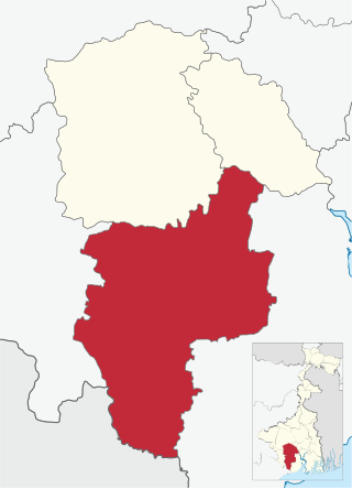
Kharagpur subdivision is an administrative subdivision of Paschim Medinipur district in the state of West Bengal, India.

Sabang is a village in the Sabang CD block in the Kharagpur subdivision of the Paschim Medinipur district in the state of West Bengal, India.

Narayangarh is a major Town in the Narayangarh CD block in the Kharagpur subdivision of the Paschim Medinipur district in the state of West Bengal, India.

Debra is a village in the Debra CD block in the Kharagpur subdivision of the Paschim Medinipur district in the state of West Bengal, India.

Mohanpur is a village in the Mohanpur CD block in the Kharagpur subdivision of the Paschim Medinipur district in the state of West Bengal, India.

Madpur is a village in the Kharagpur II CD block in the Kharagpur subdivision of the Paschim Medinipur district in the state of West Bengal, India.

Dhaneswarpur is a village, in the Dantan II CD block in the Kharagpur subdivision of the Paschim Medinipur district in the state of West Bengal, India.

Satkul is a village, in the Kharagpur I CD block in the Kharagpur subdivision of the Paschim Medinipur district in the state of West Bengal, India.

Lutunia is a village in the Sabang CD block in the Kharagpur subdivision of the Paschim Medinipur district in the state of West Bengal, India.

Shrirampur is a village in the Sabang CD block in the Kharagpur subdivision of the Paschim Medinipur district in the state of West Bengal, India.

Dubrajpur is a village in the Sabang CD block in the Kharagpur subdivision of the Paschim Medinipur district in the state of West Bengal, India.

Adasimla is a village in the Sabang CD block in the Kharagpur subdivision of the Paschim Medinipur district in the state of West Bengal, India.

Tilantapara is a village in the Sabang CD block in the Kharagpur subdivision of the Paschim Medinipur district in the state of West Bengal, India.

Kolanda is a village in the Sabang CD block in the Kharagpur subdivision of the Paschim Medinipur district in the state of West Bengal, India.

Kashmuli is a village in the Dantan II CD block in the Kharagpur subdivision of the Paschim Medinipur district in the state of West Bengal, India.

Chaulia is a census town in the Dantan I CD block in the Kharagpur subdivision of the Paschim Medinipur district in the state of West Bengal, India.

Khandrui is a village in the Dantan II CD block in the Kharagpur subdivision of the Paschim Medinipur district in the state of West Bengal, India.

References

  1. "District Human Development Report Paschim Medinipur, 2011". page 27-28. Department of Planning and Statistics, Government of West Bengal. Retrieved 10 September 2020.
  2. "District Statistical Handbook Paschim Medinipur, 2013". Table 2.2, 2.4 (a). Department of Planning and Statistics. Retrieved 10 September 2020.
  3. "District Census Handbook: Paschim Medinipur" (PDF). Map of Paschim Medinipur with CD Block HQs and Police Stations (on the fifth page). Directorate of Census Operations, West Bengal, 2011. Retrieved 20 November 2016.
  4. "District Statistical Handbook 2014 Paschim Medinipur". Tables 2.1, 2.2. Department of Planning and Statistics, Government of West Bengal. Retrieved 14 September 2020.
  5. "District at a Glance". Paschim Medinipur District Police. Archived from the original on 27 October 2016. Retrieved 27 October 2016.
  6. "58002 Puri-Santragachi Passenger". Time Table. indiarailinfo. Retrieved 17 August 2016.
  7. "Rationalisation of Numbering Systems of National Highways" (PDF). New Delhi: Department of Road Transport and Highways. Archived from the original (PDF) on 1 February 2016. Retrieved 17 August 2016.
  8. "Bhatter College, Dantan" (PDF). Bhatter College. Retrieved 28 October 2016.
  9. "Bhatter College". College Admission. Retrieved 28 October 2016.