SRI SRI KISORIMOHAN JIU MANDIRKANU THAKUR SAMADHI MANDIRসতেরোচূড়া রাসমঞ্চ, গড়বেতা
Geography
8km 5miles
^
Bhadutola Reserve Forest
]
Godapiasal Forest
\
Arabari Range Forest
[
Goaltore Reserve Forest
Z
Salboni Forest Range
Y
Lalgarh-Jhitka Forest Range
X
Gohaldanga Forest Range
W
Hoomgarh Forest
V
Kangsabati River
U
Shilabati River
F
JSW Cement Plant
F
Vidyasagar University
H
Gongoni Danga
H
Pathra
H
Karnagarh
M
Midnapore
R
Satbankura
R
Salboni
R
Pingboni
R
Keshpur
R
Godapiasal
R
Goaltore
R
Chandrakona Road
R
Chandra
R
Anandapur
CT
Naba Kola
CT
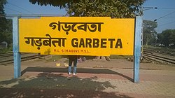
Garbeta
CT
Dwarigeria
CT
Durllabhganj
CT
Amlagora
Cities and towns in Medinpur Sadar subdivision of Paschim Medinipur district M: municipal city/ town, CT: census town, R: rural/ urban centre, H: historical/ religious centre F: facilities Owing to space constraints in the small map, the actual locations in a larger map may vary slightly
Paschim Medinipur district (before separation of Jhargram) had a total forest area of 1,700km2, accounting for 14.31% of the total forested area of the state. It is obvious from the map of the Midnapore Sadar subdivision, placed alongside, that there are large stretches of forests in the subdivision. The soil is predominantly lateritic.[1] Around 30% of the population of the district resides in this subdivision. 13.95% of the population lives in urban areas and 86.05% lives in the rural areas.[2]
Note: The map alongside presents some of the notable locations in the subdivision. All places marked in the map are linked in the larger full screen map.
Demographics
According to the 2011 Census of India Garbeta had a total population of 5,109 of which 2,576 (50%) were males and 2,533 (50%) were females. Population in the age range 0–6 years was 463. The total number of literate persons in Garbeta was 3,886 (76.06% of the population over 6 years).[3]
Infrastructure
According to the District Census Handbook 2011, Paschim Medinipur, Garbeta covered an area of 0.6071km2. Among the civic amenities, the protected water supply involved overhead tank, service reservoir, tap water from treated and untreated sources. It had 998 domestic electric connections, 50 road lighting points. Among the medical facilities it had 4 medicine shops in the town. Among the educational facilities it had were 2 primary schools, 1 secondary school, 1(?) senior secondary school, 1 general degree college.[4]
Civic administration
CD block HQ
The headquarters of Garhbeta I block are located at Garbeta.[5]
The economy of this area is agriculturally based. The principal crops include rice, potatoes, wheat, and vegetables of different kinds. Some villagers are engaged in fishing, hawking and weaving. A small percentage of the townspeople are government employees and school teachers. Most of the people are middle class to lower middle class.
There are number of well known schools in Garbeta, including Garbeta High School, Banerjee Danga High School, Saradamani Girls' High School, Garhbeta Umadevi Girls High School and Monglapota High School. The only college here is Garbeta College[8] which is part of Vidyasagar University.[9] There are also non-governmental educational organizations in or near Garbeta including "Raksha Bandhan For Education",
Health
There is a rural hospital in Garbeta, as well as many private medical practitioners. Overall, the population is generally healthy.
Sarva Mangala temple
There are a number of temples in Garbeta but particular mention has to be made of the temple of Sarva Mangala. It is peculiar in having its door facing the north.[why?] According to the tradition, during the days of MaharajaVikramaditya of Ujjain a yogi was wandering about in the thick of the forests and was attracted to this particular place. He immediately brought about a temple of Sarva Mangala Devi through his mantras.
Sarbamangala Temple of Garhbeta
Maharaja Vikramaditya came to know of the dynamic force of this and came to Garbeta where he performed a tantricsadhana sitting on a dead body. The Devi was pleased with the sadhana of the Maharaja, blessed him with supernatural powers and gave him the services of Tal and Betal[who?]. The Maharaja wanted to test the spiritual power conferred on him by the Devi and asked Tal and Betal to turn the temple and make it face the north. Tal and Betal did so and it is said that the name Garbeta derives its name from Tal and Betal.
Festivals
There are many festivals in Garbeta. There is one rural organization named Prayas which promotes all manner of cultural events. There are some religious sites, among which Sarbangala Mandir is most popular. The regular Bengali festivals like Durga Puja, Lakshmi Puja, Saraswati Puja and Kali Puja are well attended. Other common pujas are Shitala, Jagaddhatri, Holi and Bheema.
Famous Tourist Spots
Gongoni Danga - A natural hill on the silabati river bank which is a very popular picnic spot. It is a natural river canyon and has different spectacular types of formation due to soil erosion.
Sarbamangala Mandir -The largest temple on the north side of Mangala lake, it shows the influence of Oriya architecture.
Raikota Fort - Some of the most prominent architectural remains are the ruins of an old fort. At the entrance to the fort are four massive gateways which still bear their old names: Lal Darwaja, Hanuman Darwaja, Pesha Darwaja and Rauti Darwaja. Within the fort there are seven large silted up water ponds, each with a temple in the center. They all lie towards the north of the fort and it is believed that they were excavated between 1555 and 1610 A.D. in the time of the Chauhan Rajas of Bagri.
Krishnarai Jiu Temple, Bagri - The temple is situated at the left bunk of the river Silaboti. It has five pillars and is a pure example of Bengali architecture. It was built by Rajyadhar Roy, minister for the first king of Bagri, Gajapati Singha.
Kameshwar Temple and Radhaballav Temple - Both the temples are famous and one can see some similarity with Sarbamangala Temple . Radhaballav temple is a mixture of Oriya and Bengali architecture.
Raghunathji Temple, Raghunath Bari - It is situated at the southern part of river Silaboti and has nine pillars. Raghunath or Bishnupur's Adi Malla made this temple.[clarification needed]
Sri Sri Baba Basanta Ray Jiu Temple - This shiva temple is located in Raskundu (near Garhbeta). Here medicines for rheumatism artharitis and other ailments are given.
Uriyasaier Temple - The remains of a stone temple, made by Chouhan Singha.
Jhalda Fort, Nayabasat - The remains of Bagri king Ganapati Singha's fort.
History of Bagree-Rajya (Garhbeta): with Special Reference to its Anti-British Role, from Late 18th century Till the Present Times by Gouripada Chatterjee, foreword by R.C. Majumdar. Edition: 2nd rev., Delhi, India: Mittal Publications, 1987. ISBN81-7099-014-9
↑ "District Census Handbook Paschim Medinipur, Census of India 2011, Series 20, Part XII A"(PDF). Section II Town Directory, Pages 2827-2833; Statement I: Status and Growth History, Page 2827; Statement II: Physical Aspects and Location of Towns, Page 2829; Statement III: Civic and other Amenities, Page 2830; Statement IV: Medical Facilities 2831, Page 2832; Statement V: Educational, Recreational and Cultural Facilities, Page 2832,2833; Statement VI: Industry and Banking, Page 2833. Directorate of census Operations V, West Bengal. Retrieved 5 September 2020.
↑ "District Census Handbook: Paschim Medinipur"(PDF). Map of Paschim Medinipur with CD Block HQs and Police Stations (on the fifth page). Directorate of Census Operations, West Bengal, 2011. Retrieved 20 November 2016.
This page is based on this Wikipedia article Text is available under the CC BY-SA 4.0 license; additional terms may apply. Images, videos and audio are available under their respective licenses.