
Vyatskiye Polyany is a town in Kirov Oblast, Russia, located on the right bank of the Vyatka River, 350 kilometers (220 mi) southeast of Kirov. Population: 35,162 (2010 Census); 40,282 (2002 Census); 44,513 (1989 Census).

Belaya Kholunitsa is a town and the administrative center of Belokholunitsky District in Kirov Oblast, Russia, located on the Belaya Kholunitsa River, 82 kilometers (51 mi) northeast of Kirov, the administrative center of the oblast. Population: 11,232 (2010 Census); 11,975 (2002 Census); 13,367 (1989 Census).

Kirs is a town and the administrative center of Verkhnekamsky District in Kirov Oblast, Russia, located on the Kirs River near its confluence with the Vyatka, 281 kilometers (175 mi) northeast of Kirov, the administrative center of the oblast. Population: 10,420 (2010 Census); 11,786 (2002 Census); 14,200 (1989 Census).

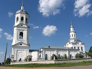
Orlov is a town and the administrative center of Orlovsky District in Kirov Oblast, Russia, located on the right bank of the Vyatka River, 75 kilometers (47 mi) west of Kirov, the administrative center of the oblast. Population: 6,959 (2010 Census); 8,596 (2002 Census); 10,296 (1989 Census).

Afanasyevsky District is an administrative and municipal district (raion), one of the thirty-nine in Kirov Oblast, Russia. It is located in the east of the oblast. The area of the district is 5,230 square kilometers (2,020 sq mi). Its administrative center is the urban locality of Afanasyevo. Population: 13,848 (2010 Census); 16,961 ; 18,994 (1989 Census). The population of Afanasyevo accounts for 24.8% of the district's total population.

Belokholunitsky District is an administrative and municipal district (raion), one of the thirty-nine in Kirov Oblast, Russia. It is located in the northeast of the oblast. The area of the district is 5,064 square kilometers (1,955 sq mi). Its administrative center is the town of Belaya Kholunitsa. Population: 19,890 (2010 Census); 23,232 ; 27,156 (1989 Census). The population of Belaya Kholunitsa accounts for 56.5% of the district's total population.

Kirovo-Chepetsky District is an administrative and municipal district (raion), one of the thirty-nine in Kirov Oblast, Russia. It is located in the center of the oblast. The area of the district is 2,210.27 square kilometers (853.39 sq mi). Its administrative center is the town of Kirovo-Chepetsk. Population: 21,317 (2010 Census); 22,193 ; 39,688 (1989 Census).

Kotelnichsky District is an administrative and municipal district (raion), one of the thirty-nine in Kirov Oblast, Russia. It is located in the west of the oblast. The area of the district is 3,940 square kilometers (1,520 sq mi). Its administrative center is the town of Kotelnich. Population: 15,799; (2010 Census) 20,507 ; 27,712 (1989 Census).

Luzsky District is an administrative and municipal district (raion), one of the thirty-nine in Kirov Oblast, Russia. It is located in the northwest of the oblast. The area of the district is 5,315 square kilometers (2,052 sq mi). Its administrative center is the town of Luza. As of the 2010 Census, the total population of the district was 18,688, with the population of Luza accounting for 60.3% of that number.

Nagorsky District is an administrative and municipal district (raion), one of the thirty-nine in Kirov Oblast, Russia. It is located in the north of the oblast. The area of the district is 7,236 square kilometers (2,794 sq mi). Its administrative center is the urban locality of Nagorsk. Population: 10,336 (2010 Census); 13,186 ; 16,577 (1989 Census). The population of Nagorsk accounts for 47.4% of the district's total population.

Nemsky District is an administrative and municipal district (raion), one of the thirty-nine in Kirov Oblast, Russia. It is located in the southeast of the oblast. The area of the district is 2,158 square kilometers (833 sq mi). Its administrative center is the urban locality of Nema. As of the 2010 Census, the total population of the district was 7,983, with the population of Nema accounting for 45.7% of that number.

Nolinsky District is an administrative and municipal district (raion), one of the thirty-nine in Kirov Oblast, Russia. It is located in the south of the oblast. The area of the district is 2,140 square kilometers (830 sq mi). Its administrative center is the town of Nolinsk. Population: 20,868 (2010 Census); 25,170 ; 28,780 (1989 Census). The population of Nolinsk accounts for 45.8% of the district's total population.
Orichevsky District is an administrative and municipal district (raion), one of the thirty-nine in Kirov Oblast, Russia. It is located in the center of the oblast. The area of the district is 2,352 square kilometers (908 sq mi). Its administrative center is the urban locality of Orichi. Population: 30,781 (2010 Census); 32,764 ; 36,425 (1989 Census). The population of Orichi accounts for 25.9% of the district's total population.

Podosinovsky District is an administrative and municipal district (raion), one of the thirty-nine in Kirov Oblast, Russia. It is located in the northwest of the oblast. The area of the district is 4,265 square kilometers (1,647 sq mi). Its administrative center is the urban locality of Podosinovets. Population: 17,009 (2010 Census); 21,649 ; 25,559 (1989 Census). The population of Podosinovets accounts for 23.7% of the district's total population.

Sanchursky District is an administrative and municipal district (raion), one of the thirty-nine in Kirov Oblast, Russia. It is located in the southwest of the oblast. The area of the district is 1,536 square kilometers (593 sq mi). Its administrative center is the urban locality of Sanchursk. Population: 10,080 (2010 Census); 14,063 ; 17,719 (1989 Census). The population of Sanchursk accounts for 46.9% of the district's total population.

Sunsky District is an administrative and municipal district (raion), one of the thirty-nine in Kirov Oblast, Russia. It is located in the center of the oblast. The area of the district is 1,260 square kilometers (490 sq mi). Its administrative center is the urban locality of Suna. Population: 6,784 (2010 Census); 8,636 ; 10,150 (1989 Census). The population of Suna accounts for 32.4% of the district's total population.

Svechinsky District is an administrative and municipal district (raion), one of the thirty-nine in Kirov Oblast, Russia. It is located in the west of the oblast. The area of the district is 1,773 square kilometers (685 sq mi). Its administrative center is the urban locality of Svecha. Population: 8,517 (2010 Census); 10,229 ; 12,229 (1989 Census). The population of Svecha accounts for 55.9% of the district's total population.

Uninsky District is an administrative and municipal district (raion), one of the thirty-nine in Kirov Oblast, Russia. It is located in the southeast of the oblast. The area of the district is 2,130 square kilometers (820 sq mi). Its administrative center is the urban locality of Uni. Population: 9,178 (2010 Census); 11,179 ; 12,955 (1989 Census). The population of Uni accounts for 50.0% of the district's total population.
Pervomaysky is a closed urban locality in Kirov Oblast, Russia. Population: 6,147(2010 Census); 9,300.
Arbazh is an urban-type settlement and the administrative center of Arbazhsky District of Kirov Oblast, Russia. Population: 3,563 (2010 Census); 4,067 (2002 Census); 4,927 (1989 Census).


