Urzhum is a town and the administrative center of Urzhumsky District in Kirov Oblast, Russia, located on the left bank of the Urzhumka River about 10 kilometers (6.2 mi) from its confluence with the Vyatka River. Population: 10,213 (2010 Census); 11,514 (2002 Census); 12,101 (1989 Census).
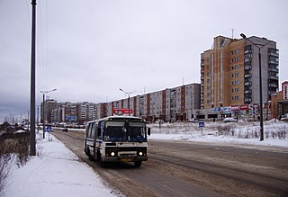
Kirovo-Chepetsk is a town in Kirov Oblast, Russia, located at the confluence of the Cheptsa and the Vyatka Rivers, 20 kilometers (12 mi) east of Kirov. Population: 80,921 (2010 Census); 90,303 (2002 Census); 92,382 (1989 Census).

Omutninsk is a town and the administrative center of Omutninsky District in Kirov Oblast, Russia. Population: 23,615 (2010 Census); 26,065 (2002 Census); 29,248 (1989 Census).

Yaransk is a town and the administrative center of Yaransky District in Kirov Oblast, Russia, located on the Yaran River, 257 kilometers (160 mi) southwest of Kirov, the administrative center of the oblast. Population: 17,253 (2010 Census); 19,723 (2002 Census); 20,466 (1989 Census).

Murashi is a town and the administrative center of Murashinsky District in Kirov Oblast, Russia, located 112 kilometers (70 mi) northwest of Kirov, the administrative center of the oblast, on the Kirov–Syktyvkar highway. Population: 6,750 (2010 Census); 7,650 (2002 Census); 10,059 (1989 Census).

Arbazhsky District is an administrative and municipal district (raion), one of the thirty-nine in Kirov Oblast, Russia. It is located in the southwest of the oblast. The area of the district is 1,416 square kilometers (547 sq mi). Its administrative center is the urban locality of Arbazh. Population: 7,328 (2010 Census); 9,647 ; 11,933 (1989 Census). The population of Arbazh accounts for 48.6% of the district's total population.

Bogorodsky District is an administrative and municipal district (raion), one of the thirty-nine in Kirov Oblast, Russia. It is located in the southeastern central part of the oblast. The area of the district is 1,443 square kilometers (557 sq mi). Its administrative center is the urban locality of Bogorodskoye. Population: 5,015 (2010 Census); 6,805 ; 8,696 (1989 Census). The population of Bogorodskoye accounts for 57.3% of the district's total population.

Darovskoy District is an administrative and municipal district (raion), one of the thirty-nine in Kirov Oblast, Russia. It is located in the west of the oblast. The area of the district is 3,757 square kilometers (1,451 sq mi). Its administrative center is the urban locality of Darovskoy. Population: 11,829 (2010 Census); 14,990 ; 18,834 (1989 Census). The population of the administrative center accounts for 60.2% of the district's total population.

Falyonsky District is an administrative and municipal district (raion), one of the thirty-nine in Kirov Oblast, Russia. It is located in the east of the oblast. The area of the district is 2,505 square kilometers (967 sq mi). Its administrative center is the urban locality of Falyonki. Population: 11,138 (2010 Census); 14,713 ; 17,756 (1989 Census). The population of Falyonki accounts for 47.2% of the district's total population.

Kiknursky District is an administrative and municipal district (raion), one of the thirty-nine in Kirov Oblast, Russia. It is located in the southwest of the oblast. The area of the district is 1,680 square kilometers (650 sq mi). Its administrative center is the urban locality of Kiknur. Population: 9,795 (2010 Census); 13,228 ; 16,347 (1989 Census). The population of Kiknur accounts for 50.7% of the district's total population.

Kilmezsky District is an administrative and municipal district (raion), one of the thirty-nine in Kirov Oblast, Russia. It is located in the southeast of the oblast. The area of the district is 3,106.4 square kilometers (1,199.4 sq mi). Its administrative center is the urban locality of Kilmez. Population: 13,086 (2010 Census); 16,132 ; 18,370 (1989 Census). The population of Kilmez accounts for 45.5% of the district's total population.

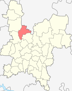
Kirovo-Chepetsky District is an administrative and municipal district (raion), one of the thirty-nine in Kirov Oblast, Russia. It is located in the center of the oblast. The area of the district is 2,210.27 square kilometers (853.39 sq mi). Its administrative center is the town of Kirovo-Chepetsk. Population: 21,317 (2010 Census); 22,193 ; 39,688 (1989 Census).

Kotelnichsky District is an administrative and municipal district (raion), one of the thirty-nine in Kirov Oblast, Russia. It is located in the west of the oblast. The area of the district is 3,940 square kilometers (1,520 sq mi). Its administrative center is the town of Kotelnich. Population: 15,799; (2010 Census) 20,507 ; 27,712 (1989 Census).

Kumyonsky District is an administrative and municipal district (raion), one of the thirty-nine in Kirov Oblast, Russia. It is located in the center of the oblast. The area of the district is 1,911 square kilometers (738 sq mi). Its administrative center is the urban locality of Kumyony. Population: 17,350 (2010 Census); 19,472 ; 21,445 (1989 Census). The population of Kumyony accounts for 27.8% of the district's total population.

Malmyzhsky District is an administrative and municipal district (raion), one of the thirty-nine in Kirov Oblast, Russia. It is located in the south of the oblast. The area of the district is 2,190 square kilometers (850 sq mi). Its administrative center is the town of Malmyzh. Population: 26,757 (2010 Census); 32,070 ; 35,618 (1989 Census). The population of Malmyzh accounts for 30.9% of the district's total population.

Pizhansky District is an administrative and municipal district (raion), one of the thirty-nine in Kirov Oblast, Russia. It is located in the southwest of the oblast. The area of the district is 1,160.2 square kilometers (448.0 sq mi). Its administrative center is the urban locality of Pizhanka. Population: 11,242 (2010 Census); 13,580 ; 15,220 (1989 Census). The population of Pizhanka accounts for 34.5% of the district's total population.

Shabalinsky District is an administrative and municipal district (raion), one of the thirty-nine in Kirov Oblast, Russia. It is located in the west of the oblast. The area of the district is 3,860 square kilometers (1,490 sq mi). Its administrative center is the urban locality of Leninskoye. Population: 10,854 (2010 Census); 14,013 ; 17,489 (1989 Census). The population of Leninskoye accounts for 46.6% of the district's total population.

Urzhumsky District is an administrative and municipal district (raion), one of the thirty-nine in Kirov Oblast, Russia. It is located in the south of the oblast. The area of the district is 3,025 square kilometers (1,168 sq mi). Its administrative center is the town of Urzhum. Population: 27,075 (2010 Census); 33,959 ; 38,836 (1989 Census). The population of Urzhum accounts for 37.7% of the district's total population.

Verkhnekamsky District is an administrative and municipal district (raion), one of the thirty-nine in Kirov Oblast, Russia. It is located in the northeast of the oblast. The area of the district is 10,297 square kilometers (3,976 sq mi). Its administrative center is the town of Kirs. Population: 32,669 (2010 Census); 39,643 ; 54,171 (1989 Census). The population of Kirs accounts for 31.9% of the district's total population.
Verkhoshizhemsky District is an administrative and municipal district (raion), one of the thirty-nine in Kirov Oblast, Russia. It is located in the center of the oblast. The area of the district is 2,415 square kilometers (932 sq mi). Its administrative center is the urban locality of Verkhoshizhemye. Population: 9,483 (2010 Census); 10,878 ; 12,849 (1989 Census). The population of Verkhoshizhemye accounts for 45.9% of the district's total population.