
Vyatskiye Polyany is a town in Kirov Oblast, Russia, located on the right bank of the Vyatka River, 350 kilometers (220 mi) southeast of Kirov. Population: 35,162 (2010 Census); 40,282 (2002 Census); 44,513 (1989 Census).

Belaya Kholunitsa is a town and the administrative center of Belokholunitsky District in Kirov Oblast, Russia, located on the Belaya Kholunitsa River, 82 kilometers (51 mi) northeast of Kirov, the administrative center of the oblast. Population: 11,232 (2010 Census); 11,975 (2002 Census); 13,367 (1989 Census).

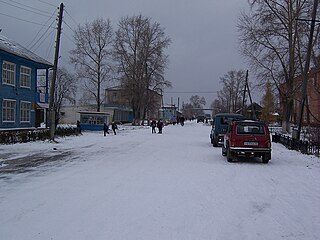
Orlov is a town and the administrative center of Orlovsky District in Kirov Oblast, Russia, located on the right bank of the Vyatka River, 75 kilometers (47 mi) west of Kirov, the administrative center of the oblast. Population: 6,959 (2010 Census); 8,596 (2002 Census); 10,296 (1989 Census).

Afanasyevsky District is an administrative and municipal district (raion), one of the thirty-nine in Kirov Oblast, Russia. It is located in the east of the oblast. The area of the district is 5,230 square kilometers (2,020 sq mi). Its administrative center is the urban locality of Afanasyevo. Population: 13,848 (2010 Census); 16,961 ; 18,994 (1989 Census). The population of Afanasyevo accounts for 24.8% of the district's total population.

Belokholunitsky District is an administrative and municipal district (raion), one of the thirty-nine in Kirov Oblast, Russia. It is located in the northeast of the oblast. The area of the district is 5,064 square kilometers (1,955 sq mi). Its administrative center is the town of Belaya Kholunitsa. Population: 19,890 (2010 Census); 23,232 ; 27,156 (1989 Census). The population of Belaya Kholunitsa accounts for 56.5% of the district's total population.

Kiknursky District is an administrative and municipal district (raion), one of the thirty-nine in Kirov Oblast, Russia. It is located in the southwest of the oblast. The area of the district is 1,680 square kilometers (650 sq mi). Its administrative center is the urban locality of Kiknur. Population: 9,795 (2010 Census); 13,228 ; 16,347 (1989 Census). The population of Kiknur accounts for 50.7% of the district's total population.

Kirovo-Chepetsky District is an administrative and municipal district (raion), one of the thirty-nine in Kirov Oblast, Russia. It is located in the center of the oblast. The area of the district is 2,210.27 square kilometers (853.39 sq mi). Its administrative center is the town of Kirovo-Chepetsk. Population: 21,317 (2010 Census); 22,193 ; 39,688 (1989 Census).

Kotelnichsky District is an administrative and municipal district (raion), one of the thirty-nine in Kirov Oblast, Russia. It is located in the west of the oblast. The area of the district is 3,940 square kilometers (1,520 sq mi). Its administrative center is the town of Kotelnich. Population: 15,799; (2010 Census) 20,507 ; 27,712 (1989 Census).

Luzsky District is an administrative and municipal district (raion), one of the thirty-nine in Kirov Oblast, Russia. It is located in the northwest of the oblast. The area of the district is 5,315 square kilometers (2,052 sq mi). Its administrative center is the town of Luza. As of the 2010 Census, the total population of the district was 18,688, with the population of Luza accounting for 60.3% of that number.

Nolinsky District is an administrative and municipal district (raion), one of the thirty-nine in Kirov Oblast, Russia. It is located in the south of the oblast. The area of the district is 2,140 square kilometers (830 sq mi). Its administrative center is the town of Nolinsk. Population: 20,868 (2010 Census); 25,170 ; 28,780 (1989 Census). The population of Nolinsk accounts for 45.8% of the district's total population.

Omutninsky District is an administrative and municipal district (raion), one of the thirty-nine in Kirov Oblast, Russia. It is located in the east of the oblast. The area of the district is 5,171 square kilometers (1,997 sq mi). Its administrative center is the town of Omutninsk. Population: 44,793 (2010 Census); 51,406 ; 59,218 (1989 Census). The population of Omutninsk accounts for 52.7% of the district's total population.
Oparinsky District is an administrative and municipal district (raion), one of the thirty-nine in Kirov Oblast, Russia. It is located in the northwest of the oblast. The area of the district is 6,043 square kilometers (2,333 sq mi). Its administrative center is the urban locality of Oparino. Population: 11,795 (2010 Census); 14,631 ; 18,201 (1989 Census). The population of Oparino accounts for 37.6% of the district's total population.

Orlovsky District is an administrative and municipal district (raion), one of the thirty-nine in Kirov Oblast, Russia. It is located in the central part of the oblast. The area of the district is 1,989 square kilometers (768 sq mi). Its administrative center is the town of Orlov. Population: 12,934 (2010 Census); 16,190 ; 19,557 (1989 Census). The population of Orlov accounts for 53.8% of the district's total population.

Svechinsky District is an administrative and municipal district (raion), one of the thirty-nine in Kirov Oblast, Russia. It is located in the west of the oblast. The area of the district is 1,773 square kilometers (685 sq mi). Its administrative center is the urban locality of Svecha. Population: 8,517 (2010 Census); 10,229 ; 12,229 (1989 Census). The population of Svecha accounts for 55.9% of the district's total population.

Tuzhinsky District is an administrative and municipal district (raion), one of the thirty-nine in Kirov Oblast, Russia. It is located in the southwest of the oblast. The area of the district is 1,468 square kilometers (567 sq mi). Its administrative center is the urban locality of Tuzha. Population: 7,688 (2010 Census); 10,396 ; 12,334 (1989 Census). The population of Tuzha accounts for 59.4% of the district's total population.

Yaransky District is an administrative and municipal district (raion), one of the thirty-nine in Kirov Oblast, Russia. It is located in the southwest of the oblast. The area of the district is 2,420 square kilometers (930 sq mi). Its administrative center is the town of Yaransk. Population: 26,899 (2010 Census); 33,682 ; 37,253 (1989 Census). The population of Yaransk accounts for 64.1% of the district's total population.

Yuryansky District is an administrative and municipal district (raion), one of the thirty-nine in Kirov Oblast, Russia. It is located in the north of the oblast. The area of the district is 3,031 square kilometers (1,170 sq mi). Its administrative center is the urban locality of Yurya. Population: 20,128 (2010 Census); 22,893 ; 34,311 (1989 Census). The population of Yurya accounts for 28.2% of the district's total population.
Pervomaysky is a closed urban locality in Kirov Oblast, Russia. Population: 6,147(2010 Census); 9,300.
Afanasyevo is an urban-type settlement and the administrative center of Afanasyevsky District of Kirov Oblast, Russia. Population: 3,435 (2010 Census); 3,474 (2002 Census); 4,982 (1989 Census).
Arbazh is an urban-type settlement and the administrative center of Arbazhsky District of Kirov Oblast, Russia. Population: 3,563 (2010 Census); 4,067 (2002 Census); 4,927 (1989 Census).


