Kirovo-Chepetsky District

Last updated
Kirovo-Chepetsky District
Кирово-Чепецкий район(Russian)
Location of Kirovo-Chepetsk Region (Kirov Oblast).svg
Location of Kirovo-Chepetsky District in Kirov Oblast
Coordinates: 58°33′N50°02′E / 58.550°N 50.033°E / 58.550; 50.033 Coordinates: 58°33′N50°02′E / 58.550°N 50.033°E / 58.550; 50.033
Artiomovskaia staritsa.jpg
Lake Artemovskoye, Kirovo-Chepetsky District
Coat of Arms of Kirovsko chepetsky rayon (Kirov oblast).png
Flag of Kirovo-Chepetsky rayon (Kirov oblast).png
Coat of arms
Flag
Location
Country Russia
Federal subject Kirov Oblast [1]
Administrative structure (as of July 2012)
Administrative center town of  Kirovo-Chepetsk [1]
Administrative divisions: [2]
rural okrug 13
Inhabited localities: [2]
Rural localities 237
Municipal structure (as of July 2012)
Municipally incorporated asKirovo-Chepetsky Municipal District [3]
Municipal divisions: [3]
Urban settlements0
Rural settlements13
Statistics
Area (municipal district) 2,210.27 km2 (853.39 sq mi) [4]
Population (2010 Census) 21,317 inhabitants [5]
 Urban0%
 Rural100%
Density 9.64/km2 (25.0/sq mi) [6]
Time zone MSK (UTC+03:00) [7]
Official website
Kirovo-Chepetsky District on WikiCommons

Kirovo-Chepetsky District (Russian : Ки́рово-Чепе́цкий райо́н) is an administrative [1] and municipal [3] district (raion), one of the thirty-nine in Kirov Oblast, Russia. It is located in the center of the oblast. The area of the district is 2,210.27 square kilometers (853.39 sq mi). [4] Its administrative center is the town of Kirovo-Chepetsk (which is not administratively a part of the district). [1] Population: 21,317(2010 Census); [5] 22,193 (2002 Census); [8] 39,688(1989 Census). [9]

Russian language East Slavic language

Russian is an East Slavic language, which is official in the Russian Federation, Belarus, Kazakhstan and Kyrgyzstan, as well as being widely used throughout Eastern Europe, the Baltic states, the Caucasus and Central Asia. It was the de facto language of the Soviet Union until its dissolution on 25 December 1991. Although nearly three decades have passed since the breakup of the Soviet Union, Russian is used in official capacity or in public life in all the post-Soviet nation-states, as well as in Israel and Mongolia.

A raion is a type of administrative unit of several post-Soviet states. The term is from the French "rayon", which is both a type of a subnational entity and a division of a city, and is commonly translated in English as "district".

Contents

Administrative and municipal status

Within the framework of administrative divisions, Kirovo-Chepetsky District is one of the thirty-nine in the oblast. [1] The town of Kirovo-Chepetsk serves as its administrative center, despite being incorporated separately as an administrative unit with the status equal to that of the districts. [1]

Kirovo-Chepetsk Town in Kirov Oblast, Russia

Kirovo-Chepetsk is a town in Kirov Oblast, Russia, located at the confluence of the Cheptsa and the Vyatka Rivers, 20 kilometers (12 mi) east of Kirov. Population: 80,921 (2010 Census); 90,303 (2002 Census); 92,382 (1989 Census).

City of federal subject significance is an umbrella term used to refer to a type of an administrative division of a federal subject of Russia which is equal in status to a district but is organized around a large city; occasionally with surrounding rural territories.

As a municipal division, the district is incorporated as Kirovo-Chepetsky Municipal District. [3] The Town of Kirovo-Chepetsk is incorporated separately from the district as Kirovo-Chepetsk Urban Okrug. [3]

Related Research Articles

Urzhum, Urzhumsky District, Kirov Oblast Town in Kirov Oblast, Russia

Urzhum is a town and the administrative center of Urzhumsky District in Kirov Oblast, Russia, located on the left bank of the Urzhumka River about 10 kilometers (6.2 mi) from its confluence with the Vyatka River. Population: 10,213 (2010 Census); 11,514 (2002 Census); 12,101 (1989 Census).

Omutninsk Town in Kirov Oblast, Russia

Omutninsk is a town and the administrative center of Omutninsky District in Kirov Oblast, Russia. Population: 23,615 (2010 Census); 26,065 (2002 Census); 29,248 (1989 Census).

Yaransk Town in Kirov Oblast, Russia

Yaransk is a town and the administrative center of Yaransky District in Kirov Oblast, Russia, located on the Yaran River, 257 kilometers (160 mi) southwest of Kirov, the administrative center of the oblast. Population: 17,253 (2010 Census); 19,723 (2002 Census); 20,466 (1989 Census).

Luza, Luzsky District, Kirov Oblast Town in Kirov Oblast, Russia

Luza is a town and the administrative center of Luzsky District in Kirov Oblast, Russia, located on the Luza River, 301 kilometers (187 mi) northwest of Kirov, the administrative center of the oblast. Population: 11,260 (2010 Census); 12,311 (2002 Census); 13,706 (1989 Census).

Malmyzh, Kirov Oblast Town in Kirov Oblast, Russia

Malmyzh is a town and the administrative center of Malmyzhsky District in Kirov Oblast, Russia, located on the Shoshma River, near its confluence with the Zasora, Moksha, and Krupny Lach Rivers, 294 kilometers (183 mi) southeast of Kirov, the administrative center of the oblast. Population: 8,265 (2010 Census); 9,318 (2002 Census); 10,699 (1989 Census).

Murashi, Kirov Oblast Town in Kirov Oblast, Russia

Murashi is a town and the administrative center of Murashinsky District in Kirov Oblast, Russia, located 112 kilometers (70 mi) northwest of Kirov, the administrative center of the oblast, on the Kirov–Syktyvkar highway. Population: 6,750 (2010 Census); 7,650 (2002 Census); 10,059 (1989 Census).

Nolinsk Town in Kirov Oblast, Russia

Nolinsk is a town and the administrative center of Nolinsky District in Kirov Oblast, Russia, located on the right bank of the Voya River, 143 kilometers (89 mi) south of Kirov, the administrative center of the oblast. Population: 9,554 (2010 Census); 10,463 (2002 Census); 10,902 (1989 Census).

Zuyevka, Kirov Oblast Town in Kirov Oblast, Russia

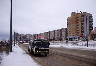
Zuyevka is a town and the administrative center of Zuyevsky District in Kirov Oblast, Russia, located 121 kilometers (75 mi) east of Kirov, the administrative center of the oblast. Population: 11,198 (2010 Census); 12,600 (2002 Census); 16,112 (1989 Census).

Kiknursky District District in Kirov Oblast, Russia

Kiknursky District is an administrative and municipal district (raion), one of the thirty-nine in Kirov Oblast, Russia. It is located in the southwest of the oblast. The area of the district is 1,680 square kilometers (650 sq mi). Its administrative center is the urban locality of Kiknur. Population: 9,795 (2010 Census); 13,228 ; 16,347 (1989 Census). The population of Kiknur accounts for 50.7% of the district's total population.

Kilmezsky District District in Kirov Oblast, Russia

Kilmezsky District is an administrative and municipal district (raion), one of the thirty-nine in Kirov Oblast, Russia. It is located in the southeast of the oblast. The area of the district is 3,106.4 square kilometers (1,199.4 sq mi). Its administrative center is the urban locality of Kilmez. Population: 13,086 (2010 Census); 16,132 ; 18,370 (1989 Census). The population of Kilmez accounts for 45.5% of the district's total population.

Kotelnichsky District District in Kirov Oblast, Russia

Kotelnichsky District is an administrative and municipal district (raion), one of the thirty-nine in Kirov Oblast, Russia. It is located in the west of the oblast. The area of the district is 3,940 square kilometers (1,520 sq mi). Its administrative center is the town of Kotelnich. Population: 15,799; (2010 Census) 20,507 ; 27,712 (1989 Census).

Lebyazhsky District District in Kirov Oblast, Russia

Lebyazhsky District is an administrative and municipal district (raion), one of the thirty-nine in Kirov Oblast, Russia. It is located in the south of the oblast. The area of the district is 1,336 square kilometers (516 sq mi). Its administrative center is the urban locality of Lebyazhye. Population: 8,700 (2010 Census); 11,176 ; 12,414 (1989 Census). The population of Lebyazhye accounts for 38.6% of the district's total population.

Murashinsky District District in Kirov Oblast, Russia

Murashinsky District is an administrative and municipal district (raion), one of the thirty-nine in Kirov Oblast, Russia. It is located in the north of the oblast. The area of the district is 3,415.78 square kilometers (1,318.84 sq mi). Its administrative center is the town of Murashi. As of the 2010 Census, the total population of the district was 12,905, with the population of Murashi accounting for 52.3% of that number.

Vyatskopolyansky District District in Kirov Oblast, Russia

Vyatskopolyansky District, sometimes spelled Vyatsko-Polyansky District, is an administrative and municipal district (raion), one of the thirty-nine in Kirov Oblast, Russia. It is located in the southeast of the oblast. The area of the district is 907.71 square kilometers (350.47 sq mi). Its administrative center is the town of Vyatskiye Polyany. Population: 30,659 (2010 Census); 34,044 ; 38,451 (1989 Census).

Yuryansky District District in Kirov Oblast, Russia

Yuryansky District is an administrative and municipal district (raion), one of the thirty-nine in Kirov Oblast, Russia. It is located in the north of the oblast. The area of the district is 3,031 square kilometers (1,170 sq mi). Its administrative center is the urban locality of Yurya. Population: 20,128 (2010 Census); 22,893 ; 34,311 (1989 Census). The population of Yurya accounts for 28.2% of the district's total population.

Zuyevsky District District in Kirov Oblast, Russia

Zuyevsky District is an administrative and municipal district (raion), one of the thirty-nine in Kirov Oblast, Russia. It is located in the east of the oblast. The area of the district is 2,820 square kilometers (1,090 sq mi). Its administrative center is the town of Zuyevka. Population: 22,586 (2010 Census); 27,823 ; 36,023 (1989 Census). The population of Zuyevka accounts for 49.6% of the district's total population.

Pervomaysky (urban-type settlement), Kirov Oblast Urban-type settlement in Kirov Oblast, Russia

Pervomaysky is a closed urban locality in Kirov Oblast, Russia. Population: 6,147(2010 Census); 9,300.

Afanasyevo, Kirov Oblast Urban-type settlement in Kirov Oblast, Russia

Afanasyevo is an urban-type settlement and the administrative center of Afanasyevsky District of Kirov Oblast, Russia. Population: 3,435 (2010 Census); 3,474 (2002 Census); 4,982 (1989 Census).

Arkul Work settlement in Kirov Oblast, Russia

Arkul is an urban locality in Nolinsky District of Kirov Oblast, Russia. Population: 2,053 (2010 Census); 2,616 (2002 Census); 3,163 (1989 Census).

References

Notes

  1. 1 2 3 4 5 6 Law #387-ZO
  2. 1 2 Law #203-ZO
  3. 1 2 3 4 5 Law #284-ZO
  4. 1 2 Official website of the Government of Kirov Oblast. About Kirovo-Chepetsky Municipal District (in Russian)
  5. 1 2 Russian Federal State Statistics Service (2011). "Всероссийская перепись населения 2010 года. Том 1" [2010 All-Russian Population Census, vol. 1]. Всероссийская перепись населения 2010 года (2010 All-Russia Population Census) (in Russian). Federal State Statistics Service . Retrieved June 29, 2012.
  6. The value of density was calculated automatically by dividing the 2010 Census population by the area specified in the infobox. Please note that this value is only approximate as the area specified in the infobox does not necessarily correspond to the area of the entity proper or is reported for the same year as the population.
  7. Правительство Российской Федерации. Федеральный закон №107-ФЗ от 3 июня 2011 г. «Об исчислении времени», в ред. Федерального закона №271-ФЗ от 03 июля 2016 г. «О внесении изменений в Федеральный закон "Об исчислении времени"». Вступил в силу по истечении шестидесяти дней после дня официального опубликования (6 августа 2011 г.). Опубликован: "Российская газета", №120, 6 июня 2011 г. (Government of the Russian Federation. Federal Law #107-FZ of June 31, 2011 On Calculating Time , as amended by the Federal Law #271-FZ of July 03, 2016 On Amending Federal Law "On Calculating Time". Effective as of after sixty days following the day of the official publication.).
  8. Russian Federal State Statistics Service (May 21, 2004). "Численность населения России, субъектов Российской Федерации в составе федеральных округов, районов, городских поселений, сельских населённых пунктов – районных центров и сельских населённых пунктов с населением 3 тысячи и более человек" [Population of Russia, Its Federal Districts, Federal Subjects, Districts, Urban Localities, Rural Localities—Administrative Centers, and Rural Localities with Population of Over 3,000](XLS). Всероссийская перепись населения 2002 года [All-Russia Population Census of 2002] (in Russian). Retrieved August 9, 2014.
  9. Demoscope Weekly (1989). "Всесоюзная перепись населения 1989 г. Численность наличного населения союзных и автономных республик, автономных областей и округов, краёв, областей, районов, городских поселений и сёл-райцентров" [All Union Population Census of 1989: Present Population of Union and Autonomous Republics, Autonomous Oblasts and Okrugs, Krais, Oblasts, Districts, Urban Settlements, and Villages Serving as District Administrative Centers]. Всесоюзная перепись населения 1989 года [All-Union Population Census of 1989] (in Russian). Институт демографии Национального исследовательского университета: Высшая школа экономики [Institute of Demography at the National Research University: Higher School of Economics]. Retrieved August 9, 2014.

Sources