Kangra-Lambagraon was a historical state and later princely estate (jagir) of British India located in the present-day state of Himachal Pradesh.

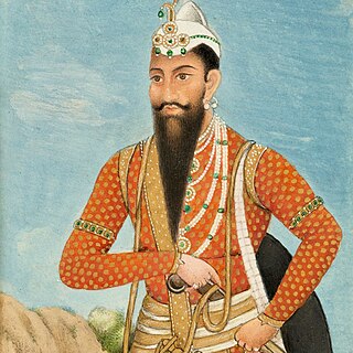
Kunwar Nau Nihal Singh was the third maharaja of the Sikh Empire, ruling from 1839 until his death in 1840. He was the only son of Maharaja Kharak Singh and his consort, Maharani Chand Kaur. He was known as Yuvraj Kunwar Nau Nihal Singh. He was also known as Kunwar Sa. His reign began with the dethronement of his father Maharaja Kharak Singh and ended with his death at the age of 19 on the day of his father's funeral.

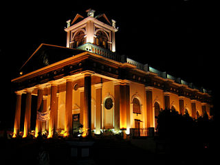
Kapurthala is a city in Punjab state of India. It is the administrative headquarters of Kapurthala District. It was the capital of the Kapurthala State, a princely state in British India. The aesthetic mix of the city with its prominent buildings based on French and Indo-Saracenic architecture self-narrate its princely past. It is also known as city of Palaces & Gardens. According to the 2011 census, Kapurthala is the least populated city in India.

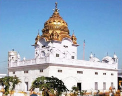
Udasis, also spelt as Udasins, also known as Nanak Putras, are a religious sect of ascetic sadhus centred in northern India who follow a tradition known as Udasipanth. Becoming custodians of Sikh shrines in the 18th century, they were notable interpreters and spreaders of the Sikh philosophy during that time. However, their religious practices border on a syncretism of Sikhism and Hinduism, and they did not conform to the Khalsa standards as ordained by Guru Gobind Singh. When the Lahore Singh Sabha reformers, dominated by Tat Khalsa Sikhs, would hold them responsible for indulging in ritual practices antithetical to Sikhism, as well as personal vices and corruption, the Udasi mahants were expelled from the Sikh shrines.
The Hill States of India were princely states lying in the northern border regions of the British Indian Empire.

Majha is a region located in the central parts of the historical Punjab region, currently split between the republics of India and Pakistan. It extends north from the right banks of the river Beas, and reaches as far north as the river Jhelum. People of the Majha region are given the demonym "Mājhī" or "Majhail". Most inhabitants of the region speak the Majhi dialect, which is the basis of the standard register of the Punjabi language. The most populous city in the area is Lahore on the Pakistani side, and Amritsar on the Indian side of the border.

The Kangra fort is a historic fort located in the Kangra district of the Himachal Pradesh state, India. This fort is also known as 'Nagarkot' and 'Kot Kangra'. This fort stands on a hillock between two rivers, among the foothills of the Dhauladhar range. This fort is the largest in the Indian Himalayas, and is under the protection of the Archeological Survey of India.

Dera Baba Nanak is a town and a municipal council in Gurdaspur district, in the state of Punjab, India. It is the sub-district headquarters of Dera Baba Nanak tehsil. It is 36 km away from Gurdaspur city, the capital of the district. Since November 2019, a corridor between India and Pakistan has been established at its shrine.
Fatehgarh Churian is a town located in Gurdaspur district in Punjab, India. It is nearby Gurdaspur city, the district headquarter. It is a municipal council of the Gurdaspur district. The city lies 15 kilometres from the Pakistani border. It is located 485 kilometres north of New Delhi, India.
Samana is a town and a municipal council, nearby Patiala City in Patiala district in the Indian state of Punjab.

Maharani Datar Kaur (born Bibi Raj Kaur Nakai; was the queen consort of Maharaja Ranjit Singh, the founder of the Sikh Empire and the mother of his successor, Maharaja Kharak Singh. She was the daughter of Sardar Ran Singh Nakai, third ruler of the Nakai Misl and Sardarni Karmo Kaur.

Jammu and Kashmir, also known as Kashmir and Jammu, was a princely state in a subsidiary alliance with the British East India Company from 1846 to 1858 and under the paramountcy of the British Crown, from 1858 until the Partition of India in 1947, when it became a disputed territory, now administered by three countries: China, India, and Pakistan. The princely state was created after the First Anglo-Sikh War, when the East India Company, which had annexed the Kashmir Valley, from the Sikhs as war indemnity, then sold it to the Raja of Jammu, Gulab Singh, for rupees 75 lakhs.

Kharak Singh was the second maharaja of the Sikh Empire, ruling from June 1839 until his dethronement and imprisonment in October 1839. He was the eldest son of Maharaja Ranjit Singh, founder of the Sikh Empire and his consort, Maharani Datar Kaur. Kharak was succeeded by his only son Nau Nihal Singh.

Kutlehar State, covering an area of 2,200 km2 (850 sq mi), was one of the Princely states of India.

Siba State, was a small independent Indian hill state in the Lower Himalayas. It was centered on the town of Dadasiba, Pragpur tehsil, Kangra district, in modern-day Himachal Pradesh. The state was founded in 1450. In 1849 the territory of Datarpur was added to Siba Jagir and annexed by the British Raj as 'Dada-Siba'.

Nurpur kingdom in the Himalayan foothills of India was founded in 1064 A.D at north-eastern Bari Doab between the Ravi and the Beas rivers at the fusion of Kangra, Duggar, Majha, Dharab and Chamba areas which ended in 1815. The remnants of Nurpur kingdom exist as ruined forts, restored temples, water bodies, and canals in Nurpur tehsil, Fatehpur tehsil, Pathankot tehsil, Dhar Kalan tehsil, Jawali tehsil, Indora tehsil Bhattiyat tehsil, and Sihunta tehsil.
Apra also known as The Golden City Apra is a census town in Phillaur Tehsil in Jalandhar district of Punjab State, India. The town is known for gold jewelry and paddy crops which are produced in large amounts. It is located 46 kilometres (29 mi) towards East from Jalandhar, 12 kilometres (7.5 mi) from Phillaur and 110 kilometres (68 mi) from Chandigarh. Apra is the largest town as compared to other surrounding villages and has the main marketplace. The town is administrated by Sarpanch an elected representative of the village.
Dadwal, also written as Dadhwal and Dhadwal, is a surname prevalent in Punjab, Himachal Pradesh and Jammu. The surname is prevalent in the Rajput community. It is also prevalent in the Jatt community and is a clan name amongst Hindus and Sikhs.
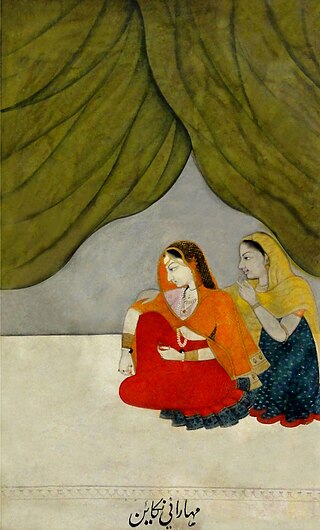
Nanaki Kaur Atariwala (1823-1856) was the queen consort of Maharaja Nau Nihal Singh, the third Maharaja of the Sikh Empire. She was the daughter of the legendary general Sham Singh Atariwala.


