Related Research Articles

Fourth Crossing is an unincorporated community in Calaveras County, California. It lies at an elevation of 922 feet and is located on State Route 49 at 38°07′53″N120°38′05″W. The community is in ZIP code 95248 and area code 209.

Melones is a former settlement in Calaveras County, California, now submerged beneath a reservoir named New Melones Lake. It lay at an elevation of 955 feet. Melones was founded on the site of a ferry operated from 1848 by John W. Robinson and Stephen Mead. The town initially took its name from the ferry.

Castaic Creek is a 25.0-mile-long (40.2 km) stream in the Sierra Pelona Mountains, in northeastern Los Angeles County, California. It is a tributary of the Santa Clara River.

Kanab Creek is one of the many tributaries of the Colorado River. It begins in Kane County, Utah, just south of the watershed to the Great Basin and flows 125 miles (201 km) south to the Colorado River.
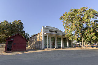
La Grange is a small unincorporated community in rural Stanislaus County, California. Its altitude is 249 feet (76 m). As of 2008 it has a population of 345. It is located at 37°39′49″N120°27′49″W along the Tuolumne River, and is near the La Grange Dam and the New Don Pedro Dam.
Llanhennock is a village and community in Monmouthshire, south east Wales, United Kingdom. The population taken at the 2011 census was 496. The village of Tredunnock is within the community.
The McConnell State Recreation Area is on the banks of the Merced River, about two miles northeast of Livingston. Fishing is popular for catfish, black bass and perch. There are picnic, camping and play areas.

Moores Valley is an unincorporated community in Marengo County, Alabama, United States.

Turlock Lake State Recreation Area is regional park and recreation area at Turlock Reservoir in Stanislaus County, central California, United States.
Hills Ferry is a small unincorporated community of the northern San Joaquin Valley in Stanislaus County, California. Hills Ferry is located at 37°20′56″N120°58′47″W.
Atlanta is an unincorporated community located in San Joaquin County, California. Its elevation is 62 ft and is located at 37°48′47″N121°07′15″W.

Varshavskoye Highway is a major street in Moscow, Russia, continued beyond the city limit at Moscow Ring Road into Moscow Oblast as a backup route for M2 highway, a major trunk road. It continues the Bolshaya Tulskaya Street of central Moscow, and close from its start the Kashira Highway branches from it.
Rancho Orestimba y Las Garzas was a 26,668-acre (107.92 km2) Mexican land grant in present-day Stanislaus County and Merced County, California given in 1844 by Governor Manuel Micheltorena to Sebastián Núñez. The grant was originally in a part of Tuolumne County that became part of Stanislaus County in 1854. The grant was located west of the San Joaquin River and south of Rancho Del Puerto, and encompassed present-day Newman. Arroyo Orestimba lay across the northern section of the Rancho Orestimba with Arroyo de las Garzas across the southern end of the Rancho.
Phillips' Ferry was a historical ferry crossing of the Merced River, located in present-day Merced County, California.
Temple's Ranch, was the ranch and a home of F. P. F. Temple, a wealthy land owner in Los Angeles County, with large business and land holdings of thousands of acres in Madera County and Fresno County including this ranch in Fresno County near the Merced County border.
Hooser is an unincorporated community in Dexter Township of Cowley County, Kansas, United States. Hooser is located at 37°08′18″N96°37′48″W.
Colorado City is a ghost town in what is now Yuma County, Arizona. It was located on the south bank of the Colorado River at Jaeger's Ferry, 1 mile down river from Fort Yuma.
Watson's Ferry was a former settlement, river ferry and steamboat landing on Fresno Slough near its confluence with the San Joaquin River nearby to the northeast of modern Mendota in what is now Fresno County, California. Watson's Ferry was located 8 miles southeast of Firebaugh.
Beale's Crossing, was a river crossing of the Colorado River, near the head of the Mohave Valley, between New Mexico Territory and California along the along the 35th Parallel route of Beale's Wagon Road. The crossing was located at what became the site of Fort Mohave in what is now Fort Mohave, Arizona and west of Beaver Lake, Nevada. The crossing was named for Edward Fitzgerald Beale who lead the expedition that built what came to be called Beale's Wagon Road from Albuquerque, New Mexico to Beale's Crossing in California, then by way of the Mohave Trail/Old Spanish Trail, and another old route west from the Mojave River to Fort Tejon, California.
Indian Creek is a stream in Cape Girardeau County in the U.S. state of Missouri. It is a tributary of the Mississippi River.
References
- ↑ ITINERARY XXI. From Fort Yuma to Benicia, California, in The Prairie Traveler: A Hand-book for Overland Expeditions by Randolph Barnes Marcy, Published by Authority of the War Department, (1859)]
