Muzaffargarh District is a district of the Punjab province of Pakistan. Its capital is Muzaffargarh city. It lies on the bank of the Chenab River.
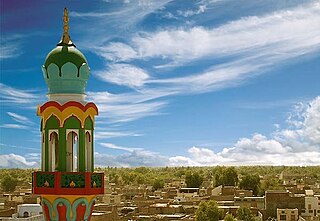
Rojhan is a city and headquarters for Rojhan Tehsil in Rajanpur District, Punjab, Pakistan. It is the headquarter of Mazari (tribe).

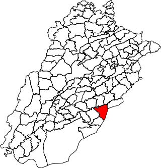
Rajanpur, is a city and the headquarters of Rajanpur District in the far southwestern part of Punjab, Pakistan. The district lies entirely west of the Indus River. it is a narrow, 32 kilometres (20 mi) to 64 kilometres (40 mi) wide strip of land sandwiched between the Indus River on the east and the Sulaiman Mountains on the west. Most of its inhabitants are Saraikis and Baloch.
Layyah District, is a district in the Punjab, Pakistan. It is located in the southern part of the province. Layyah is the district headquarter of Layyah District. Layyah has hot desert climate.

Dera Ghazi Khan is a district in the Punjab province of Pakistan. Its capital is the Dera Ghazi Khan city.
Rahim Yar Khan District is a district in the province of Punjab, Pakistan. Its headquarters is the city of Rahim Yar Khan.

Rajanpur is a district of the Pakistani province of Punjab, with its administrative headquarters the city of Rajanpur. Lying west of the Indus River, its inhabitants are mostly Saraikis and Baloch. According to the 1998 census, the district had a population of 1,100,000, and 14.27% of these were inhabitants of urban areas.
Bahawalnagar Tehsil is a tehsil located in Bahawalnagar District, Punjab, Pakistan. There are two towns in Bahawalnagar Tehsil: Bahawalnagar and Dunga Bunga. The city of Bahawalnagar is the headquarters of the tehsil which is administratively subdivided into 31 Union Councils.

Chistian Tehsil is a tehsil located in Bahawalnagar District, Punjab, Pakistan. The city of Chishtian is the headquarters of the tehsil which is administratively subdivided into 29 Union Councils.

Minchinabad Tehsil, is a tehsil located in Bahawalnagar District, Punjab, Pakistan. The city of Minchinabad is the headquarters of the tehsil which is administratively subdivided into 25 Union Councils.

Haroonabad Tehsil is a tehsil located in Bahawalnagar District, Punjab, Pakistan. The city of Haroonabad is the headquarters of the tehsil which is administratively subdivided into 22 Union Councils.
Rajanpur, is a tehsil located in Rajanpur District, Punjab, Pakistan. It is administratively subdivided into 16 Union Councils, two of which form the tehsil capital Rajanpur.
Jampur, is a Tehsil located in Punjab, Pakistan. It is capital of Jampur district. It is administratively subdivided into 19 Union Councils, two of which form the tehsil capital Jampur.
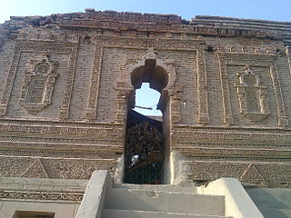
Rojhan, is a (tehsil) located in Rajanpur District, Punjab, Pakistan. It is administratively subdivided into 8 Union Councils The headquarters of the tehsil is located in the town of Rojhan at the footholds of the Suleiman Range and on the western bank of Indus River.It is situated in the tri border area of Punjab, Pakistan. Rojhan tehsil borders Balochistan to its south west, Sindh to its south and Rahim Yar Khan District to its west. It is the stronghold of Mazari (tribe).

Fort Abbas is a tehsil located in Bahawalnagar District, Punjab, Pakistan.
De-Excluded Area D.G. Khan also known as D.G. Khan Tribal Area is a tehsil located in Dera Ghazi Khan District, Punjab, Pakistan. The population is 212,430 according to the 2017 census.
Lahore Cantonment is a tehsil located in Lahore District, Punjab, Pakistan. The population is 1,636,342 according to the 2017 census. The Assistant Commissioner is Ms. Qurat-ul-Ain Zafar, PAS. The seat of Government is located in the Cantt Kutchery. The main areas under the Tehsil include: DHA, Lahore Cantt., Walton Cantt., Bedian, Burki, Paragon.
Sardar Kaure Khan Jatoi or Sardar Kauray Khan Jatoi. (Urdu سردار کوڑے خان جتوئی ) was a landlord in Muzaffargarh, Punjab, Pakistan born in 1800. His father's name was Sardar Saad Khan Jatoi. He donated 82553 Kanals and 14 Marla of land for public welfare purposes in British Raj
Muhammadpur, is a tehsil located in Punjab, Pakistan. Its one of the tehsil of newest district Jampur. It is administratively subdivided into 13 Union Councils, two of which form the tehsil capital Muhammadpur.