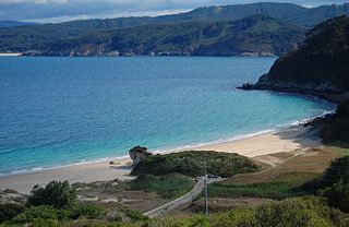
The Bay of Biscay is a gulf of the northeast Atlantic Ocean located south of the Celtic Sea. It lies along the western coast of France from Point Penmarc'h to the Spanish border, and along the northern coast of Spain, extending westward to Cape Ortegal. The southern area of the Bay of Biscay that washes over the northern coast of Spain is known locally as the Cantabrian Sea.
Albiztur is a town located in the province of Gipuzkoa, in the autonomous community of Basque Country, in the north of Spain. In 2014 Albiztur had a total population of 327.

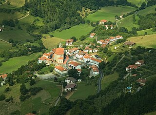
Anoeta is a town located in the province of Gipuzkoa, in the autonomous community of Basque Country, in the north of Spain.
Durango is a town and municipality of the historical territory and province of Biscay, located in the Basque Country, Spain. It is the main town of Durangaldea, one of the comarcas of Biscay. Because of its economical activities and population, Durango is considered one of the largest towns in Biscay after the ones that compose the conurbation of Greater Bilbao.
Asteasu is a town located in the province of Gipuzkoa, in the autonomous community of Basque Country, in the north of Spain.

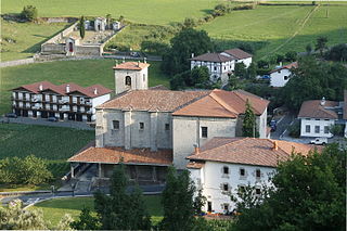
Baliarrain is a town located in the province of Gipuzkoa, in the autonomous community of Basque Country, in northern Spain.
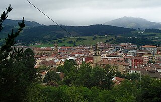
Belauntza is a town located in the province of Gipuzkoa, in the autonomous community of Basque Country, northern Spain.

Elgoibar is an industrial town located in the province of Gipuzkoa, in the Autonomous Community of the Basque Country, northern Spain. Located in a valley, it is traversed by the Deba river. Elgoibar is nicknamed the "capital city of the Machine tool".
Errezil is a town in the province of Gipuzkoa in the autonomous community of Basque Country, located in the north of Spain. According to the 2016 Basque sociological survey, Errezil has the largest percentage of Basque language speakers of any municipality in the Basque Country, with over 90% of Errezil respondents reporting Basque as their first language and/or reporting speaking Basque at home.

Mutriku is a coastal town located in the province of Gipuzkoa in the Autonomous Community of Basque Country in northern Spain. It has a population of around 5000 and provides access to the Bay of Biscay. It is the site of the world's first multi-turbine breakwater wave power station, opened July 8, 2011. The Church of San Andrés can be found here, being one of the oldest churches in Gipuzkoa, dating to the year 1080.

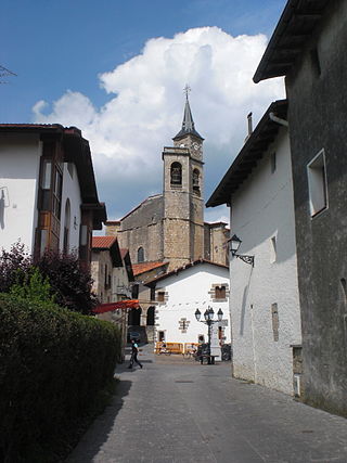
Orexa is a town located in the province of Gipuzkoa, in the Autonomous Community of Basque Country, northern Spain.

Soraluze (Basque) or Placencia de las Armas (Spanish), officially Soraluze-Placencia de las Armas, is a town located in the province of Gipuzkoa, in the Basque Country, Spain.

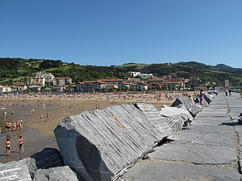
Zarautz is a coastal town located in central Gipuzkoa, Basque Country, in Spain. It is bordered by Aia to the east and the south and Getaria to the west, located about 15 kilometres (9.3 mi) west of San Sebastián. It has four enclaves limiting the aforementioned municipalities: Alkortiaga, Ekano, Sola, and Arbestain. As of 2014, Zarautz has a population of 22,890, which usually swells to about 60,000 in the summer.

Santurtzi is a port town in the province of Biscay, in the autonomous community of Basque Country, Spain. It is located in the Bilbao Abra bay, near the mouth of the Nervión river, on its left bank, 14 km downriver from Bilbao and forms part of the Greater Bilbao agglomeration. It has a population of 45,853 (2019) and a land area of 6.77 km2.

Getaria is a town on the Urola coast, in the province of Gipuzkoa, in the autonomous community of the Basque Country, in northern Spain. It borders Zarautz to the east and Zumaia to the west.

The Varduli were a pre-Roman tribe settled in the north of the Iberian Peninsula, in what today is the western region of the Basque Country.

Hernani is a town and municipality located in the province of Gipuzkoa, Basque Autonomous Community, Spain. The town sits on the left bank of the Urumea river. It is located at a distance of 9.2 km from San Sebastián. The municipality of Hernani occupies an area of approximately 40 square kilometres and is bordered by San Sebastián, Astigarraga, Arano, Elduayen, Errenteria, Lasarte-Oria and Urnieta.

Gaztelugatxe is an islet on the coast of Biscay belonging to the municipality of Bermeo, Basque Country (Spain). It is connected to the mainland by a man-made bridge. On top of the island stands a hermitage, dedicated to John the Baptist, that dates from the 10th century, although discoveries indicate that the date might be the 9th century. With another small neighboring island, Aketx, they form a protected biotope that extends from the town of Bakio to Cape Matxitxako, on the Bay of Biscay.

Debabarrena is an eskualdea / comarca located in Gipuzkoa, Basque Country (Spain). It has an area of 180,3 km2. It is north from the comarca of Debagoiena, east from the province of Biscay, and south from the Gulf of Biscay.

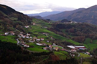
Itziar is a neighborhood in Deba, Gipuzkoa, Spain, next to Mount Andutz. It is located 6 km from the town of Deba.