Denton, Georgia | |
|---|---|
| Denton City Hall | |
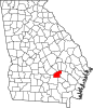
| Location in Jeff Davis County and the state of Georgia | |
| Coordinates: 31°43′22″N82°41′47″W / 31.72278°N 82.69639°W | |
| Country | United States |
| State | Georgia |
| County | Jeff Davis |
| Area | |
• Total | 1.54 sq mi (3.99 km2) |
| • Land | 1.52 sq mi (3.94 km2) |
| • Water | 0.02 sq mi (0.05 km2) |
| Elevation | 262 ft (80 m) |
| Population (2020) | |
• Total | 189 |
| • Density | 124.34/sq mi (48.00/km2) |
| Time zone | UTC-5 (Eastern (EST)) |
| • Summer (DST) | UTC-4 (EDT) |
| ZIP code | 31532 |
| Area code | 912 |
| FIPS code | 13-22388 [2] |
| GNIS feature ID | 0313447 [3] |
Denton is a city in Jeff Davis County, Georgia, United States. The population was 189 in 2020.
The Georgia General Assembly incorporated the place in 1911 as the "Town of Denton". [4] The community most likely was named after Samuel Denton, an early settler. [5]
Denton is located at 31°43′22″N82°41′47″W / 31.72278°N 82.69639°W (31.722663, -82.696323). [6]
According to the United States Census Bureau, the city has a total area of 1.5 square miles (3.9 km2), all land.
| Census | Pop. | Note | %± |
|---|---|---|---|
| 1930 | 215 | — | |
| 1940 | 254 | 18.1% | |
| 1950 | 273 | 7.5% | |
| 1960 | 255 | −6.6% | |
| 1970 | 244 | −4.3% | |
| 1980 | 286 | 17.2% | |
| 1990 | 335 | 17.1% | |
| 2000 | 269 | −19.7% | |
| 2010 | 250 | −7.1% | |
| 2020 | 189 | −24.4% | |
| U.S. Decennial Census [7] | |||
In 2020, its population was 189, down from 250 in 2010.