Dexter, Georgia

Last updated

Dexter, Georgia
Laurens County Georgia Incorporated and Unincorporated areas Dexter Highlighted.svg
Location in Laurens County and the state of Georgia
Coordinates: 32°26′4″N83°3′32″W / 32.43444°N 83.05889°W / 32.43444; -83.05889
Country United States
State Georgia
County Laurens
Area
[1]
  Total0.79 sq mi (2.03 km2)
  Land0.77 sq mi (1.99 km2)
  Water0.02 sq mi (0.05 km2)
Elevation
312 ft (95 m)
Population
 (2020)
  Total655
  Density852.86/sq mi (329.50/km2)
Time zone UTC-5 (Eastern (EST))
  Summer (DST) UTC-4 (EDT)
ZIP code
31019
Area code 478
FIPS code 13-22752 [2]
GNIS feature ID0331543 [3]

Dexter is a town in Laurens County, Georgia, United States. As of 2020, its population was 655.

Contents

History

The first permanent settlement at Dexter was made in 1889. [4] A post office has been in operation at Dexter since 1890. [5] The Georgia General Assembly incorporated the place in 1891 as the "Town of Dexter". [6]

Geography

Dexter is located in western Laurens County at 32°26′4″N83°3′32″W / 32.43444°N 83.05889°W / 32.43444; -83.05889 (32.434580, -83.058904). [7] Georgia State Route 257 is the town's Main Street; the highway leads northeast 12 miles (19 km) to Dublin, the county seat, and southwest 6 miles (10 km) to Chester. State Route 338 leads north 9 miles (14 km) to Dudley and south 7 miles (11 km) to Cadwell.

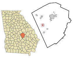
According to the United States Census Bureau, Dexter has a total area of 0.77 square miles (2.0 km2), of which 0.02 square miles (0.05 km2), or 2.31%, are water. [8] The town sits on a low ridge between Boggy Branch to the north and Stitchihatchie Creek to the south. Both streams flow northeast to Rocky Creek, part of the Oconee River watershed.

Demographics

Historical population
CensusPop.Note
1900 199
1910 550176.4%
1920 481−12.5%
1930 336−30.1%
1940 324−3.6%
1950 264−18.5%
1960 35936.0%
1970 43822.0%
1980 52720.3%
1990 475−9.9%
2000 5097.2%
2010 57513.0%
2020 65513.9%
U.S. Decennial Census [9]
Dexter racial composition as of 2020 [10]
RaceNum.Perc.
White (non-Hispanic)40361.53%
Black or African American (non-Hispanic)22334.05%
Asian 20.31%
Other/Mixed 223.36%
Hispanic or Latino 50.76%

As of the 2020 United States census, there were 655 people, 271 households, and 215 families residing in the town.

Related Research Articles

<span class="mw-page-title-main">Laurens County, Georgia</span> County in Georgia, United States

Laurens County is a county located in the central part of the U.S. state of Georgia. As of the 2020 census, the population was 49,570, up from 48,434 in 2010. The county seat is Dublin. The county was founded on December 10, 1807, and named after Lieutenant Colonel John Laurens, an American soldier and statesman from South Carolina during the American Revolutionary War.

<span class="mw-page-title-main">Allentown, Georgia</span> City in Georgia, United States

Allentown is a city in Bleckley, Laurens, Twiggs, and Wilkinson counties in the U.S. state of Georgia, primarily in Wilkinson County. As of the 2010 census, the city had a population of 169, down from 287 at the 2000 census. In 2020, its population was 195. The Twiggs County portion is part of the Macon metropolitan statistical area, while the Laurens County portion is part of the Dublin micropolitan statistical area. The remaining Wilkinson and Bleckley County portions are not part of any metropolitan or micropolitan area.

<span class="mw-page-title-main">Chester, Georgia</span> Town in Georgia, United States

Chester is a town in Dodge County, Georgia, United States. The population was 1,596 at the 2010 census, up from 305 in 2000, due to inclusion of Dodge State Prison within the town limits. By 2020, its township population was 525.

<span class="mw-page-title-main">Byromville, Georgia</span> Town in Georgia, United States

Byromville is a town in Dooly County, Georgia, United States. The population was 546 at the 2010 census, up from 415 in 2000.

<span class="mw-page-title-main">Pinehurst, Georgia</span> City in Georgia, United States

Pinehurst is a city in Dooly County, Georgia, United States. The population was 455 at the 2010 census, up from 307 in 2000.

<span class="mw-page-title-main">Unadilla, Georgia</span> City in Georgia, United States

Unadilla is a city in Dooly County, Georgia, United States. The population was 3,796 at the 2010 census, up from 2,772 in 2000. Dooly State Prison is located in the northeast corner of the city.

<span class="mw-page-title-main">Gibson, Georgia</span> City in Georgia, United States

Gibson is a city in Glascock County, Georgia, United States. The population was 663 at the 2010 census. The city is the county seat of Glascock County and home to the Glascock County Courthouse, a National Register of Historic Places listed site.

<span class="mw-page-title-main">Shady Dale, Georgia</span> Town in Georgia, United States

Shady Dale is a town in Jasper County, Georgia, United States. The population was 249 at the 2010 census.

<span class="mw-page-title-main">Wrightsville, Georgia</span> City in Georgia, United States

Wrightsville is a city in and the county seat of Johnson County, Georgia, United States. The population was 2,195 at the 2010 census, down from 2,223 at the 2000 census. By 2020, its population grew to 3,449. The city limits include Johnson State Prison on the northeast side of town. Wrightsville is part of the Dublin Micropolitan Statistical Area.

<span class="mw-page-title-main">Barnesville, Georgia</span> City in Georgia, United States

Barnesville is a city in Lamar County, Georgia, United States. As of the 2010 census, the city had a population of 6,755, up from 5,972 at the 2000 census. The city is the county seat of Lamar County and is part of the Atlanta metropolitan area.

<span class="mw-page-title-main">Cadwell, Georgia</span> Town in Georgia, United States

Cadwell is a town in Laurens County, Georgia, United States. The population was 381 in 2020.

<span class="mw-page-title-main">Dudley, Georgia</span> City in Georgia, United States

Dudley is a city in Laurens County, Georgia, United States. The population was 593 in 2020.

<span class="mw-page-title-main">East Dublin, Georgia</span> City in Georgia, United States

East Dublin is a city in Laurens County, Georgia, United States. The population was 2,492 in 2020.

<span class="mw-page-title-main">Rentz, Georgia</span> Town in Georgia, United States

Rentz is a city in Laurens County, Georgia, United States. The population was 312 in 2020.

<span class="mw-page-title-main">Leesburg, Georgia</span> City in Georgia, United States

Leesburg is a city and the county seat of Lee County, Georgia, United States. The population was 3,480 at the 2020 census, up from 2,896 at the 2010 census. It is part of the Albany, Georgia metropolitan statistical area.

<span class="mw-page-title-main">Lincolnton, Georgia</span> City in Georgia, United States

Lincolnton is a city and the county seat of Lincoln County, Georgia, United States. The population was 1,480 at the 2020 census. It contains numerous houses and historic districts listed on the National Register of Historic Places. Both the city and the county were named for General Benjamin Lincoln, who served in the Continental Army during the American Revolution.

<span class="mw-page-title-main">Ila, Georgia</span> City in Georgia, United States

Ila is a city in Madison County, Georgia, United States. The population was 350 at the 2020 census.

<span class="mw-page-title-main">Culloden, Georgia</span> City in Georgia, United States

Culloden is a city in Monroe County, Georgia, United States. The population was 200 in the 2020 census. It is part of the Macon Metropolitan Statistical Area.

<span class="mw-page-title-main">Higgston, Georgia</span> Town in Georgia, United States

Higgston is a town in Montgomery County, Georgia, United States. The population was 314 at the 2020 census.

<span class="mw-page-title-main">Uvalda, Georgia</span> City in Georgia, United States

Uvalda is a city in Montgomery County, Georgia, United States. The population was 439 at the 2020 census, down from 598 in 2010.

References

  1. "2020 U.S. Gazetteer Files". United States Census Bureau. Retrieved December 18, 2021.
  2. "U.S. Census website". United States Census Bureau . Retrieved January 31, 2008.
  3. "US Board on Geographic Names". United States Geological Survey. October 25, 2007. Retrieved January 31, 2008.
  4. Krakow, Kenneth K. (1975). Georgia Place-Names: Their History and Origins (PDF). Macon, GA: Winship Press. p. 62. ISBN   0-915430-00-2.
  5. "Post Offices". Jim Forte Postal History. Retrieved April 22, 2018.
  6. Acts and Resolutions of the General Assembly of the State of Georgia. Clark & Hines, State Printers. 1892. p. 685.
  7. "US Gazetteer files: 2010, 2000, and 1990". United States Census Bureau. February 12, 2011. Retrieved April 23, 2011.
  8. "U.S. Gazetteer Files: 2019: Places: Georgia". U.S. Census Bureau Geography Division. Retrieved December 11, 2019.
  9. "Census of Population and Housing". Census.gov. Retrieved June 4, 2015.
  10. "Explore Census Data". data.census.gov. Retrieved December 18, 2021.