
District #3 is one of six districts located in Grand Bassa County, Liberia. The city of Buchanan, capital of Grand Bassa County, is located in the district.

District #3 is one of six districts located in Grand Bassa County, Liberia. The city of Buchanan, capital of Grand Bassa County, is located in the district.

Springer is a town in Colfax County, New Mexico, United States. Its population was 1,047 at the 2010 census.
Savoy is a city in Fannin County, Texas, United States. The population was 831 at the 2010 census.

Las Lomas is a census-designated place (CDP) in Starr County, Texas, United States. The population was 3,147 at the 2010 census. Las Lomas is one of several colonias in Starr County, within the Rio Grande Valley region. The name is derived from the community's terrain.
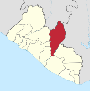
Nimba County is a county in northeastern Liberia that shares borders with the Republic of Côte d'Ivoire in the East and the Republic of Guinea in the Northwest. Its capital city is Sanniquellie and its most populous city is Ganta. With the county's area measuring 11,551 square kilometres (4,460 sq mi), Nimba is the largest of Liberia's 15 counties. The county has six statutory districts. As of the 2008 Census, it had a population of 462,026, making it the second most-populous county in Liberia.
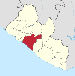
Grand Bassa is a county in the west-central portion of the West African nation of Liberia. One of 15 counties that comprise the first-level of administrative division in the nation, it has eight districts. Buchanan serves as the capital with the area of the county measuring 7,936 square kilometres (3,064 sq mi). As of the 2008 Census, it had a population of 224,839, making it the fifth most populous county in Liberia.

District #2 is one of six districts located in Grand Bassa County, Liberia.
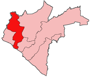
District #1 is one of six districts located in Grand Bassa County, Liberia.
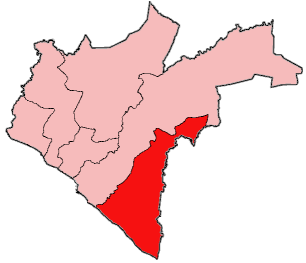
District #4 is one of six districts located in Grand Bassa County, Liberia.

St. John River District is one of six districts located in Grand Bassa County, Liberia. The name derives from the Saint John River.

Owensgrove is one of six districts located in Grand Bassa County, Liberia.
St. Paul River is a district located in Montserrado County, Liberia. It recorded a population of 71,831 in the 2008 census. It has no official administrative status. Its inhabitants are primarily Christians and members of the Bassa, Dey, or Kpelle tribes. Farming and fishing are the main economic activities along with some small scale trading. The district has one paved road.

Virginia's 8th congressional district is a United States congressional district in the Commonwealth of Virginia. It comprises all of Arlington County, portions of Fairfax County and all of the independent cities of Alexandria and Falls Church.
Bristow is an unincorporated community in Monroe County, Mississippi.
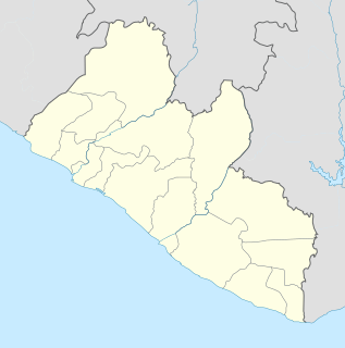
Edina is a city in District 1 of Grand Bassa County, Liberia. Located on the central portion of the Atlantic Coast of Liberia on the north shore of the mouth of the St. John River, it is about 3.5 miles (5.6 km) north of Grand Bassa’s capitol of Buchanan. Settled in 1832, Samuel A.L. Johnson has been the city's mayor since 2018. The community is named after Edinburgh, Scotland, which provided monetary support for the foundation of the settlement.

Tuchomko is a village in the administrative district of Gmina Tuchomie, within Bytów County, Pomeranian Voivodeship, in northern Poland. It lies approximately 3 kilometres (2 mi) north-east of Tuchomie, 9 km (6 mi) west of Bytów, and 87 km (54 mi) west of the regional capital Gdańsk.

Czaple is a village in the administrative district of Gmina Żukowo, within Kartuzy County, Pomeranian Voivodeship, in northern Poland. It lies approximately 6 kilometres (4 mi) north-east of Żukowo, 16 km (10 mi) east of Kartuzy, and 14 km (9 mi) west of the regional capital Gdańsk. It is located within the historic region of Pomerania.

Grange Hall is an unincorporated community in Lake County, Illinois, United States. Grange Hall is located at 42°21′50″N87°57′48″W.

Raleigh is an unincorporated community in Washington Township, Rush County, in the U.S. state of Indiana.
The White River Plateau is a "broad structural dome" located north of Glenwood Springs, Colorado and north of the Colorado River. Also called the White River Uplift, the mountainous area is shown on maps as being roughly circular in area, occupying parts of the Colorado counties of Garfield and Rio Blanco, with small portions extending into Eagle and Routt counties. The Grand Hogback marks parts of the plateau's southern and western boundaries. The Flat Tops mountain range is part of the White River Plateau, and much of the plateau is located within the White River National Forest.