Related Research Articles
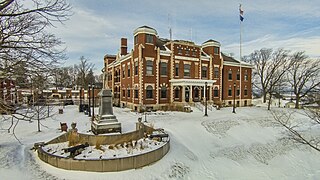
Kewaunee County is a county located in the U.S. state of Wisconsin. As of the 2020 census, the population was 20,563. Its county seat is Kewaunee. The county was created in 1852 and organized in 1859. Its Menominee name is Kewāneh, an archaic name for a species of duck. Kewaunee County is part of the Green Bay, WI Metropolitan Statistical Area as well as the Green Bay-Shawano, WI Combined Statistical Area.
The National Fish Hatchery System (NFHS) was established by the U.S. Congress in 1871 through the creation of a U.S. Commissioner for Fish and Fisheries. This system of fish hatcheries is now administered by the Fisheries Program of the U.S. Fish and Wildlife Service (Service), an agency within the United States Department of the Interior.
The Paw Paw River is located in the U.S. state of Michigan in the southwest portion of the lower peninsula. It is formed by the confluence of the north and south branches at 42°15′17″N85°55′36″W in Waverly Township in the northeast of Van Buren County. It flows approximately 61.8 miles (99.5 km) through Van Buren County and Berrien County until joining the St. Joseph River just above its mouth on Lake Michigan at Benton Harbor.
The St. Joseph River is a tributary of Lake Michigan with a length of 206 miles (332 km). The river flows in a generally westerly direction through southern Michigan and northern Indiana, United States, to its terminus on the southeast shore of the lake. It drains a primarily rural farming area in the watershed of Lake Michigan. It was enormously important to Native Americans and greatly aided in the colonial exploration, settlement and administration of New France and the nascent United States as a canoe route between Lake Michigan and the watershed of the Mississippi River.

The rainbow trout is a trout and species of salmonid native to cold-water tributaries of the Pacific Ocean in Asia and North America. The steelhead is an anadromous (sea-run) form of the coastal rainbow trout(O. m. irideus) or Columbia River redband trout (O. m. gairdneri) that usually returns to fresh water to spawn after living two to three years in the ocean. Freshwater forms that have been introduced into the Great Lakes and migrate into tributaries to spawn are also called steelhead.

Drayton Plains is an unincorporated community in Oakland County in the U.S. state of Michigan. The community is located within Waterford Township. As an unincorporated community, Drayton Plains has no legally defined area or population statistics of its own. It once had its own post office with the 48020 ZIP Code but now uses the 48329 Waterford ZIP Code. It is located on Dixie Highway near the west end of Loon Lake.

The cutthroat trout(Oncorhynchus clarkii) is a fish species of the family Salmonidae native to cold-water tributaries of the Pacific Ocean, Rocky Mountains, and Great Basin in North America. As a member of the genus Oncorhynchus, it is one of the Pacific trout, a group that includes the widely distributed rainbow trout. Cutthroat trout are popular gamefish, especially among anglers who enjoy fly fishing. The common name "cutthroat" refers to the distinctive red coloration on the underside of the lower jaw. The specific name clarkii was given to honor explorer William Clark, coleader of the Lewis and Clark Expedition.

Oncorhynchus is a genus of fish in the family Salmonidae; it contains the Pacific salmon and Pacific trout. The name of the genus is derived from the Greek ὄγκος + ῥύγχος, in reference to the hooked snout that the males develop during mating season.

Saginaw Bay is a bay within Lake Huron located on the eastern side of the U.S. state of Michigan. It forms the space between Michigan's Thumb region and the rest of the Lower Peninsula of Michigan. Saginaw Bay is 1,143 square miles (2,960 km2) in area. It is located in parts of five Michigan counties: Arenac, Bay, Huron, Iosco, and Tuscola.
The Michigan Department of Natural Resources (DNR) is the agency of the state of Michigan charged with maintaining natural resources such as state parks, state forests, and recreation areas. It is governed by a director appointed by the Governor and accepted by the Natural Resources Commission. Currently the Director is Daniel Eichinger. The DNR has about 1,400 permanent employees, and over 1,600 seasonal employees.

Fish stocking is the practice of raising fish in a hatchery and releasing them into a river, lake or ocean to supplement existing populations or to create a population where previously none exists. Stocking may be done for the benefit of commercial, recreational or tribal heritage fishing, but may also be done to restore or increase the population of threatened or endangered fish in a body of water closed to fishing.
The Pigeon River is part of the Lake Huron watershed in Michigan in the United States. It is one of many rivers that have their headwaters in Otsego County. The Pigeon River's headwaters start just north and east of Gaylord, Michigan, at the Otsego Club and Resort. From there the river flows north 47.4 miles (76.3 km) through private land and the Pigeon River Country State Forest to Mullett Lake.

The Mount Whitney Fish Hatchery, located in Independence, California, in the United States, is an historic fish hatchery that has played an important role in the preservation of the golden trout, California's state fish.
The Utah Division of Wildlife Resources is part of the Utah Department of Natural Resources for the state of Utah in the United States. The mission of the Division of Wildlife Resources is to serve the people of Utah as trustee and guardian of the state's wildlife. In addition to managing and protecting Utah's wildlife, UDWR manages hunting and fishing opportunities within the state.

The C.D. "Buzz" Besadny Anadromous Fish Facility is a Wisconsin Department of Natural Resources egg collection station near the city of Kewaunee. Trout and salmon migrating from Lake Michigan through the Kewaunee River are led by flowing water in a fish ladder to collection ponds. Fish are moved from the ponds into the processing building to be spawned and then sent to hatcheries where they are raised before being released into Lake Michigan's tributaries in order to negate the proliferation of the alewife and support sports fishing.

The Bennington Fish Hatchery, also known as the Bennington Fish Culture Station, is a state-operated fish hatchery at 110 Hatchery Road in Bennington, Vermont, USA. The station, the state's largest, produces a variety of trout, which are used to stock the state's water resources. Its facilities, dating to 1916, are listed on the National Register of Historic Places. The station has a visitors' center that is open daily.
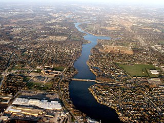
Loon Lake is a freshwater lake located in Waterford Township, Michigan. It borders Dixie Highway on the west and is south of Walton Blvd. on the north. The sand-bottom lake is 243 acres, making it the 18th largest lake in Oakland County, Michigan and one of the largest in Waterford Township.
Clintonville is an unincorporated community in Oakland County in the U.S. state of Michigan. The community is located within Waterford Township. As an unincorporated community, Clintonville has no legally defined area or population statistics of its own, and it uses the Waterford 48328 ZIP Code.
References
- ↑ "Home". michmarkers.com.
- ↑ "Waterford Historical Society | Museums".
- ↑ "Waterford Historical Society | Museums".
- ↑ "Home". michmarkers.com.
- ↑ "DNR - History of Michigan's Fish Production Systems". www.michigan.gov. Archived from the original on 2012-12-22.
- ↑ "The House a Bass Station Built". Waterford Township Historical Society. Retrieved 15 July 2020.
- ↑ "DNR - Fish Production System". www.michigan.gov. Archived from the original on 2012-11-21.
- ↑ "Clinton River Assessment" (PDF). State of Michigan, Department of Natural Resources. Retrieved 16 July 2020.
- ↑ "LEMU Fisheries Newsletter, January 2013" (PDF). Michigan DNR. Retrieved 15 July 2020.
- ↑ "Archived copy". Archived from the original on 2016-03-03. Retrieved 2016-03-02.
{{cite web}}: CS1 maint: archived copy as title (link) - ↑ "Drayton Plains Nature Center". 29 December 2016.
| Lists by county |
|  |
|---|---|---|
| Other lists | ||