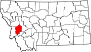
Drummond, Montana | |
---|---|
Coordinates: 46°40′00″N113°08′49″W / 46.66667°N 113.14694°W | |
Country | United States |
State | Montana |
County | Granite |
Area | |
• Total | 0.54 sq mi (1.40 km2) |
• Land | 0.54 sq mi (1.40 km2) |
• Water | 0.00 sq mi (0.00 km2) |
Elevation | 3,954 ft (1,205 m) |
Population (2020) | |
• Total | 272 |
• Density | 501.85/sq mi (193.78/km2) |
Time zone | UTC-7 (Mountain (MST)) |
• Summer (DST) | UTC-6 (MDT) |
ZIP code | 59832 |
Area code | 406 |
FIPS code | 30-21850 |
GNIS feature ID | 2412449 [2] |
Drummond is a town in Granite County, Montana, United States. The population was 272 at the 2020 census. [3]
Drummond can be accessed via exits 153 and 154 on Interstate 90. It is just north of the Clark Fork River.
According to the United States Census Bureau, the town has a total area of 0.53 square miles (1.37 km2), all land. [4]
According to the Köppen Climate Classification system, Drummond has a semi-arid climate, abbreviated "BSk" on climate maps. [5]
Climate data for Drummond, Montana | |||||||||||||
---|---|---|---|---|---|---|---|---|---|---|---|---|---|
Month | Jan | Feb | Mar | Apr | May | Jun | Jul | Aug | Sep | Oct | Nov | Dec | Year |
Mean daily maximum °F (°C) | 28 (−2) | 32 (0) | 36 (2) | 45 (7) | 54 (12) | 63 (17) | 75 (24) | 73 (23) | 61 (16) | 50 (10) | 37 (3) | 31 (−1) | 49 (9) |
Mean daily minimum °F (°C) | 10 (−12) | 12 (−11) | 12 (−11) | 21 (−6) | 28 (−2) | 36 (2) | 42 (6) | 40 (4) | 33 (1) | 27 (−3) | 18 (−8) | 13 (−11) | 24 (−4) |
Average precipitation inches (mm) | 2.5 (64) | 2.3 (58) | 2.4 (61) | 2.5 (64) | 3.1 (79) | 3.2 (81) | 1.4 (36) | 1.4 (36) | 1.6 (41) | 1.5 (38) | 2.1 (53) | 2.5 (64) | 26.4 (670) |
Source: Weatherbase [6] |
The Northern Pacific Railroad arrived in 1883. They changed the town name from Edwardsville to Drummond, after either a Northern Pacific engineer or Hugh Drummond, a local trapper. [7]
Mayor Gail Leeper is known for her long tenure. Elected to the office in 1993, Leeper is seeking her 7th term as Mayor in 2017. [8]
Census | Pop. | Note | %± |
---|---|---|---|
1950 | 531 | — | |
1960 | 577 | 8.7% | |
1970 | 494 | −14.4% | |
1980 | 414 | −16.2% | |
1990 | 264 | −36.2% | |
2000 | 318 | 20.5% | |
2010 | 309 | −2.8% | |
2020 | 272 | −12.0% | |
U.S. Decennial Census [9] [3] |
As of the census [10] of 2010, there were 309 people, 143 households, and 84 families residing in the town. The population density was 583.0 inhabitants per square mile (225.1/km2). There were 179 housing units at an average density of 337.7 per square mile (130.4/km2). The racial makeup of the town was 97.7% White (U.S. Census)], 0.3% African American, 0.3% Native American, and 1.6% from two or more races. Hispanic or Latino of any race were 1.6% of the population.
There were 143 households, of which 21.7% had children under the age of 18 living with them, 47.6% were married couples living together, 7.0% had a female householder with no husband present, 4.2% had a male householder with no wife present, and 41.3% were non-families. 38.5% of all households were made up of individuals, and 13.3% had someone living alone who was 65 years of age or older. The average household size was 2.11 and the average family size was 2.80.
The median age in the town was 46.9 years. 19.1% of residents were under the age of 18; 7.1% were between the ages of 18 and 24; 18.5% were from 25 to 44; 32% were from 45 to 64; and 23.3% were 65 years of age or older. The gender makeup of the town was 48.5% male and 51.5% female.
As of the census [11] of 2000, there were 318 people, 140 households, and 84 families residing in the town. The population density was 547.8 inhabitants per square mile (211.5/km2). There were 172 housing units at an average density of 296.3 per square mile (114.4/km2). The racial makeup of the town was 96.54% White, 1.57% Native American, 0.31% from other races, and 1.57% from two or more races. Hispanic or Latino of any race were 0.94% of the population.
There were 140 households, out of which 30.7% had children under the age of 18 living with them, 45.0% were married couples living together, 11.4% had a female householder with no husband present, and 39.3% were non-families. 35.0% of all households were made up of individuals, and 9.3% had someone living alone who was 65 years of age or older. The average household size was 2.27 and the average family size was 2.93.
In the town, the population was spread out, with 28.6% under the age of 18, 5.3% from 18 to 24, 27.0% from 25 to 44, 25.8% from 45 to 64, and 13.2% who were 65 years of age or older. The median age was 38 years. For every 100 females there were 101.3 males. For every 100 females age 18 and over, there were 100.9 males.
The median income for a household in the town was $26,500, and the median income for a family was $32,841. Males had a median income of $30,625 versus $16,563 for females. The per capita income for the town was $14,213. About 6.6% of families and 13.6% of the population were below the poverty line, including 15.0% of those under age 18 and 5.0% of those age 65 or over.
Drummond Public Schools provides education. [12] Drummond High School's team name is the Trojans. [13]
The Drummond School and Community Library serves the town. [14]
Masardis is a town in Aroostook County, Maine, United States. The population was 204 at the 2020 census.
Springfield is a town in Penobscot County, Maine, United States. The population was 293 at the 2020 census.
Winston is a census-designated place (CDP) in Broadwater County, Montana, United States. The population was 147 at the 2010 census.
Bridger is a town in Carbon County, Montana, United States. It is part of the Billings, Montana Metropolitan Statistical Area. The population was 662 at the 2020 census.
Belt is a town in Cascade County, Montana, United States. The population was 510 according to the 2020 census. It is part of the Great Falls, Montana metropolitan area.
Cascade is a town in Cascade County, Montana, United States. The population was 600 at the 2020 census. It is part of the Great Falls, Montana Metropolitan Statistical Area, which in 2020 had a population of 84,414. Cascade was incorporated in 1911.
Moore is a town in Fergus County, Montana, United States. The population was 194 at the 2020 census.
Winifred is a small town in rural north-central Fergus County, Montana, United States. It was founded in 1913 and provides services for its region's populace. The town population was 172 at the 2020 census. The current mayor is Travis Willson.
Sheridan is a town in Madison County, Montana, United States named after the Civil War general Philip Sheridan. The population was 694 at the 2020 census. Sheridan is known as the "heart of the Ruby Valley." Seven mountain ranges surround the town: Tobacco Root Mountains, Highland Mountains, McCartney Mountain, The Pioneers, The Ruby Range, The Gravelly Range and the Snowcrest Range. The Ruby River winds through the valley just west of the town.
Clinton is a census-designated place (CDP) in Missoula County, Montana, United States. It is part of the 'Missoula, Montana Metropolitan Statistical Area'. The CDP was named for General Sir Henry Clinton. The population was 1,052 at the 2010 census, an increase from its population of 549 in 2000.
Melstone is a rural small town in far eastern Musselshell County, Montana, United States, along U.S. Route 12. The population was 126 at the 2020 census. The town was established in 1908 as a base for operating crews on the Chicago, Milwaukee, St. Paul and Pacific Railroad, then under construction in Montana. Although the railroad was abandoned in 1980, Melstone survives as a community center for farmers and ranchers in the lower Musselshell River valley.
Fallon is an unincorporated small town in Prairie County, Montana, United States. The population was 164 at the 2010 census., although, as the town name has been co-opted for use by the United States Census Bureau as a census-designated place, this figure may include persons living well outside the town's limits. Fallon's current mayor is Colin Armould.
Westby is a town in Sheridan County, Montana, United States. The population was 167 at the 2020 census.
Nashua is a town in Valley County, Montana, United States. The population was 301 at the 2020 census.
Broadview is a town in Yellowstone County, Montana, United States. The population was 139 at the 2020 census.
Plevna is a town in Fallon County, Montana, United States. The population was 179 at the 2020 census.
Iaeger is a town in McDowell County, West Virginia, United States. The population was 257 at the 2020 census.
Matoaka is a census-designated place in Mercer County, West Virginia, United States. The population was 173 at the 2020 census. It is part of the Bluefield, WV-VA micropolitan area which has a population of 100,093. This town is named for Chief Powhatan's daughter Matoaka who was better known by her nickname "Pocahontas". Matoaka became an unincorporated town when it voted to dissolve its charter in May 2018.
Cairo is a town in Ritchie County, West Virginia, United States, along West Virginia Route 31, the North Fork of the Hughes River, and the North Bend Rail Trail. The population was 174 at the 2020 census.
Drummond is a town in Bayfield County, Wisconsin, United States. The population was 169 at the 2020 census, down from 463 at the 2010 census. The census-designated place of Drummond is located in the town. The unincorporated community of Lake Owen is also located in the town.
Media related to Drummond, Montana at Wikimedia Commons