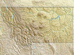
Montana is a landlocked state in the Northwestern United States. Montana has several nicknames, although none are official, including "Big Sky Country" and "The Treasure State", and slogans that include "Land of the Shining Mountains" and more recently "The Last Best Place".

The Absaroka Range is a sub-range of the Rocky Mountains in the United States. The range stretches about 150 mi (240 km) across the Montana-Wyoming border, and 75 miles at its widest, forming the eastern boundary of Yellowstone National Park along Paradise Valley (Montana), and the western side of the Bighorn Basin. The range borders the Beartooth Mountains to the north and the Wind River Range to the south. The northern edge of the range rests along I-90 and Livingston, Montana. The highest peak in the range is Francs Peak, located in Wyoming at 13,153 ft (4,009 m). There are 46 other peaks over 12,000 ft (3,700 m).

The Inland Northwest or Inland Empire is a region of the Pacific Northwest centered on the Greater Spokane Area, that includes all of Eastern Washington and North Idaho. Western Montana is sometimes considered part of the Inland Northwest, but generally is not considered part of the Inland Empire. Under some definitions, the term Inland Empire also excludes Central Washington.
As of 2016 the U.S. Census Bureau estimated the region's population at 2,240,645, comparable to that of New Mexico. Its Canadian counterpart, north of the border, is the British Columbia Interior. Significant urban centers include the Spokane–Coeur d'Alene area and the Tri-Cities.

The Musselshell River is a tributary of the Missouri River, 341.9 miles (550.2 km) long from its origins at the confluence of its North and South Forks near Martinsdale, Montana to its mouth on the Missouri River. It is located east of the Continental divide entirely within Montana in the United States. Counting its pre-confluence tributaries, it measures 425–500 miles (684–805 km) in length.

Pinus ponderosa, commonly known as the ponderosa pine, bull pine, blackjack pine, or western yellow-pine, is a very large pine tree species of variable habitat native to the western United States and Canada. It is the most widely distributed pine species in North America.

The Beaverhead-Deerlodge National Forest is the largest of the National Forests in Montana, United States. Covering 3.36 million acres (13,600 km2), the forest is broken into nine separate sections and stretches across eight counties in the southwestern area of the state. President Theodore Roosevelt named the two forests in 1908 and they were merged in 1996. Forest headquarters are located in Dillon, Montana. In Roosevelt's original legislation, the Deerlodge National Forest was called the Big Hole Forest Reserve. He created this reserve because the Anaconda Copper Mining Company, based in Butte, Montana, had begun to clearcut the upper Big Hole River watershed. The subsequent erosion, exacerbated by smoke pollution from the Anaconda smelter, was devastating the region. Ranchers and conservationists alike complained to Roosevelt, who made several trips to the area.
(Munday 2001)

The Mission Mountains or Mission Range are a range of the Rocky Mountains located in northwestern Montana in the United States. They lie chiefly in Lake County and Missoula County and are south and east of Flathead Lake and west of the Swan Range. On the east side of the range is the Swan
River Valley and on the west side the Mission Valley.

The Tobacco Root Mountains lie in the northern Rocky Mountains, between the Jefferson and Madison Rivers in southwest Montana. The highest peak is Hollowtop at 10,604 feet (3,232 m). The range contains 43 peaks rising to elevations greater than 10,000 feet.

The Gallatin Range is a mountain range of the Rocky Mountains, located in the U.S. states of Montana and Wyoming. It includes more than 10 mountains over 10,000 feet (3,000 m). The highest peak in the range is Electric Peak at 10,969 feet (3,343 m).

The Flathead Range is a mountain range of the Northern Rocky Mountains located south-east of Whitefish, Montana in the Great Bear Wilderness, part of the Bob Marshall Wilderness Complex. It is east of the Swan Range and southeast of the Whitefish Range. Its west side is drained by the South Fork Flathead River which forms Hungry Horse Reservoir.

The Centennial Mountains are the southernmost sub-range of the Bitterroot Range in the United States states of Idaho and Montana. The Centennial Mountains include the Western and Eastern Centennial Mountains. The range extends east from Monida Pass along the Continental Divide to Henrys Fork 48 km (30 mi) NNW of Ashton, Idaho; bounded on the west by Beaver Creek, on the north by Centennial Valley and Henrys Lake Mountains, on the east by Henrys Lake Flat, and on the south by Shotgun Valley and the Snake River Plain. The highest peak in the range is Mount Jefferson.
The Castle Mountains, highest point Elk Peak, el. 8,589 feet (2,618 m), are an island range east of White Sulphur Springs in Meagher County, Montana, United States. About 30,000 acres of the Castles were roadless as of 1995. The western portion of the Castles are moist, while the eastside is dry, porous limestone hills. The range gets its name from "castle turrets", 50-foot high igneous rock spires on the western slopes. The range was the focus of mining activity in the previous century; crumbling remains of old miners' cabins and diggings are present throughout the area. The landscape is characterized by a central cluster of peaks over 8,000 feet and extensive grassy parks surrounded by lodgepole pine and limber pine. The Castles are lightly used by recreationists except for hunters in the fall. On the peak of Castle Mountain itself is a login book for the few who reach the top. There is no trail that leads to the peak.

The Horseshoe Hills, el. 6,673 feet (2,034 m), are a roughly crescent-shaped range of hills north of Manhattan, Montana in Gallatin County, Montana. They lie in the area between the southern Big Belt Mountains and the northern Bridger Range. The hills are bounded on the north by Sixteen Mile Creek, the first major tributary of the Missouri River. As they are in the rain shadow of the Boulder, Elkhorn, and Bull Mountains to the west, the Horseshoe Hills are notably dry, receiving 10 - 12 inches of precipitation annually. This is especially true on the southern and southeastern flanks, which are also in the rain shadow of the hills themselves. In the driest areas, Missouri foxtail cacti, plains prickly pear cacti, and yucca abound, as well as prairie rattlesnakes. Much of the hills are private property, but there is also some State, BLM, and National Forest land.

The Pryor Mountains are a mountain range in Carbon and Big Horn counties of Montana. They are located on the Crow Indian Reservation and the Custer National Forest, and portions of them are on private land. They lie south of Billings, Montana, and north of Lovell, Wyoming.
The Ruby Range is a mountain range in Madison and Beaverhead counties Montana. The range lies east of Dillon and southwest of Sheridan. The highest point, Ruby Peak with an elevation of 9,391 feet (2,862 m), lies in the northeast portion of the range. Gordon Peak with an elevation of 8,478 ft (2,584 m) lies in the southwest part of the range to the southeast of Dillon. The range is oriented NE–SW with a length of about 42.7 kilometres (26.5 mi). The Beaverhead River lies to the northwest of the range. Ruby River runs along the southeast and east flanks of the range with Ruby Reservoir on the southeast flank. Blacktail Deer Creek drains the southwest portion of the range and the Blacktail Mountains lie to the southwest. The Tobacco Root Mountains and the Greenhorn Range lie to the northeast and east respectively.
The Snowcrest Range, el. 10,581 feet (3,225 m), is a small mountain range southeast of Dillon, Montana in Madison County, Montana. The Snowcrest and adjacent Gravelly Range is one of Montana's most popular hunting grounds. The two mountain ranges are home to nearly 10,000 elk and a growing population of grizzly bears.

Moccasin is an unincorporated community in Judith Basin County, Montana, United States. The community was named for the nearby Moccasin mountain range. Although it is unincorporated, Moccasin has a post office, with the ZIP code of 59462.

The Mountain States form one of the nine geographic divisions of the United States that are officially recognized by the United States Census Bureau. It is a subregion of the Western United States.