Springfield is a historic neighborhood of Jacksonville, Florida, United States, located to the north of downtown. Established in 1869, it experienced its greatest growth from the early 1880s through the 1920s. The Springfield Historic District is listed in the National Register of Historic Places, and contains some of the city's best examples of 19th and early 20th century architecture.

The West Newton Hill NR Historic District is a residential National Register historic district in the village of West Newton, in the city of Newton, Massachusetts in the United States. It is composed of a cohesive collection of spacious houses built in the second half of the 19th century, representing the development of the West Newton area as a fashionable railroad suburb. The district was listed on the National Register of Historic Places in 1986.

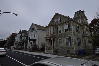
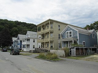
The South Central Falls Historic District is a historic district in Central Falls, Rhode Island. It is a predominantly residential area, densely populated, which was developed most heavily in the late 19th century. It is bounded roughly by Broad Street to the east, the Pawtucket city line to the south, Dexter Street to the west, and Rand Street and Jenks Park to the north. It has 377 contributing buildings, most of which were built before 1920. The district was added to the National Register of Historic Places in 1991.

The Lower Highlands Historic District encompasses one of the oldest residential areas of Fall River, Massachusetts. The district is roughly bounded by Cherry, Main, Winter, and Bank Streets, and is located just east of the Downtown Fall River Historic District and directly south of the Highlands Historic District. This area was settled by 1810, has architecture tracing the city's growth as a major industrial center. The historic district was added to the National Register of Historic Places in 1984.
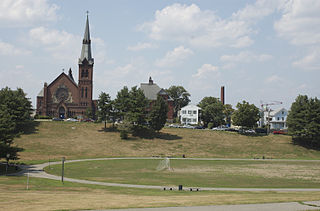
The North Bedford Historic District is a historic district roughly bounded by Summer, Parker, Pleasant and Kempton Streets in New Bedford, Massachusetts. It encompasses a predominantly residential neighborhood north of downtown New Bedford which was developed primarily in the mid 19th-century. It features a variety of worker housing of the period, as well as a number of higher quality houses built by businessmen. The district was added to the National Register of Historic Places in 1979.

The Towne Street Historic District is a historic district on Towne Street, east of Jackson Street in North Attleborough, Massachusetts. Included in the district are numbers 224, 240, 251, and 260 Towne Street. It encompasses a collection of widely spaced rural-suburban houses built in the middle decades of the 19th century. The district was added to the National Register of Historic Places in 2003.

The Attleborough Falls Historic District is a predominantly residential historic district on Mt. Hope and Towne Streets in North Attleborough, Massachusetts. Located just south of the Ten Mile River, it encompasses a stylish mid-to-late 19th century residential area that developed in a previously rural area due to industrial development across the river. The district was added to the National Register of Historic Places in 2004.

Hortonville is a village in the town of Swansea, Bristol County, Massachusetts, United States. The part of the village on Locust Street from Oak Street to Hortonville Road comprises the Hortonville Historic District, which was listed on the National Register of Historic Places in 1990.
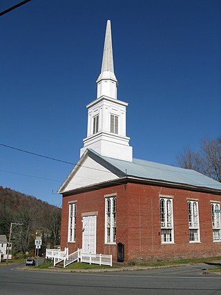
The Colrain Center Historic District encompasses the historic center of Colrain, Massachusetts, a rural hill town in north-western Franklin County. The 30-acre (12 ha) district was listed on the National Register of Historic Places in 2006.

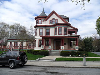
The Springfield Street Historic District is a predominantly residential historic district south of the downtown area of Chicopee, Massachusetts. It encompasses a significant number of Queen Anne style houses built in the second half of the 19th century by wealthy residents of Chicopee, as well as housing for skilled workers at the nearby textile mills. It is centered where Springfield Street and Fairview Avenue meet. The district was listed on the National Register of Historic Places in 1991.

The Pleasant–High Historic District encompasses the earliest area of non-agricultural residential development in Methuen, Massachusetts. It encompasses houses along High and Pleasant Streets from just east of Broadway to Vine Street, as well as a few that face on adjoining streets. The district was listed on the National Register of Historic Places in 1984; on its western boundary it abuts the Spicket Falls Historic District.

The Spring Hill Historic District is a historic district roughly bounded by Summer, Central, Atherton, and Spring Streets in the Spring Hill area of Somerville, Massachusetts. The district encompasses the city's best-preserved residential subdivision from the mid-19th century, with later infill construction in the late 19th and early 20th centuries. The district was listed on the National Register of Historic Places in 1989.

The Wedgemere Historic District encompasses the largest single 19th-century residential development of Winchester, Massachusetts. It is one of the town's largest surviving 19th-century residential subdivisions, with a concentration of high-quality residences built between about 1890 and 1920. The district was listed on the National Register of Historic Places in 1989.
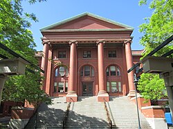
The South Common Historic District of Lowell, Massachusetts, encompasses the city's South Common and the various public, religious, and private residential buildings that flank its borders. The South Common, about 22.5 acres (9.1 ha) in size, was purchased by the city in 1845 in an auction by the Proprietors of Locks and Canals, who owned much of the city's industrial area. Although the common was landscaped, it was not apparently done so to a plan. It quickly became lined with fashionable residences, and several iconic public buildings, including the 1850 courthouse, a Romantic Revival structure designed by Ammi Young, and a series of Gothic Revival churches. Highland Avenue was built out with a series of fine Italianate houses.
The Woodland Street Historic District is a historic housing district in the Main South area of Worcester, Massachusetts. It consists of 19 Victorian houses that either face or abut on Woodland Street, between Charlotte and Oberlin Streets. The district was listed on the National Register of Historic Places in 1980. Located directly adjacent to the campus of Clark University, some of the buildings are used by Clark for housing and administration.

The Homestead–Horton Neighborhood Historic District encompasses a small turn-of-the-20th century neighborhood area in Brattleboro, Vermont. Located on a portion of Canal Street and all of Horton and Homestead Places, the district includes a significant number of Queen Anne Victorians, as well as the Italianate home of Jacob Estey, proprietor of the Estey Organ Company, one of the city's larger employers. The district was listed on the National Register of Historic Places in 2009.
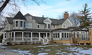
The Barrington Historic District is a 92-acre (37 ha) historic district in Barrington, Illinois. The district encompasses a residential area in southwest Barrington and is roughly bounded by the Chicago and Northwestern Railway tracks to the north, Dundee Avenue to the west, E. Hillside and W. Coolidge Streets to the south, and S. Spring and S. Grove Streets to the east. The large majority of the district is in Cook County, but about one square block is in Lake County, Illinois.

Fourth and Gill is a neighborhood in Knoxville, Tennessee, United States, located north of the city's downtown area. Initially developed in the late nineteenth century as a residential area for Knoxville's growing middle and professional classes, the neighborhood still contains most of its original Victorian-era houses, churches, and streetscapes. In 1985, 282 houses and other buildings in the neighborhood were added to the National Register of Historic Places as the Fourth and Gill Historic District.
The Williams Street Extension Historic District encompasses a locally architecturally distinctive residential area on Williams Street in Bellows Falls, a village of Rockingham, Vermont. Developed between about 1880 and 1930, the neighborhood has a collection of 15 historically significant well-preserved worker housing units. It was listed on the National Register of Historic Places in 2010.
The Ascension-Caproni Historic District encompasses a mixed collection of late 19th and early 20th century architecture along Washington, Newcomb, and Thorndike Streets in the Roxbury neighborhood of Boston, Massachusetts. Including religious, residential, commercial, and industrial buildings, it encapsulates the area's transition from industrial to residential uses between about 1850 and 1930. The district was listed on the National Register of Historic Places in 2019.