Inae Konasara Iye Pinesara Inae Liasara Iye Pinekasara Whoever respects customs will be honored but whoever does not respect customs will not be honored.
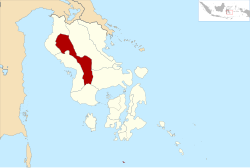
The East Kolaka Regency is a new and the only landlocked regency of Southeast Sulawesi, Indonesia, established on 11 January 2013 from the former eastern nine districts of the Kolaka Regency. The administrative centre lies at Tirawuta; its current Regent (from 2022) is Abdul Aziz. The area is 3,991.78km2, and the population at the 2020 census was 120,699;[2] the official estimate as at mid 2023 was 126,754 - comprising 65,337 males and 61,417 females.[1]
On 14 December 2012, the Indonesian Parliament approved the establishment of a new East Kolaka Regency (Kolaka Timur), to be split off from the existing Kolaka Regency; the new regency - which came into effect on 11 January 2013 under Law No. 8 of 2013 - comprised nine districts of the existing Kolaka Regency; subsequently an additional three districts have been created by splitting existing districts. These are detailed below with their areas and their populations at the 2010 census[3] and the 2020 census,[2] together with the official estimates as at mid 2023.[1] The table also includes the locations of the district administrative centres, the number of administrative villages in each district (totaling 117 rural desa and 16 urban kelurahan), and its post code.
Kode Wilayah
Name of District (kecamatan)
Area in km2
Pop'n census 2010
Pop'n census 2020
Pop'n estimate mid 2023
Admin centre
No. of villages
Post code
74.11.10
Aere
305.39
(a)
8,471
8,688
Aere
11
93573
74.11.05
Lambandia
211.59
27,893
19,555
20,459
Penanggo Jaya
15 (b)
93578
74.11.04
Poli-Polia
164.77
10,606
10,997
11,474
Poli-Polia
12 (b)
93579
74.11.12
Dangia
109.73
(c)
8,535
8,886
Gunung Jaya
12
93576
74.11.03
Ladongi
142.34
23,818
18,333
18,471
Atula
10 (d)
93577
74.11.02
Loea
88.11
6,174
7,242
7,800
Loea
9 (e)
93581
74.11.01
Tirawuta
276.74
12,483
16,792
18,459
Rate-Rate
16 (e)
93582
74.11.06
Lalolae
60.21
3,542
4,551
4,906
Lalolae
5 (b)
93572
74.11.07
Mowewe
129.63
7,538
8,557
9,117
Inebenggi
10 (f)
93571
74.11.09
Tinondo
348.98
7,119
8,985
9,194
Tinengi
12 (b)
93570
74.11.08
Uluiwoi
284.58
7,242
5,061
5,125
Sanggona
10 (b)
93574
74.11.11
Ueesi
1,869.71
(g)
3,620
4,175
Ueesi
11
93575
Totals
3,991.78
106,415
120,699
126,754
Tirawuta
133
Notes: (a) the 2010 population of Aere District is included in the figure for Lambandia District, from which it was subsequently split off. (b) including one kelurahan. (c) the 2010 population of Dangia District is included in the figure for Ladongi District, from which it was subsequently split off. (d) comprising 4 kelurahan and 6 desa. (e) including 2 kelurahan. (f) including 3 kelurahan. (g) the 2010 population of Ueesi District is included in the figure for Uluiwoi District, from which it was subsequently split off.
References
1 2 3 Badan Pusat Statistik, Jakarta, 28 February 2024, Kabupaten Kolaka Timur Dalam Angka 2024 (Katalog-BPS 1102001.7411)
This page is based on this Wikipedia article Text is available under the CC BY-SA 4.0 license; additional terms may apply. Images, videos and audio are available under their respective licenses.