West Muna Regency

Last updated
West Muna Regency
Kabupaten Muna Barat
Lambang Kabupaten Muna Barat.png
Motto: 
Wite Barakati
Lokasi Sulawesi Tenggara Kabupaten Muna Barat.svg
Location within Southeast Sulawesi
Sulawesi location map plain.svg
Red pog.svg
West Muna Regency
Location in Sulawesi and Indonesia
Indonesia location map.svg
Red pog.svg
West Muna Regency
West Muna Regency (Indonesia)
Coordinates: 4°47′24″S122°29′48″E / 4.7900362°S 122.4966354°E / -4.7900362; 122.4966354
Country Indonesia
Province Southeast Sulawesi
Established24 July 2014;9 years ago (2014-07-24) [1]
Founded by Government of Indonesia
Capital Laworo
Government
  RegentLaode Muhammad Rajiun Tumada
  Vice RegentAhmad Lamani
Area
  Total906.28 km2 (349.92 sq mi)
Population
 (mid 2023 Estimate) [2]
  Total85,706
  Density95/km2 (240/sq mi)
Time zone UTC+8 (ICST)
Area code (+62) 403
Website munabaratkab.go.id

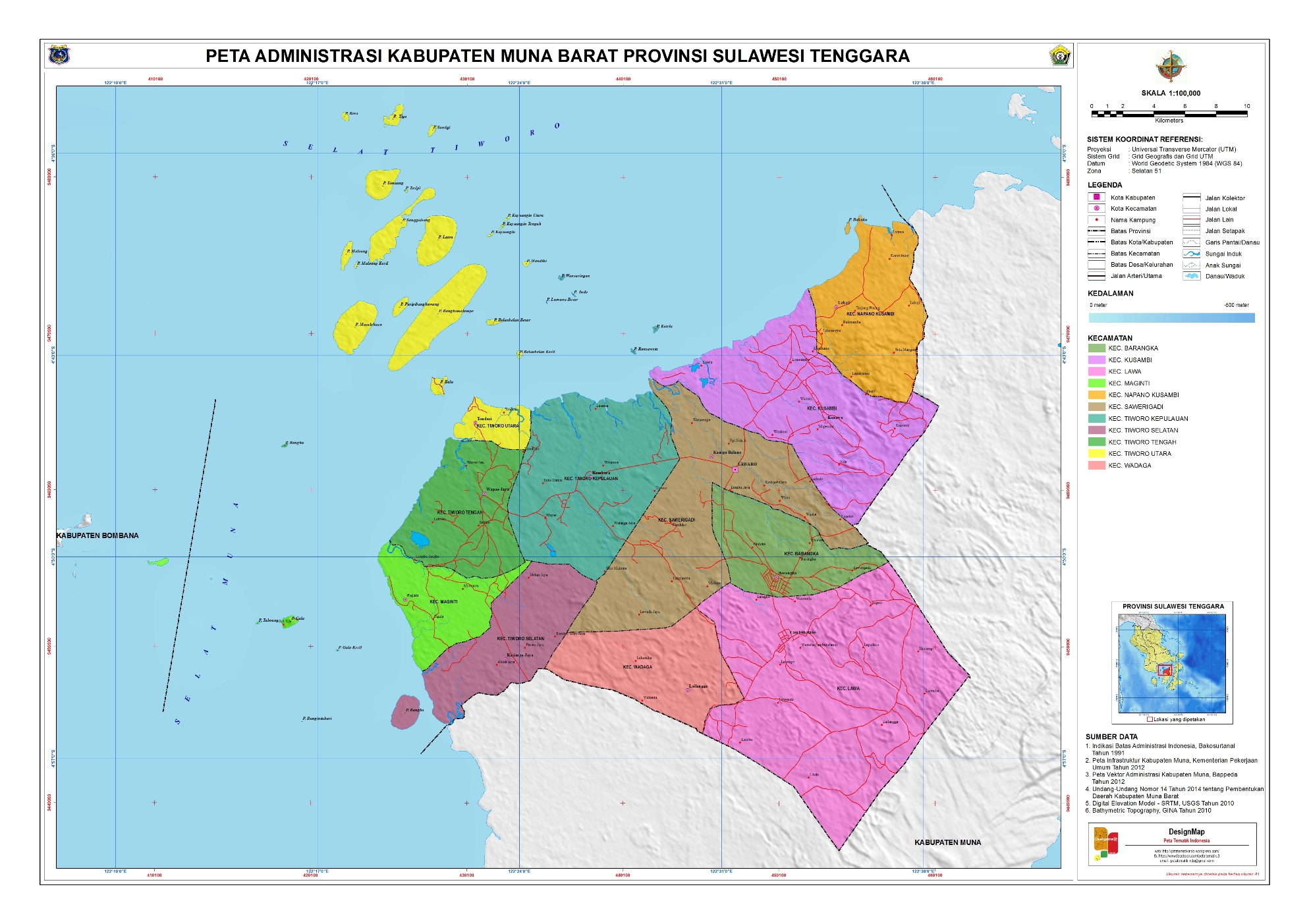
West Muna Regency (Indonesian : Kabupaten Muna Barat) is a new regency of Southeast Sulawesi Province of Indonesia,and is situated in the northwest corner of Muna Island and smaller ilsands of its coast. It was established under Act No.14 of 2014, dated 23 July 2014 by separation from the Muna Regency. It covers an area of 906.28 km2, and the districts comprising it had a population of 71,632 at the 2010 Census; [3] the 2020 Census resulted in a population of 84,590, [4] and the official estimate as at mid 2022 was 85,706, comprising 42,242 males and 43,464 females. [2] The administrative centre lies at Laworo in the Tiworo Islands District. [5]

Contents

Administrative districts

The West Muna Regency is divided into eleven districts (kecamatan), [6] tabulated below with their areas and their populations at the 2010 Census [3] and the 2020 Census, [4] together with the official estimates as at mid 2023. [2] The table also includes the locations of the district headquarters, the number of administrative villages in each district (totaling 81 rural desa and 5 urban kelurahan), and its post code.

Kode
Wilayah
Name of
District
(kecamatan)
Area
in
km2
Pop'n
Census
2010
Pop'n
Census
2020
Pop'n
Estimate
mid 2023
Admin
centre
No.
of
Villages
Post
Code
74.13.09Tiworo Kepulauan (a)
(Tiworo Islands)
77.906,4067,6538,317Kambara9 (b)93653
74.13.06Maginti (c)40.578,2268,9537,589Pajala893643
74.14.07Tiworo Tengah (d)
(Central Tiworo)
82.356,5037,6048,667Wapae Jaya893654
74.13.05Tiworo Selatan
(South Tiworo)
66.984,8305,7386,500Kasimpa Jaya593644
74.13.08Tiworo Utara (e)
(North Tiworo)
62.054,8635,6845,824Tondasi793656
74.13.03Lawa85.177,4308,7318,737Lawa8 (f)93651
74.13.01Sawerigadi102.606,2848,0477,893Sawerigadi1093657
74.13.02Barangka33.095,9787,3115,537Barangka893650
74.13.04Wadaga175.055,7066,3877,781Wadaga793652
74.13.10Kusambi103.3310,69912,94412,993Kusambi10 (g)93655
74.13.11Napano Kusambi77.194,7075,5385,868Lahaji693658
Totals906.2871,63284,59085,706Laworo86

Notes:

Related Research Articles

<span class="mw-page-title-main">Southeast Sulawesi</span> Province of Indonesia

Southeast Sulawesi, is a province on the island of Sulawesi, forming the southeastern peninsula of that island, together with a number of substantial offshore islands such as Buton, Muna, Kabaena and Wawonii, together with many smaller islands. It is bordered by South Sulawesi and Central Sulawesi to the north, sharing a maritime border with Maluku and North Maluku to the east and East Nusa Tenggara to the south, as well a very narrow maritime border with East Timor to the south. The capital is the city of Kendari, on the east coast of the peninsula.

<span class="mw-page-title-main">Morotai Island Regency</span> Regency in North Maluku, Indonesia

Morotai Island Regency is a regency of North Maluku province, Indonesia, located on Morotai Island. It covers an area of 2,336.6 km2 including the smaller Rao Island to the west of Morotai. The population was 52,860 at the 2010 census and 74,436 at the 2020 census; the official estimate as at mid 2023 was 80,566.

<span class="mw-page-title-main">Sikka Regency</span> Regency in Lesser Sunda Islands, Indonesia

Sikka is a regency within East Nusa Tenggara province, Indonesia, on the island of Flores. It is bordered to the west by Ende Regency and to the east by East Flores Regency. It covers an area of 1,675.36 km2 and had a population of 300,301 at the 2010 census and 321,953 at the 2020 Census; the official estimate as at mid 2023 was 335,360 - comprising 163,060 males and 172,300 females). The capital is the town of Maumere, which comprises the districts of Alok Barat, Alok and Alok Timur.

<span class="mw-page-title-main">Muna Island</span> Island in Southeast Sulawesi, Indonesia

Muna is an island in the Southeast Sulawesi province of Indonesia with an area of 3,219.84 km2 (1,243.19 sq mi) and had a population of 316,293 at the 2010 Census and 368,654 at the 2020 Census. It is just southeast of the island of Sulawesi and west of Buton Island. It currently comprises most of three administrative regencies within the province: Muna Regency, West Muna Regency, and Central Buton Regency.

<span class="mw-page-title-main">Mamuju Regency</span> Regency in West Sulawesi, Indonesia

Mamuju Regency is a regency of West Sulawesi province, Indonesia. The regency capital is at Karema, while Mamuju town is the capital of West Sulawesi. The population of the regency was 336,879 at the 2010 Census, but it was substantially reduced by the creation of the new Central Mamuju Regency which was cut out of it on 14 December 2012. The reduced Mamuju Regency covers an area of 4,942.25 km2 and had a population of 278,764 at the 2020 Census; the official estimate as at mid 2022 was 285,616.

<span class="mw-page-title-main">Polewali Mandar Regency</span> Regency in West Sulawesi, Indonesia

Polewali Mandar is one of the five regencies in West Sulawesi province of Indonesia. It borders on the regencies of Mamasa in the North, Majene in the West and Pinrang regency of South Sulawesi in the East. It covers an area of 2,074.76 km2 and had a population of 396,120 at the 2010 Census and 478,534 at the 2020 Census; the official estimate as at mid 2022 was 490,493. The regency is inhabited by various ethnic groups such as the Mandar, Buginese, Javanese and Toraja.

<span class="mw-page-title-main">East Lombok Regency</span> Regency in West Nusa Tenggara, Indonesia

East Lombok Regency is a regency of the Indonesian Province of West Nusa Tenggara. It is located on the island of Lombok, of which it comprises the eastern third ; the administrative capital is the town of Selong. The Regency covers an area of 1,605.55 km2 and had a population of 1,105,582 at the 2010 Census and 1,325,240 at the 2020 Census; the official estimate as at mid 2023 was 1,404.343.

<span class="mw-page-title-main">West Sumbawa Regency</span> Regency in West Nusa Tenggara, Indonesia

West Sumbawa Regency is a Regency (Kabupaten) of the Indonesian Province of West Nusa Tenggara. It is located on the island of Sumbawa and has an area of 1,743.58 km2. The regency was created on 18 December 2003 from what were at that time the westernmost five districts (kecamatan) of Sumbawa Regency. The population at the 2010 Census was 114,754, and at the 2020 Census was 145,798; the official estimate as at mid 2023 was 152,950 comprising 77,030 males and 75,920 females. The capital is the town of Taliwang.

<span class="mw-page-title-main">Manggarai Regency</span> Regency in East Nusa Tenggara, Indonesia

Manggarai Regency is a regency in East Nusa Tenggara province of Indonesia, situated on the island of Flores. Established in 1958 the regency was reduced in size and population by the separation of the more western districts to form West Manggarai Regency in 2003 and of the more eastern districts to form East Manggarai Regency in 2007. The area of the residual Manggarai Regency is 1,343.83 km2 and its population was 292,037 at the 2010 census and 312,855 at the 2020 census; the official estimate as at mid 2023 was 328,758. The capital of the regency is the town of Ruteng.

<span class="mw-page-title-main">Siau Tagulandang Biaro Islands Regency</span> Regency in North Sulawesi, Indonesia

Sitaro Islands Regency is a regency located off the northern extremity of Sulawesi Island in the southern Sangihe Islands, North Sulawesi Province, Indonesia. The regency was formed under Law Number 15 Year 2007 from 2 January 2007, by separation from the Sangihe Islands Regency of which it had previously formed the southern part. The short form of the name is formed from those of the three principal islands — Siau, Tagulandang and Biaro.

<span class="mw-page-title-main">Ambelau</span> Island and district in Buru Selatan Regency, Maluku Province, Indonesia

Ambelau or Ambalau is a volcanic island in the Banda Sea within Maluku Islands of Indonesia. The island forms an administrative district which is part of the South Buru Regency of Maluku province, Indonesia. It has a land area of 306 km2, and had a population of 6,846 at the 2010 Census; the official estimate as at mid 2023 was 9,225. The administrative center is Wailua, a settlement located at the south of the island. About half of the island's population is composed of indigenous Ambelau people who speak the Ambelau language; the other half are mostly immigrants from the nearby Maluku Islands and Java.

<span class="mw-page-title-main">Pangkajene and Islands Regency</span> Regency in South Sulawesi, Indonesia

The Pangkajene and Islands Regency, is a regency of South Sulawesi province of Indonesia. The regency lies primarily on the mainland of Sulawesi's southern peninsula, but also includes the Spermonde Islands off the west coast of that peninsula, as well as other small islands further west and southwest. The principal town lies at Pangkajene on Sulawesi, but there are a series of further small towns like Lejang, Labakkang, Bonto-Bonto and Segeri proceeding northwards from Pangkajene along the Trans-Sulawesi Highway. The total land area is 1,112.29 km2, and the population was 305,737 at the 2010 Census and 345,775 at the 2020 Census; the official population estimate as of mid-2022 was 351,426.

<span class="mw-page-title-main">Muna Regency</span> Regency in Southeast Sulawesi, Indonesia

Muna Regency is a regency of Southeast Sulawesi Province of Indonesia, covering parts of the island of Muna as well as part of the neighbouring Buton Island and smaller islands off its coast. Until 2014 it had an area of 2,945.05 km2, but in that year the western eleven districts of that Regency were split off to form a new West Muna Regency. The reduced regency now covers an area of 2,057.69 km2, and the districts comprising that area had a population of 196,645 at the 2010 Census; the total at the 2020 Census was 215,527, and the official estimate as at mid 2023 was 228,639, comprising 112,624 males and 116,015 females. The principal town lies at Raha, in Katobu District.

<span class="mw-page-title-main">Minahasa Regency</span> Regency in North Sulawesi, Indonesia

Minahasa Regency is a regency in North Sulawesi, Indonesia. Its capital is Tondano. It covers an area of 1,141.64 km2 and had a population of 310,384 at the 2010 Census; this rose to 347,290 at the 2020 Census, and the official estimate as at mid 2022 was 350,317.

<span class="mw-page-title-main">North Minahasa Regency</span> Regency in North Sulawesi, Indonesia

North Minahasa Regency is a regency in North Sulawesi, Indonesia. Its capital is Airmadidi. It was originally part of the Minahasa Regency until it was split off and established as a separate regency on 20 November 2003. It covers an area of 1,059.24 km2, and had a population of 188,904 at the 2010 Census; this had risen to 224,993 at the 2020 Census, and the official estimate as at mid 2022 was 229,368. The Regency includes the offshore islands of Bangka and Talisei to the north of Sulawesi, and Mantenang and Naeng Besar to the northwest.

<span class="mw-page-title-main">Southeast Minahasa Regency</span> Regency in North Sulawesi, Indonesia

Southeast Minahasa Regency is a regency in North Sulawesi, Indonesia. It covers an area of 710.83 km2, and had a population of 100,443 at the 2010 Census; this had risen to 116,323 at the 2020 Census, and the official estimate as at mid 2022 was 118,023. It was established as a separate regency from part of the South Minahasa Regency on 2 January 2007. Its administrative centre is at the town of Ratahan; Ratahan is also a language spoken in the Regency.

<span class="mw-page-title-main">Southeast Maluku Regency</span> Regency in Maluku, Indonesia

Southeast Maluku Regency is a regency of Maluku, Indonesia. It is coincident with the Kei Islands, except that the city of Tual, although within the Kei Islands geographically and the seat of the Regency's administration, is since 17 July 2007 technically independent of the Regency. The land area of the Regency is 1,031.01 km2, while the sea area administered by the Regency was 3,181 km2; it had a population of 96,442 at the 2010 Census; this increased to 121,511 at the 2020 Census, and the official estimate as at mid 2023 was 129,034.

<span class="mw-page-title-main">Tanimbar Islands Regency</span> Regency in Maluku, Indonesia

Tanimbar Islands Regency is a regency of Maluku province, Indonesia, consisting primarily of the Tanimbar Islands. The Regency covers a land area of 10,102 km2, and it had a population of 105,341 at the 2010 Census and 123,572 at the 2020 Census; the official estimate as at mid 2022 was 124,787. The principal town and administrative centre lies at Saumlaki in Tanimbar Selatan District.

<span class="mw-page-title-main">Central Buton Regency</span> Regency in Southeast Sulawesi, Indonesia

Central Buton Regency is a new regency of Southeast Sulawesi established by separation from Buton Regency under Act No.15 of 2014, dated 23 July 2014. It covers an area of 837.16 km2 comprising the southern parts of Muna Island and Kabaena Island, together with several small offshore islands adjacent to these two main islands, but with no territory located on Buton Island. It had a population of 86,112 at the 2010 Census and 114,773 at the 2020 Census; the official estimate as at mid 2023 was 121,369. The administrative centre lies at Labungkari in Lakudo District.

<span class="mw-page-title-main">South Buton Regency</span> Regency in Southeast Sulawesi, Indonesia

South Buton Regency is a regency located on Buton Island in Southeast Sulawesi Province of Indonesia. This regency was formed from the southern part of Buton Regency, from which it was separated by Act No.16 of 2014, dated 23 July 2014. It covers an area of 546.58 km2, and the population of the districts now comprising the new regency was 74,974 at the 2010 Census and 95,261 at the 2020 Census; the official estimate as at mid 2023 was 101,635. The regency capital is located in Batauga.

References

  1. "Pembentukan Kabupaten Muna Barat Di Provinsi Sulawesi Tenggara" (PDF) (in Indonesian). Government of Indonesia.
  2. 1 2 3 Badan Pusat Statistik, Jakarta, 28 February 2024, Kabupaten Muna Barat Dalam Angka 2024 (Katalog-BPS 1102001.7413)
  3. 1 2 Biro Pusat Statistik, Jakarta, 2011.
  4. 1 2 Badan Pusat Statistik, Jakarta, 2021.
  5. "UNDANG-UNDANG REPUBLIK INDONESIA NOMOR 14 TAHUN 2014 PEMBENTUKAN KABUPATEN MUNA BARAT DI PROVINSI SULAWESI TENGGARA" (in Indonesian). Government of Indonesia.
  6. "Pembagian Administrasi Kabupaten Muna Barat" (in Indonesian). Peta Tematik Indonesia.