South Buton Regency

Last updated
South Buton Regency
Kabupaten Buton Selatan
Lambang Kabupaten Buton Selatan.png
Lokasi Sulawesi Tenggara Kabupaten Buton Selatan.svg
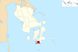
Location within Southeast Sulawesi
Sulawesi location map plain.svg
Red pog.svg
South Buton Regency
Location in Sulawesi and Indonesia
Indonesia location map.svg
Red pog.svg
South Buton Regency
South Buton Regency (Indonesia)
Coordinates: 5°40′45″S122°43′15″E / 5.6792483°S 122.7209625°E / -5.6792483; 122.7209625
Country Indonesia
Province Southeast Sulawesi
Established24 July 2014;10 years ago (2014-07-24) [1]
Founded by Government of Indonesia
Capital Batauga
Government
  RegentAgus Faisal Hidayat
  Vice RegentLa Ode Arusani
Area
  Total
510 km2 (200 sq mi)
Population
 (mid 2023 estimate)
  Total
101,635
  Density200/km2 (520/sq mi)
  [2]
Time zone UTC+8 (ICST)
Postcode
93752
Area code (+62) 411
Website butonselatankab.go.id

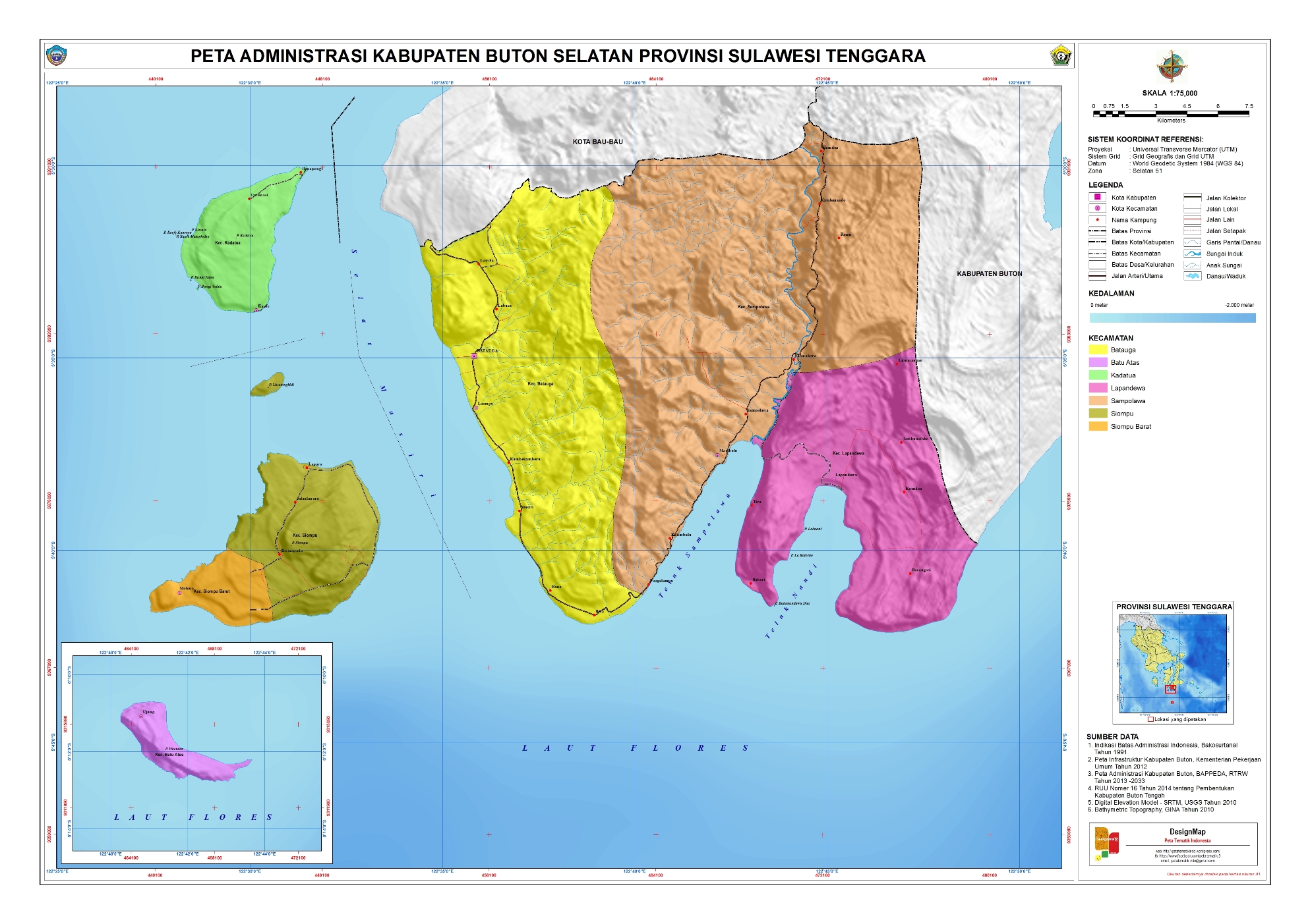
South Buton Regency (Indonesian : Kabupaten Buton Selatan) is a regency located on Buton Island in Southeast Sulawesi Province of Indonesia. This regency was formed from the southern part of Buton Regency, from which it was separated by Act No.16 of 2014, dated 23 July 2014. It covers an area of 546.58 km2, and the population of the districts now comprising the new regency was 74,974 at the 2010 Census [3] and 95,261 at the 2020 Census; [4] the official estimate as at mid 2023 was 101,635. [2] The regency capital is located in Batauga. [5]

Contents

The Regency contains three districts in the south of Buton Island (bordered by Buton Regency, the city of Baubau, and the Flores Sea), as well as 17 islands (the largest being Kadatua, Siompu and Batu Abas) lying to the west and to the south of Buton Island.

Administrative districts

South Buton Regency is divided into the following seven districts (kecamatan), [6] with their areas and populations at the 2010 Census [3] and the 2020 Census, [4] together with the official estimates as at mid 2023. [2] The table also includes the locations of the district administrative centres, the number of villages in each district (totaling 60 rural desa and 10 urban kelurahan - the latter consisting of 7 in Batauga District and 3 in Sampolawa District), and its post code.

Kode
Wilayah
Name of
District
(kecamatan)
Area
in
km2
Pop'n
Census
2010
Pop'n
Census
2020
Pop'n
Estimate
mid 2023
Admin
centre
No.
of
villages
Post
code
74.15.02Sampolawa221.9520,12123,59325,249Mambulu16 (a)94747
74.15.03Lapandewa (b)89.677,7729,85710,377Lapandewa793746
74.15.01Batauga148.5313,99317,80718,821Laompo12 (c)93741
74.15.07Kadatua (d)24.047,70310,13510,716Kaofe1093742
74.15.06Siompu (e)38.628,75311,17911,736Biwinapada1093743
74.15.05Siompu Barat
(West Siompu)
14.588,11910,39211,915Molona893744
74.15.04Batu Atas (f)9.198,24612,29812,821Ujung793745
Totals546.5874,97495,261101,635Batauga70

Notes: (a) including 3 kelurahan (Jaya Bakti, Katilombu and Todombulu). (b) includes Batumandawu Dua, Batumandawu Satu, La Kuteeno and Labuani islets.
(c) comprises 7 kelurahan (Bandar Batauga, Busoa, Lakambau, Laompo, Majapahit, Masiri and Molagina) and 5 desa.
(d) includes offshore islets of Bungi Napa, Bungi Salata, Kaliwu Liwuto, Liwuto, Kaofe Kansopa and Kaofe Matagholeo.
(e) includes offshore Liwutongkidi islet. (f) includes Kawikawia, Kawikawia Bara, Kawikawia Timbu and Waruata islets.

References

  1. "Pembentukan Kabupaten Buton Selatan Di Provinsi Sulawesi Tenggara" (PDF) (in Indonesian). Government of Indonesia.
  2. 1 2 3 Badan Pusat Statistik, Jakarta, 28 February 2024, Kabupaten Buton Selatan Dalam Angka 2024 (Katalog-BPS 1102001.7415)
  3. 1 2 Biro Pusat Statistik, Jakarta, 2011.
  4. 1 2 Badan Pusat Statistik, Jakarta, 2021.
  5. "UNDANG-UNDANG REPUBLIK INDONESIA NOMOR 16 TAHUN 2014 PEMBENTUKAN KABUPATEN BOTON SELATAN DI PROVINSI SULAWESI TENGGARA" (in Indonesian). Government of Indonesia.
  6. "Pembagian Administrasi Kabupaten Buton Selatan" (in Indonesian). Peta Tematik Indonesia.