Predominantly industrial in development, East Little Rock generally refers to most portions of the city of Little Rock, Arkansas located east of Interstate 30. The low-lying easternmost end of Arkansas' capital city is marked by distribution facilities and warehouses, Little Rock National Airport and its environs, the Port of Little Rock, and various manufacturers. A small number of residential areas can also be found dispersed throughout East Little Rock, progressing towards census-designated places including College Station and Sweet Home.
Physically and economically, East Little Rock often contrasts sharply with the newest, westernmost neighborhoods of Little Rock. The two parts of the city are linked via Interstate 630, which has its first west-bound access near East 15th Street.
Part of East Little Rock has received tremendous attention since the late 2004 opening of the William J. Clinton Presidential Center and Park near the banks of the Arkansas River. Development and subsequent opening of the facility and its adjoining Clinton School of Public Service, affiliated with the University of Arkansas, has served as a catalyst in plans to further improve its immediate area along the riverfront and downtown's River Market District. The next major addition for East Little Rock, the new headquarters of Heifer International adjacent to the Clinton library campus, opened on January 30, 2006.
Rock Island County is a county located in the U.S. state of Illinois, bounded on the west by the Mississippi River. According to the 2010 census, it had a population of 147,546. Its county seat is Rock Island; its largest city is neighboring Moline. Rock Island County is one of the four counties that make up the Davenport-Moline-Rock Island, IA-IL Metropolitan Statistical Area.
Stone County is located in the Ozark Mountains in the U.S. state of Arkansas. The county is named for rugged, rocky area terrain of the Ozarks. Created as Arkansas's 74th county on April 21, 1873, Stone County has two incorporated cities: Mountain View, the county seat and most populous city, and Fifty-Six. The county is also the site of numerous unincorporated communities and ghost towns.
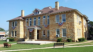
Prairie County is in the Central Arkansas region of the U.S. state of Arkansas. The county is named for the Grand Prairie, a subregion of the Arkansas Delta known for rice cultivation and aquaculture that runs through the county. Created as Arkansas's 54th county in 1846, Prairie County is home to four incorporated towns, including DeValls Bluff, the southern district county seat, and two incorporated cities, including Des Arc, the northern district county seat. The county is also the site of numerous unincorporated communities and ghost towns. Occupying 676 square miles (175,000 ha), Prairie County is the median-sized county in Arkansas. As of the 2020 Census, the county's population was 8,282. Based on population, the county is the ninth-smallest county of the 75 in Arkansas.
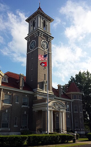
Monroe County is located in the Arkansas Delta in the U.S. state of Arkansas. The county is named for James Monroe, the fifth President of the United States. Created as Arkansas's 20th county on November 2, 1829, Monroe County is home to two incorporated towns and three incorporated cities, including Clarendon, the county seat, and Brinkley, the most populous city. The county is also the site of numerous unincorporated communities and ghost towns.
Mayflower is a city in Faulkner County, Arkansas, United States. The population was 2,234 at the 2010 census, up from 1,631 at the 2000 census.
Sherwood is a city in Pulaski County, Arkansas, United States. As of the 2020 census, the population of the city was 32,731. It is part of the Little Rock−North Little Rock−Conway Metropolitan Statistical Area with 699,757 people according to the 2010 census.
The Ark-La-Tex is a socio-economic tri-state region where the Southern U.S. states of Arkansas, Louisiana, and Texas join together. The region contains portions of Northwest Louisiana, Northeast Texas, and South Arkansas as well as the extreme southeastern tip of Oklahoma, in McCurtain County, partly centered upon the Red River, which flows along the Texas–Oklahoma state line into Southwestern Arkansas and Northwest Louisiana.
Central Arkansas, also known as the Little Rock metro, designated by the United States Office of Management and Budget as the Little Rock-North Little Rock-Conway Metropolitan Statistical Area, is the most populous metro area in the U.S. state of Arkansas. With an estimated 2020 population of 748,031, it is the most populated area in Arkansas. Located at the convergence of Arkansas's other geographic regions, the region's central location make Central Arkansas an important population, economic, education, and political center in Arkansas and the South. Little Rock is the state's capital and largest city, and the city is also home to two Fortune 500 companies, Arkansas Children's Hospital, and University of Arkansas for Medical Sciences (UAMS).
The William J. Clinton Presidential Library and Museum is the presidential library of Bill Clinton, who served as the 42nd president of the United States from 1993 to 2001. It is located in Little Rock, Arkansas and includes the Clinton Presidential Library, the offices of the Clinton Foundation, and the University of Arkansas Clinton School of Public Service. It is the thirteenth presidential library to have been completed in the United States, the eleventh to be operated by the National Archives and Records Administration, and the third to comply with the Presidential Records Act of 1978.
The Clinton School of Public Service is a branch of the University of Arkansas system and is the newest of the presidential schools. It is located on the grounds of the Clinton Presidential Center in Little Rock. The school is housed in the Choctaw Route Station, a former Chicago, Rock Island and Pacific Railroad station built in 1899.
Simmons Bank Arena is an 18,000-seat multi-purpose arena in North Little Rock, Arkansas, directly across the Arkansas River from downtown Little Rock. Opened in October 1999, it is the main entertainment venue serving Central Arkansas.
Arkansas Highway 10 is an east–west state highway in West Arkansas. The route runs 135.41 miles (217.92 km) from Oklahoma State Highway 120 near Hackett east to Interstate 30 in Little Rock, the state's capitol. The highway serves both the Fort Smith metropolitan area and the Little Rock – North Little Rock – Conway metropolitan area.
Interstate 440 (I-440) and Highway 440 (AR 440), in the central part of the US state of Arkansas, form a partial loop of 14.16 miles (22.79 km) connecting U.S. Highway 67 (US 67), US 167, and I-40 with I-30 and I-530 near Little Rock. I-440, known as the East Belt Freeway during planning and construction, travels through much of the area's industrial core in the eastern part of the metropolitan area, near Clinton National Airport and the Port of Little Rock. The route is mostly a six-lane freeway. North of I-40, the route continues as AR 440 until it reaches US 67/US 167 in Jacksonville. This section is known as the North Belt Freeway.
Pinnacle Valley is the northwesternmost neighborhood of the city of Little Rock, Arkansas. The area is to the south of Pinnacle Mountain, one of the highest elevations in Pulaski County. Like Chenal Valley which borders the area on its south side, Pinnacle Valley is a fast-developing portion of Little Rock as the city continues to expand westward.
The Quapaw Quarter of Little Rock, Arkansas, is a section of the city including its oldest and most historic business and residential neighborhoods. The area's name was first given in 1961, honoring the Quapaw Indians who lived in the area centuries ago.
Pleasant Valley is a neighborhood that is among the older western neighborhoods of the city of Little Rock, Arkansas. The area is to the northwest of Breckenridge and west of Colony West. Pleasant Valley lies to the south of the hillier Pleasant Ridge and Walton Heights areas, and mostly to the east of St. Charles.
Robinwood is an exclusive residential section of northwest Little Rock, Arkansas, marked by several large, stately homes among a wooded area near the Arkansas River. Some of the homes of Robinwood can be seen along the riverside cliffs approaching the city via Interstate 430 from Maumelle. The area is bordered by the interstate and Pleasant Valley to the west, the Arkansas River to its north, and Old Forge to the south. The Reservoir Road area, including the city's Reservoir Park, lies to the east. Development evolved in the Robinwood area during the 1960s and 1970s as Little Rock continued its westward expansion.
The Arkansas River Trail is a rail trail that runs 17 miles (27 km) in along both sides of the Arkansas River in Central Arkansas.
Little Rock is the capital and most populous city of the U.S. state of Arkansas. The city's population was 204,405 in 2022, according to the United States Census Bureau. As the county seat of Pulaski County, the city was incorporated on November 7, 1831, on the south bank of the Arkansas River close to the state's geographic center. The city derived its name from a rock formation along the river, named the "Little Rock" by the French explorer Jean-Baptiste Bénard de la Harpe in 1722. The capital of the Arkansas Territory was moved to Little Rock from Arkansas Post in 1821. The six-county Little Rock–North Little Rock–Conway, AR Metropolitan Statistical Area (MSA) is ranked 81st in terms of population in the United States with 748,031 residents according to the 2020 estimate by the United States Census Bureau.
Little Rock, Arkansas is home to numerous neighborhoods. See List of Little Rock Neighborhoods for an exhaustive list.
This page is based on this Wikipedia article Text is available under the CC BY-SA 4.0 license; additional terms may apply. Images, videos and audio are available under their respective licenses.