
Charlotte is the most populous city in the U.S. state of North Carolina and the county seat of Mecklenburg County. The population was 874,579 at the 2020 census, making Charlotte the 15th-most populous city in the United States, the seventh-most populous city in the South, and the second-most populous city in the Southeast behind Jacksonville, Florida. Charlotte is the cultural, economic, and transportation center of the Charlotte metropolitan area, whose estimated 2023 population of 2,805,115 ranked 22nd in the United States. The Charlotte metropolitan area is part of an 18-county market region and combined statistical area with an estimated population of 3,387,115 as of 2023.

Mecklenburg County is a county located in the southwestern region of the U.S. state of North Carolina, in the United States. As of the 2020 census, the population was 1,115,482, making it the second-most populous county in North Carolina, and the first county in the Carolinas to surpass one million in population. Its county seat is Charlotte, the state's largest municipality.

Gastonia is the most populous city in and the county seat of Gaston County, North Carolina, United States. It is the second-largest satellite city of the Charlotte area, behind Concord. The population was 80,411 in the 2020 census, up from 71,741 in 2010. Gastonia is the 13th-most populous city in North Carolina. It is part of the Charlotte-Concord-Gastonia, NC-SC Metropolitan Statistical Area, which is part of the Charlotte-Concord, NC-SC Combined Statistical Area.

SouthPark is an upscale shopping mall in the affluent SouthPark neighborhood in Charlotte, North Carolina. The mall is located approximately five miles (8 km) south of Uptown Charlotte, at the corner of Sharon and Fairview Roads. With 1,688,480 square feet (160,000 m2), It is one of the most profitable malls in the country with sales at over $700 per square foot. It is the 10th largest on the East Coast and is the 28th largest in the United States. SouthPark is the most congested shopping area in the United States during Black Friday weekend. The mall is visited by more than 12 million visitors a year.
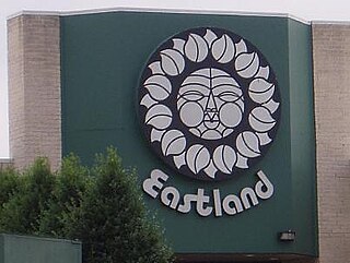
Eastland Mall was a shopping mall in Charlotte, North Carolina. The center opened on July 30, 1975, as the then-largest mall in North Carolina with three anchor department stores, Belk, J.C. Penney, and Ivey's. A Sears, Roebuck and Company store joined four years later. The mall was owned by Glimcher Realty Trust and the City of Charlotte. Glimcher requested the mall be put into receivership due to heavy debt, and there were reports of the mall entering foreclosure. LNR sold the interior space in the mall to Boxer Properties of Houston for $2 million. It ceased operations on June 30, 2010, and was purchased by the city of Charlotte from Boxer Properties, and the owners of the vacant anchors in hopes of selling it to a developer.

Myers Park is a neighborhood and historic district in Charlotte, North Carolina, United States.
The Charlotte Area Transit System (CATS) is the agency responsible for public transportation in the Charlotte metropolitan area. CATS operates bus and rail transit services in Mecklenburg County and surrounding areas. Established in 1999, CATS' bus and rail operations carry about 320,000 riders on an average week. CATS is governed by the Metropolitan Transit Commission and is operated as a department of the City of Charlotte. In 2023, the system had a ridership of 13,476,600, or about 40,900 per weekday as of the first quarter of 2024.
Uptown Charlotte, also called Center City, is the central business district of Charlotte, North Carolina, United States. The area is split into four wards by the intersection of Trade and Tryon Streets, and bordered by Interstate 277 and Interstate 77. The area is managed and overseen by the Charlotte Central City Partners, which is one of the three Municipal Service Districts in Charlotte. Uptown Charlotte is the largest business district in Charlotte and the Carolinas.

South End is a high density commercial and residential neighborhood and edge city in Charlotte, North Carolina, known for its vibrant mix of residential, commercial, and industrial development. The neighborhood is located just south of Uptown Charlotte, the city's central business district, and is bounded by the major thoroughfares of South Boulevard, East/West Boulevard, and Interstate 277. It is also one of six Municipal Service Districts in Charlotte.
SouthPark is an area edge city in Charlotte, North Carolina, United States. Its name is derived from the upscale SouthPark Mall, which opened on February 12, 1970. At nearly 1.8 million square feet, SouthPark Mall is the largest shopping mall in Charlotte and all of the Carolinas. The area is geographically centered at the intersection of Fairview Road and Sharon Road in the south central sector of the city, about six miles south of Uptown Charlotte. In addition to being home to the mall, SouthPark is also a residential area and one of the larger business districts in Charlotte.
Plaza-Midwood is a neighborhood located approximately one mile to the northeast of Uptown in Charlotte, North Carolina. The neighborhood is roughly bound by Hawthorne Lane to the west, The Plaza to the north, Briar Creek Road and the Charlotte Country Club to the east and Central Avenue to the south.
Sedgefield is a neighborhood of Charlotte, North Carolina, United States. It is situated between Park Rd. and South Blvd and belongs to popular South End.

The Cotswold neighborhood of Charlotte, North Carolina, United States, was named after the region of the same name in England. It is well-known for a large shopping center, Cotswold Village Shops, located at the intersection of Randolph and Sharon Amity Roads. Originally known as Cotswold Mall, it was one of Charlotte's first suburban malls. Cotswold is emerging as one of the more desirable areas for living and shopping with close proximity to Uptown. Many 1950s and 1960s homes are being remodeled and sold.
The Lynx Red Line is a proposed commuter rail service, connecting the towns in northern Mecklenburg and southern Iredell counties to Uptown Charlotte, North Carolina. In 2019, after a reevaluation of the entire corridor, the Charlotte Area Transit System (CATS) decided to move forward with BRT and shelve the commuter rail; which had been met with frustration by various city leaders and residents impacted by it.
The Charlotte metropolitan area, sometimes referred to as Metrolina, is a metropolitan area of the U.S. states of North and South Carolina, containing the city of Charlotte. The metropolitan area also includes the cities of Gastonia, Concord, Huntersville, and Rock Hill as well as the large suburban area in the counties surrounding Mecklenburg County, which is at the center of the metro area. Located in the Piedmont, it is the largest metropolitan area in the Carolinas, and the fourth largest in the Southeastern United States. The Charlotte metropolitan area is one of the fastest growing metropolitan areas in the United States.
Charles Christian Hook (1870–1938) was an American architect. He was also the founder of FreemanWhite, Inc. a Haskell Company (1892), the oldest practicing firm in North Carolina and currently the 11th oldest architecture firm in the United States.

The Lynx Blue Line is a light rail line in Charlotte, North Carolina, United States. Opened in 2007, it was the first rail line of the Charlotte Area Transit System, and the first major rapid rail service of any kind in the state. The 26-station, 19.3-mile (31.1 km) line extends from its northern terminus at the University of North Carolina at Charlotte in University City through NoDa, Uptown, and South End, then runs along South Boulevard to its southern terminus just north of Interstate 485 at the Pineville city limits. The line carries an average of over 27,700 passenger trips every day and offers connections to the CATS' CityLynx Gold Line which opened in 2015.

First Ward Park is a 4.6 acre urban park in the First Ward neighborhood of Uptown Charlotte. After a national competition to attract architects, the firm Shadley Associates was selected to build the park. The park incorporates the existing Dixie's Tavern and UNCC buildings, and new construction will include an office tower, hotel, and parking deck on adjacent land.
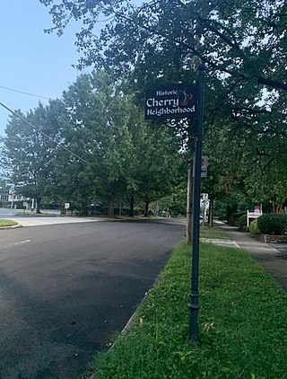
Cherry is a historical African-American neighborhood in Charlotte, North Carolina. Adjacent to Uptown Charlotte, it is bounded within Little Sugar Creek, Kenilworth Avenue, John Belk Freeway, East 4th Street, Queens Road, and Henley Place.


