
Thrissur, also known by its former name Thrissivaperur, is a city and the headquarters of the Thrissur district in Kerala, India. It is the third largest urban agglomeration in Kerala after Kochi and Calicut urban areas and the 21st largest in India. It is famous for the Thrissur Pooram festival.

Guruvayur also written as Guruvayoor, is a municipal temple town in Thrissur District, of Kerala State in India It is a suburban town of Thrissur city, located 28 km from Thrissur towards the north-west. It houses the famous Guruvayur Sri Krishna Temple. It is located at a distance of 645 km from Chennai towards the south-west, 292 km from the state capital Trivandrum towards the north-west, 494 km from Bengaluru towards the south-west and 80 km from Kochi towards the north.

Khordha district is an administrative division of the state of Odisha, India. It was formed on April 1, 1993, by the division of former Puri District into Puri, Khordha and Nayagarh districts. In the year 2000 the district name was changed to Khordha. The district headquarters is Khordha Town. The capital city of Bhubaneswar is located in this district. Khordha is the most urbanized of all the districts of Odisha. Khordha Road, the railway station that serves the town is also the divisional headquarters of the East Coast Railway of the Indian Railways. Khordha is known for its brass utensils, cottage industries, railway coach manufacturing, and cable manufacturing unit.

Vadakkumnathan Temple is an ancient Hindu temple dedicated to Shiva at city of Thrissur, of Kerala state in India. This temple is a classical example of the architectural style of Kerala and has one monumental tower on each of the four sides in addition to a kuttambalam. Mural paintings depicting various scenes from the Mahabharata can be seen inside the temple. The shrines and the Kuttambalam display vignettes carved in wood. The temple, along with the mural paintings, has been declared as a National Monument by India under the AMASR Act. According to popular local lore, this is the first temple built by Parasurama, the sixth avatara of Vishnu. Thekkinkadu Maidan, encircling the Vadakkunnathan Temple, is the main venue of the renowned Thrissur Pooram festival.
Kizhakkancherry is a gram panchayat in the Palakkad district, state of Kerala, India. It is a local government organisation that serves the villages of Kizhakkencheri-I and Kizhakkencheri-II. It was formed in the year of 1951 and is the fourth largest grama panchayath in Kerala. It covers an area of 112.56 km2 and comprises 22 wards. The boundaries are Vadakkencherry (north), Pananjeri (south), Vandazhy (east) and Kannambra (west). The village is located 37.4 km from the city of Palakkad and 34.9 km from Thrissur.

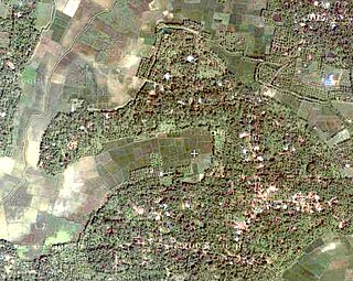
Cherpu is a big village in Thrissur district of Kerala state in south India. It is 12 kilometres south of Thrissur town and is on the Thriprayar road. It is dotted by a number of temples and has quite a few rivers flowing by its vicinity.

Thrissur is a district of Kerala situated in the central part of that state. Spanning an area of about 3,032 km2 (1,171 sq mi), Thrissur district is home to over 9% of Kerala's population.
Edacheri is a small panchayath in the district of Kozhikode in the South Indian state of Kerala.

Chavakkad, formerly Chowghat, is a colony in Thrissur district of Kerala state in India. It is a suburban town of Thrissur city. Chavakkad is noted for its beach and fishing. It lies on National Highway 66 is located about 75 km (47 mi) north of the city of Kochi, 25 km (16 mi) northwest of Thrissur, and 24 km (15 mi) south of Ponnani.
Nurani is a commercial and residential area in Palakkad city in the state of Kerala,India. Nurani contains a heritage village populated mainly by Tamil Brahmins (Iyers). This village is famous for its culture and religious fervour. About five centuries ago, Brahmins – mostly scholars, pandits, vaidikas, priests and cooks – from Thiruvannamalai in North Arcot district and other parts of Tamil Nadu came to Nurani in search of new pastures and established their dwelling in the present Agraharam (village). They brought in their Tamil culture and over years, became part and parcel of Palakkad population and their identity got merged in the new culture. Their Tamil accent and cultural milieu, in the present generation of people, can be seen distinctly different from that of the people of Tamil Nadu.

Aryankavu is a village in Punalur, Kollam district, Kerala. It lies at the border between Kerala and Tamilnadu on National Highway 744 near Thenmala.
Chamakunnu is a village in Kerala, India.

Erumely, also spelt "Erumeli" is a panchayath in the southeast part of Kottayam district in Kerala state, India. Erumely is situated 49 km east of Kottayam town and 133 km North of capital city Trivandrum. It is situated on the way to Sabarimala and also an important halting place (idathavalam) for the Sabarimala pilgrims. Erumely is famed for its religious harmony and prosperity between Hindus and Muslims which existed from the early periods. It is a place which have strong roots in legends and myths associated with lord Ayyappa. A new airport has been proposed in Erumeli. The village is nourished by Manimala River.
Perunad (Ranni-Perunad) is a scenic hilly village in Pathanamthitta district, Kerala state, India It's located on the banks of Pamba River and Kakkadu River.
Padur is a village in Palakkad District, Kerala. There is a temple of Sree Panickanar where a yearly festival called Padur Vela is celebrated, which is the curtain raiser for Vela-Poorams in Palakkad.
Vattappara is a village in Thiruvananthapuram district in the state of Kerala, India. , well known for its geographical peculiarities with quarries that are generally used for extracting building materials (rock).This town is by the side of MC Road connecting Trivandrum and Kottayam and 14 km away from Trivandrum City. The nearest township is Nedumangad.There is no recorded history on the origin of this place. The major occupation in Vattappara is farming(Rubber, Coconut).
Avanur is a village in Thrissur district in the state of Kerala, India. Avanur is located around 3 km east of the Thrissur-Kunnamkulam highway from Mundur junction and around 8 to 9 km from Thrissur town. The new Government Medical College at Mulankunnathukavu is just 3.5 km from Avanur. Avanur Grama panchayath won the Swaraj Trophy for the best village panchayat in Kerala for the year 2000–2001. The award was given in recognition of the successful implementation of developmental programmes and efficient administration. Avanur is well connected by around 20 private buses plying through it to various places like Thrissur town, Mundur, Kunnamkulam, Chavakkad, Mundathikode, Medical College and Athani. The newly proposed a combined Medical University by Government of Kerala is being planned around the Thrissur Medical College sprawling across a lush green campus. This is planned to host universities for Evidence Based Medicine, Ayurveda, Homoeopathy, Siddha and Yunani systems of medicine.
Nelluvai is a village in Thrissur district in the state of Kerala, India.It is located between Thrissur and Guruvayur, Kunnamkulam towns.It is known for the temple of Lord Dhanvantari. Nelluvai is a small Village/hamlet in WadakkancheryTaluk in Thrissur District of KeralaState, India. It comes under Erumapetty Panchayath. It belongs to central kerala Division. It is located 21 km towards North from District headquarters Thrissur, 12 km from Wadakkanchery. 303 km from state capital Thiruvananthapuram. Nelluvaipincode is 680584 and postal head office is Erumapetty. Nelluvai is surrounded by Mangad village towards East, Kuttanchery village towards North, Muringatheri Village towards North and Erumapetty village towards West. Kunnamkulam, shoranur, Thrissur, wadakkancheri are the nearby Cities to Nelluvai
Venkitangu is a city in Thrissur district in the state of Kerala, India.

Korwar is a village in the southern state of Karnataka, India. Sri Ksethra Korwar was initially called Kokilapur. It is located in the Devar Hippargi taluk of Vijayapur district in Karnataka. It is famous for Lord Hanuman temple, called as Korawareshwara. It comes under Korwar Panchayath. It belongs to Belgaum Division. It is located 64 km towards East from District headquarters Bijapur and 541 km from state capital Bangalore. Korwar Pin code is 586120 and postal head office is Korwar. Kannada is the Local Language here.

