Egypt Mills, Missouri

Last updated

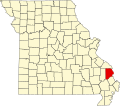
Egypt Mills is an unincorporated community in Randol Township in eastern Cape Girardeau County, Missouri, United States. It is located approximately 12 miles east of Jackson.

Egypt Mills is part of the Cape Girardeau Jackson, MO-IL Metropolitan Statistical Area.

In June 1821, a Baptist church called Ebenezer was constituted in the Big Bend near the present site of Egypt Mills. A post office was established in 1889, which operated until 1934. Tradition has it that the name originated from a zealous school teacher who organized a Sunday school class which met in an old mill located here. One of the first lessons dealt with Egypt, so the place came to be known as Egypt Mills. Trinity Lutheran church was dedicated in 1881 by pastor H. Guemmer. [1] [2] [3] [4]

Related Research Articles

<span class="mw-page-title-main">Cape Girardeau County, Missouri</span> County in Missouri, United States

Cape Girardeau County is located in the southeastern part of the U.S. state of Missouri; its eastern border is formed by the Mississippi River. At the 2020 census, the population was 81,710. The county seat is Jackson, the first city in the US to be named in honor of President Andrew Jackson. Officially organized on October 1, 1812, the county is named after Ensign Sieur Jean Baptiste de Girardot, an official of the French colonial years. The "cape" in the county's name is named after a former promontory rock overlooking the Mississippi River; this feature was demolished during railroad construction. Cape Girardeau County is the hub of the Cape Girardeau–Jackson metropolitan area. Its largest city is Cape Girardeau.

<span class="mw-page-title-main">Dutchtown, Missouri</span> Census-designated place in Missouri, United States

Dutchtown is a census-designated place (CDP) and former village in Cape Girardeau County, Missouri, United States, located at the intersection of Routes 25 and 74. The population was 163 at the 2020 census. It was part of the Cape Girardeau–Jackson, MO-IL Metropolitan Statistical Area.

<span class="mw-page-title-main">Gordonville, Missouri</span> Village in Missouri, United States

Gordonville is a village in Cape Giradeau County, Missouri, United States. The population was 625 at the 2020 census. It is part of the Cape Girardeau–Jackson, MO-IL Metropolitan Statistical Area.

<span class="mw-page-title-main">Oak Ridge, Missouri</span> Village in Missouri, United States

Oak Ridge is a village in the southern part of Apple Creek Township in Cape Girardeau County, Missouri, United States. The population was 237 at the 2020 census. It is part of the Cape Girardeau–Jackson, MO-IL Metropolitan Statistical Area.

<span class="mw-page-title-main">Old Appleton, Missouri</span> Village in Missouri, United States

Old Appleton is a village in Cape Girardeau County, Missouri, United States. The population was 73 at the 2020 census. It is part of the Cape Girardeau–Jackson, MO-IL Metropolitan Statistical Area.

<span class="mw-page-title-main">Patton, Missouri</span> Unincorporated community in the American state of Missouri

Patton is an unincorporated community in the southeastern part of Union Township in northern Bollinger County in Southeast Missouri, United States. It is located on State Highway 51, approximately one mile south of the intersection with Route 72 along Little Whitewater Creek and 15 miles north of Marble Hill. The ZIP Code for Patton is 63662.

<span class="mw-page-title-main">Burfordville, Missouri</span> Unincorporated community in Missouri, United States

Burfordville is an unincorporated community in western Cape Girardeau County, Missouri, United States, on the banks of the Whitewater River. It is located five miles west of Jackson on Route 34. Bufordville is part of the Cape Girardeau–Jackson, MO-IL Metropolitan Statistical Area.

<span class="mw-page-title-main">Friedheim, Missouri</span> Unincorporated community in the American state of Missouri

Friedheim is an unincorporated community in Apple Creek Township in northwestern Cape Girardeau County, Missouri, United States.

Daisy is an unincorporated community in northwestern Cape Girardeau County, Missouri, United States. It is located sixteen miles northwest of Cape Girardeau and is part of the Cape Girardeau–Jackson, MO-IL Metropolitan Statistical Area.

<span class="mw-page-title-main">New Wells, Missouri</span> Unincorporated community in the American state of Missouri

New Wells is an unincorporated community in northern Cape Girardeau County, Missouri, United States. It is located 20 miles (32 km) north of Cape Girardeau and is part of the Cape Girardeau–Jackson, MO-IL Metropolitan Statistical Area.

<span class="mw-page-title-main">Millersville, Missouri</span> Unincorporated community in the American state of Missouri

Millersville is an unincorporated community in western Cape Girardeau County, Missouri, United States. It is located six miles (10 km) west of Jackson on Route 72.

<span class="mw-page-title-main">Gipsy, Missouri</span> Unincorporated community in the American state of Missouri

Gipsy is an unincorporated community in the northwestern part of Wayne Township in the western part of Bollinger County, Missouri, United States. It is located on Missouri Supplemental Route E, fourteen miles southwest of Marble Hill on Lick Log Creek.

<span class="mw-page-title-main">Grassy, Missouri</span>

Grassy is an unincorporated community in Filmore Township in western Bollinger County, Missouri, United States.

Scopus is an unincorporated community in central Bollinger County in Southeast Missouri, United States. It is located approximately nine miles northeast of Marble Hill at the intersection of Highway B and Highway M.

<span class="mw-page-title-main">Dresden, Perry County, Missouri</span> Abandoned village in Missouri, United States

Dresden is an abandoned village in Brazeau Township in Perry County, Missouri, United States.

<span class="mw-page-title-main">Shawneetown, Missouri</span> Unincorporated community in the American state of Missouri

Shawneetown is an unincorporated community in Shawnee Township in northern Cape Girardeau County, Missouri, United States. It is located twenty miles north of Cape Girardeau and is part of the Cape Girardeau–Jackson, MO-IL Metropolitan Statistical Area.

Saint Michaels Township is a township in Madison County, Missouri, in the United States.

<span class="mw-page-title-main">Mayfield, Missouri</span> Unincorporated community in the American state of Missouri

Mayfield is an unincorporated community in the central part of Scopus Township in Bollinger County, Missouri, United States, approximately 4.5 miles west of the Cape Girardeau County line.

<span class="mw-page-title-main">Tallent, Missouri</span> Unincorporated community in the American state of Missouri

Tallent is an unincorporated community in the northern part of Crooked Creek Township in Bollinger County, Missouri, United States. Tallent lies 4 1/2 miles southwest of Patton, and was named for Reverend George W. Tallent, who was a local minister and school commissioner. A post office was established here in 1902, and operated until 1935.

Hubble Creek is a stream in Cape Girardeau County, Missouri in the United States. It is a tributary of the Castor River Diversion Channel.

References

  1. State Historical Society of Missouri: Cape Girardeau Place Names http://shs.umsystem.edu/manuscripts/ramsay/ramsay_cape_girardeau.html Archived 2016-03-31 at the Wayback Machine
  2. Cape Girardeau churches areaconnect http://capegirardeau.areaconnect.com/churches.htm
  3. Robert Sidney Douglass (1912). "History of Southeast Missouri: A Narrative Account of Its Historical Progress, Its People and Its Principal Interests, Volume 1".{{cite journal}}: Cite journal requires |journal= (help)
  4. A Directory of Towns, Villages, and Hamlets Past and Present of Cape Girardeau County, Missouri, by Arthur Paul Moser http://thelibrary.org/lochist/moser/girardpl.html

37°24′18″N89°27′49″W / 37.40500°N 89.46361°W / 37.40500; -89.46361