El Cerro, New Mexico | |
|---|---|
Census-designated place | |
 El Cerro, New Mexico | |
| Coordinates: 34°46′50″N106°41′44″W / 34.78056°N 106.69556°W | |
| Country | United States |
| State | New Mexico |
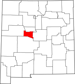
| County | Valencia |
| Area | |
• Total | 4.25 sq mi (11.00 km2) |
| • Land | 4.25 sq mi (11.00 km2) |
| • Water | 0 sq mi (0.00 km2) |
| Elevation | 4,843 ft (1,476 m) |
| Population | |
• Total | 2,946 |
| • Density | 693.9/sq mi (267.91/km2) |
| Time zone | UTC-7 (Mountain (MST)) |
| • Summer (DST) | UTC-6 (MDT) |
| GNIS feature ID | 2584092 [2] |
El Cerro is a census-designated place in Valencia County, New Mexico, United States. Its population was 2,953 as of the 2010 census. [4] It is part of the Albuquerque Metropolitan Statistical Area.