Las Maravillas, New Mexico

Last updated

Las Maravillas, New Mexico
Census-designated place
USA New Mexico location map.svg
Red pog.svg
Las Maravillas, New Mexico
Coordinates: 34°44′02″N106°40′08″W / 34.73389°N 106.66889°W / 34.73389; -106.66889
Country United States
State New Mexico
County Valencia
Area
[1]
  Total1.01 sq mi (2.62 km2)
  Land1.01 sq mi (2.61 km2)
  Water0.00 sq mi (0.00 km2)
Elevation
[2]
5,013 ft (1,528 m)
Population
 (2020) [3]
  Total1,604
  Density1,588.12/sq mi (613.44/km2)
Time zone UTC-7 (Mountain (MST))
  Summer (DST) UTC-6 (MDT)
GNIS feature ID2584133 [2]

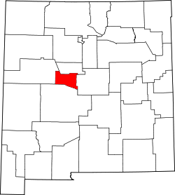
Las Maravillas is a census-designated place in Valencia County, New Mexico, United States. Its population was 1,628 as of the 2010 census. [4]

Contents

Geography

According to the United States Census Bureau, Las Maravillas has a total area of 1.02 square miles (2.6 km2), of which 0.0039 square miles (0.010 km2) is water. [5]

Demographics

Historical population
CensusPop.Note
2020 1,604
U.S. Decennial Census [6] [3]

According to the 2010 census, [4] 1628 people were living in Las Maravillas. The population density was 615.04 inhabitants per km2. Of the 1628 inhabitants, Las Maravillas was composed by 79.48% White, 1.04% were African American, 2.33% were Native American, 0.61% were Asian, 0.31% were Pacific Islanders, 11.3% were of other races and 4.91% from two or more races. Of the total population 47.79% were Hispanic or Latino of any race. [7]

Education

The majority of Las Maravillas is in Los Lunas Public Schools, while a portion is in Belen Consolidated Schools. [8] Belén High School is the Belén district's comprehensive high school.

Related Research Articles

<span class="mw-page-title-main">Valencia County, New Mexico</span> County in New Mexico, United States

Valencia County is a county in the U.S. state of New Mexico. As of the 2020 census, the population was 76,205. The county seat is Los Lunas.

<span class="mw-page-title-main">Torrance County, New Mexico</span> County in New Mexico, United States

Torrance County is a county located in the center of the U.S. state of New Mexico. As of the 2020 census, the population was 15,045. The county seat is Estancia.

<span class="mw-page-title-main">Cibola County, New Mexico</span> County in New Mexico, United States

Cibola County is a county in the U.S. state of New Mexico. As of the 2020 census, the population was 27,172. Its county seat is Grants. It is New Mexico's youngest county, and the third youngest county in the United States, created on June 19, 1981, from the westernmost four-fifths of the formerly much larger Valencia County.

<span class="mw-page-title-main">Springer, New Mexico</span> Town in New Mexico, United States

Springer is a town in Colfax County, New Mexico, United States. Its population was 1,047 at the 2010 census.

<span class="mw-page-title-main">Hatch, New Mexico</span> Village in New Mexico, United States

Hatch is a village in Doña Ana County, New Mexico, United States. The population was 1,648 at the 2010 census. The town is experiencing moderate growth, along with its outliers of Salem, Arrey, Derry, and Rincon. Hatch is widely known as the "best chile place in the World," for growing a wide variety of peppers, especially the New Mexican cuisine staple, and one of New Mexico's state vegetables, the New Mexico chile.

<span class="mw-page-title-main">University Park, New Mexico</span> Census-designated place in New Mexico, United States

University Park is a census-designated place (CDP) in Doña Ana County, New Mexico, United States. The population was 4,192 at the 2010 census. It is part of the Las Cruces Metropolitan Statistical Area.

<span class="mw-page-title-main">Bosque Farms, New Mexico</span> Village in Valencia County, New Mexico, United States

Bosque Farms is a village in Valencia County, New Mexico, United States. The population was 3,904 at the 2010 census. It is part of the Albuquerque Metropolitan Statistical Area.

<span class="mw-page-title-main">Casa Colorada, New Mexico</span> CDP in New Mexico, United States

Casa Colorada is a census-designated place (CDP) in Valencia County, New Mexico, United States. The population was 272 at the 2010 census. It is part of the Albuquerque Metropolitan Statistical Area.

El Cerro Mission is a census-designated place (CDP) in Valencia County, New Mexico, United States. The population was 4,657 at the 2010 census. It is part of the Albuquerque Metropolitan Statistical Area.

<span class="mw-page-title-main">Jarales, New Mexico</span> CDP in New Mexico, United States

Jarales is a census-designated place (CDP) in Valencia County, New Mexico, United States. The population was 2,475 at the 2010 census. It is part of the Albuquerque Metropolitan Statistical Area.

<span class="mw-page-title-main">Los Chavez, New Mexico</span> CDP in New Mexico, United States

Los Chavez is a census-designated place (CDP) in Valencia County, New Mexico. The population was 5,033 at the time of the 2000 census. It is part of the Albuquerque Metropolitan Statistical Area.

<span class="mw-page-title-main">Meadow Lake, New Mexico</span> CDP in New Mexico, United States

Meadow Lake is a census-designated place (CDP) in Valencia County, New Mexico, United States. The population was 4,491 at the 2000 census. It is part of the Albuquerque Metropolitan Statistical Area.

<span class="mw-page-title-main">Peralta, New Mexico</span> Town in New Mexico, United States

Peralta is a town in Valencia County, New Mexico, United States. Prior to its incorporation on July 1, 2007, it was a census-designated place (CDP). The population was 3,660 as of the 2010 census. Peralta is part of the Albuquerque metropolitan area.

<span class="mw-page-title-main">Rio Communities, New Mexico</span> City in New Mexico, United States

Rio Communities is a city in Valencia County, New Mexico, United States. Prior to its incorporation on May 16, 2013, it was a census-designated place (CDP). The CDP population was 4,723 as of the 2010 census.

<span class="mw-page-title-main">Valencia, Valencia County, New Mexico</span> CDP in New Mexico, United States

Valencia is a census-designated place (CDP) in Valencia County, New Mexico, United States. The population was 2,192 at the 2010 census. It is part of the Albuquerque Metropolitan Statistical Area.

<span class="mw-page-title-main">Valencia, Pennsylvania</span> Borough in Pennsylvania, United States

Valencia is a borough in Butler County, Pennsylvania, United States. The population was 551 at the 2010 census.

Sausal is a census-designated place in Valencia County, New Mexico, United States. Its population was 1,258 as of the 2010 census.

Madrone is a census-designated place in Valencia County, New Mexico, United States. Its population was 707 as of the 2010 census. New Mexico State Road 304 passes through the community.

Pueblitos is a census-designated place in Valencia County, New Mexico, United States. Its population was 794 as of the 2010 census. New Mexico State Road 116 passes through the community.

Las Nutrias is an unincorporated community and census-designated place in Socorro County, New Mexico, United States. Its population was 149 as of the 2010 census. New Mexico State Road 304 passes through the community.

References

  1. "ArcGIS REST Services Directory". United States Census Bureau. Retrieved October 12, 2022.
  2. 1 2 U.S. Geological Survey Geographic Names Information System: Las Maravillas, New Mexico
  3. 1 2 "Census Population API". United States Census Bureau. Retrieved October 12, 2022.
  4. 1 2 "U.S. Census website". United States Census Bureau . Retrieved September 19, 2016.
  5. "2010 Census Gazetteer Files". United States Census Bureau . Retrieved September 19, 2016.
  6. "Census of Population and Housing". Census.gov. Retrieved June 4, 2016.
  7. U.S. Board on Geographic Names
  8. "2020 CENSUS - SCHOOL DISTRICT REFERENCE MAP: Valencia County, NM" (PDF). U.S. Census Bureau . Retrieved September 4, 2022.