Rio Communities North, New Mexico

Last updated

Rio Communities North, New Mexico
CDP
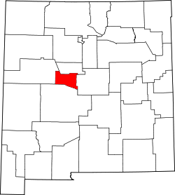
Valencia County New Mexico Incorporated and Unincorporated areas Rio Communities North Highlighted.svg
Location of Rio Communities North, New Mexico
Usa edcp location map.svg
Red pog.svg
Rio Communities North, New Mexico
Location in the United States
Coordinates: 34°43′58″N106°41′16″W / 34.73278°N 106.68778°W / 34.73278; -106.68778
Country United States
State New Mexico
County Valencia
Area
  Total4.7 sq mi (12.3 km2)
  Land4.7 sq mi (12.3 km2)
  Water0.0 sq mi (0.0 km2)
Elevation
[1]
4,997 ft (1,523 m)
Population
 (2000)
  Total1,588
  Density335.3/sq mi (129.4/km2)
Time zone UTC-7 (Mountain (MST))
  Summer (DST) UTC-6 (MDT)
Area code 505
FIPS code 35-63156
GNIS feature ID2409172 [1]

Rio Communities North is a census-designated place (CDP) in Valencia County, New Mexico, United States. The population was 1,588 at the 2000 census. It is part of the Albuquerque Metropolitan Statistical Area.

Contents

Geography

According to the United States Census Bureau, the CDP has a total area of 4.7 square miles (12 km2), all land.

Demographics

As of the census [2] of 2000, there were 1,588 people, 550 households, and 451 families residing in the CDP. The population density was 335.3 inhabitants per square mile (129.5/km2). There were 591 housing units at an average density of 124.8 per square mile (48.2/km2). The racial makeup of the CDP was 70.09% White, 1.83% African American, 1.95% Native American, 0.88% Asian, 20.40% from other races, and 4.85% from two or more races. Hispanic or Latino of any race were 43.70% of the population.

There were 550 households, out of which 47.3% had children under the age of 18 living with them, 70.9% were married couples living together, 7.1% had a female householder with no husband present, and 18.0% were non-families. 12.5% of all households were made up of individuals, and 2.7% had someone living alone who was 65 years of age or older. The average household size was 2.89 and the average family size was 3.16.

In the CDP, the population was spread out, with 32.0% under the age of 18, 6.5% from 18 to 24, 37.0% from 25 to 44, 17.7% from 45 to 64, and 6.7% who were 65 years of age or older. The median age was 31 years. For every 100 females, there were 99.7 males. For every 100 females age 18 and over, there were 96.4 males.

The median income for a household in the CDP was $46,773, and the median income for a family was $46,471. Males had a median income of $40,685 versus $25,536 for females. The per capita income for the CDP was $17,745. About 2.8% of families and 3.9% of the population were below the poverty line, including 4.2% of those under age 18 and 5.2% of those age 65 or over.

Related Research Articles

<span class="mw-page-title-main">Mignon, Alabama</span> CDP in Alabama, United States

Mignon is a census-designated place (CDP) in Talladega County, Alabama, United States. At the 2020 census, the population was 1,186.

<span class="mw-page-title-main">Bootjack, California</span> Unincorporated community in California, United States

Bootjack is an unincorporated community and census-designated place in Mariposa County, California, United States. The population was 661 at the 2020 census, down from 960 in 2010 and 1,588 in 2000, largely due to reductions in the area of the CDP.

Goodings Grove was a census-designated place in northern Will County, Illinois, United States. The population was 17,084 at the 2000 census. It is now a neighborhood of the village of Homer Glen, Illinois, which was incorporated in 2001.

<span class="mw-page-title-main">Teaticket, Massachusetts</span> Census-designated place in Massachusetts, United States

Teaticket is a census-designated place (CDP) in the town of Falmouth, Massachusetts. The population was 1,692 at the 2010 census.

<span class="mw-page-title-main">Park Layne, Ohio</span> Census-designated place in Ohio, United States

Park Layne is a census-designated place (CDP) in Bethel Township, Clark County, Ohio, United States. The population of the CDP was 4,248 at the 2020 census. It is part of the Springfield, Ohio Metropolitan Statistical Area. Park Layne became a CDP in the 1980 United States Census.

<span class="mw-page-title-main">Mount Healthy Heights, Ohio</span> Census-designated place in Ohio, United States

Mount Healthy Heights is a census-designated place (CDP) in Hamilton County, Ohio, United States. The population was 2,918 at the 2020 census.

<span class="mw-page-title-main">Lucasville, Ohio</span> Census-designated place in Ohio, United States

Lucasville is a census-designated place (CDP) in Scioto County, Ohio, United States. The population was 1,655 at the 2020 census. It is part of the Portsmouth micropolitan area.

<span class="mw-page-title-main">Chewey, Oklahoma</span> Census-designated place in Oklahoma, United States

Chewey is a census-designated place (CDP) in Adair County, Oklahoma, United States. The population was 135 at the 2010 census.

West Wyomissing is a census-designated place (CDP) in Spring Township, Berks County, Pennsylvania, United States. The population was 3,407 at the 2010 census.

<span class="mw-page-title-main">Shenandoah Heights, Pennsylvania</span> CDP in Pennsylvania, United States

Shenandoah Heights is a census-designated place (CDP) in Schuylkill County, Pennsylvania. The population was 1,298 at the 2000 census.

<span class="mw-page-title-main">Grantley, Pennsylvania</span> CDP in Pennsylvania, United States

Grantley is a census-designated place (CDP) in York County, Pennsylvania, United States. The population was 3,628 at the 2010 census.

<span class="mw-page-title-main">Woods Creek, Washington</span> CDP in Washington, United States

Woods Creek is a census-designated place (CDP) in Snohomish County, Washington, United States. The population was 6,017 at the 2020 census.

<span class="mw-page-title-main">Loveland Park, Ohio</span> Census-designated place in Ohio, United States

Loveland Park is a census-designated place (CDP) located in Symmes Township, Hamilton County and Deerfield Township, Warren County, in the southwestern part of the U.S. state of Ohio. The CDP is named after the city of Loveland. The population was 1,737 at the 2020 census.

<span class="mw-page-title-main">Bourne (CDP), Massachusetts</span> Census-designated place in Massachusetts, United States

The village of Bourne is a census-designated place (CDP) in the town of Bourne in Barnstable County, Massachusetts, United States. The population was 1,418 at the 2010 census, out of 19,754 in the town of Bourne as a whole.

Greece is a suburban community and census-designated place in Monroe County, New York, United States. The population was 14,519 at the 2010 census. Google Maps only shows that part of Greece.

Mexico is a census-designated place (CDP) in the town of Mexico in Oxford County, Maine, United States. The population was 1,946 at the 2000 census.

Norway is a census-designated place (CDP) in the town of Norway in Oxford County, Maine, United States. The population was 2,623 at the 2000 census.

Rumford is a census-designated place (CDP) in the town of Rumford in Oxford County, Maine, United States. The population was 4,795 at the 2000 census.

Lincoln is a census-designated place (CDP) consisting of the primary settlement in the town of Lincoln in Penobscot County, Maine, United States. The population was 2,884 at the 2010 census.

Machias is a census-designated place (CDP) corresponding to the central village area within the town of Machias in Washington County, Maine, United States. The population of the CDP was 1,274 at the 2010 census.

References

  1. 1 2 U.S. Geological Survey Geographic Names Information System: Rio Communities North, New Mexico
  2. "U.S. Census website". United States Census Bureau . Retrieved January 31, 2008.