
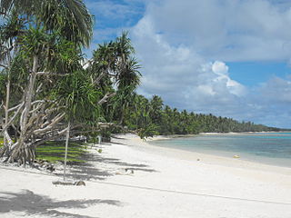
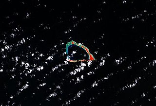
The Marshall Islands, officially the Republic of the Marshall Islands, is an island country west of the International Date Line and north of the equator in the Micronesia region in the Northwestern Pacific Ocean.

The Marshall Islands consist of two archipelagic island chains of 30 atolls and 1,152 islands, which form two parallel groups—the "Ratak" (sunrise) chain and the "Ralik" (sunset) chain. The Marshalls are located in the North Pacific Ocean and share maritime boundaries with Micronesia and Kiribati. Two-thirds of the nation's population lives in the capital of Majuro and the settlement of Ebeye. The outer islands are sparsely populated due to lack of employment opportunities and economic development.

The Marshall Islands is an island country in Oceania.
Majuro is the capital and largest city of the Marshall Islands. It is also a large coral atoll of 64 islands in the Pacific Ocean. It forms a legislative district of the Ratak (Sunrise) Chain of the Marshall Islands. The atoll has a land area of 9.7 square kilometers (3.7 sq mi) and encloses a lagoon of 295 square kilometers (114 sq mi). As with other atolls in the Marshall Islands, Majuro consists of narrow land masses. It has a tropical trade wind climate, with an average temperature of 27 °C (81 °F).
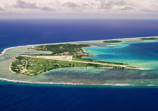
Kwajalein Atoll is part of the Republic of the Marshall Islands (RMI). The southernmost and largest island in the atoll is named Kwajalein Island, which its majority English-speaking residents often use the shortened name, Kwaj. The total land area of the atoll amounts to just over 6 square miles (16 km2). It lies in the Ralik Chain, 2,100 nautical miles southwest of Honolulu, Hawaii.
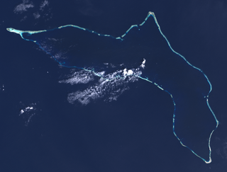
Mili Atoll is a coral atoll of 92 islands in the Pacific Ocean, and forms a legislative district of the Ratak Chain of the Marshall Islands. It is located approximately 78 kilometers (48 mi) southeast of Arno. Its total land area is 14.9 square kilometers (5.8 sq mi) making it the second largest of the Marshall Islands after Kwajalein.

Ebeye is the populous island of Kwajalein Atoll in the Marshall Islands, and the second most populated in the Marshall Islands. It is a center for Marshallese culture in the Ralik Chain of the archipelago. Settled on 80 acres of land, it 2021 it had a population of 8,416. Over 50% of the population is estimated to be under the age of 18.

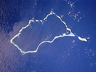
Wotho Atoll is a coral atoll of 13 islands in the Pacific Ocean, and forms a legislative district of the Ralik Chain of the Marshall Islands. Its total land area is only 4.33 square kilometers (1.67 sq mi), but it encloses a lagoon of 94.92 square kilometers (36.65 sq mi). The name "Wotho" means either "entrance through the reef", or "island far away" according to different sources.

The Battle of Kwajalein was fought as part of the Pacific campaign of World War II. It took place 31 January – 3 February 1944, on Kwajalein Atoll in the Marshall Islands. Employing the hard-learned lessons of the Battle of Tarawa, the United States launched a successful twin assault on the main islands of Kwajalein in the south and Roi-Namur in the north. The Japanese defenders put up stiff resistance, although outnumbered and under-prepared. The determined defense of Roi-Namur left only 51 survivors of an original garrison of 3,500.
Roi-Namur is an island in the north part of the Kwajalein Atoll in the Marshall Islands. Today it is a major part of the Ronald Reagan Ballistic Missile Defense Test Site, hosting several radar systems used for tracking and characterizing missile reentry vehicles (RV) and their penetration aids (penaids). A flooding event by wave overtopping made national news in the United States, with dramatic footage of water bursting through a door.

Air Marshall Islands is an airline based in Majuro, Marshall Islands. It is the flag carrier of the Marshall Islands, operating inter-island services in the Central Pacific. Its main base is Marshall Islands International Airport, Majuro.
Lae Atoll is a coral atoll of 20 islands in the Pacific Ocean, and forms a legislative district of the Ralik Chain of the Marshall Islands. Its total land area is only 1.5 square kilometers (0.58 sq mi), but it encloses a lagoon with an area of 17.7 square kilometers (6.8 sq mi). It is located approximately 47 kilometers (29 mi) east of Ujae Atoll. The population of Lae Atoll was 133 in 2021. Its islands include Lae, Looj (Lotj), Bilalalon, Riblong (Ribon) and Lweijab (Lejab).

Ujae Atoll is a coral atoll of 15 islands in the Pacific Ocean, and forms a legislative district of the Ralik Chain of the Marshall Islands. Its total land area is only 1.86 square kilometers (0.72 sq mi), but it encloses a lagoon of 185.94 square kilometers (71.79 sq mi). It is located about 122 kilometers (76 mi) west of Kwajalein Atoll.

The Ronald Reagan Ballistic Missile Defense Test Site, commonly referred to as the Reagan Test Site, is a missile test range in Marshall Islands. It covers about 750,000 square miles (1,900,000 km2) and includes rocket launch sites at the Kwajalein Atoll, Wake Island, and Aur Atoll. It primarily functions as a test facility for U.S. missile defense and space research programs. The Reagan Test Site is under the command of the US Army Kwajalein Atoll, or USAKA.
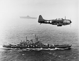
The Gilbert and Marshall Islands campaign were a series of battles fought from August 1942 through February 1944, in the Pacific theatre of World War II between the United States and Japan. They were the first steps of the drive across the Central Pacific by the United States Pacific Fleet and Marine Corps. The purpose was to establish airfields and naval bases that would allow air and naval support for upcoming operations across the Central Pacific. Operation Galvanic and Operation Kourbash were the code names for the Gilberts campaign that included the seizures of Tarawa and Makin, during the Battle of Tarawa on 20–23 November 1943 and the Battle of Makin on 20–24 November 1943. Operation Flintlock and Operation Catchpole were aimed at capturing Japanese bases at Kwajalein, Eniwetok, and Majuro in the Marshall Islands.

Bucholz Army Airfield is a United States Army airfield located on Kwajalein Atoll, Marshall Islands. Its position is ideal for refueling during trans-Pacific flights, and the airport is available to civilians through Air Marshall Islands and United Airlines.

The following is an alphabetical list of topics related to the Marshall Islands.
Dyess Army Airfield is a military airfield on Roi-Namur, Kwajalein Atoll, Marshall Islands. It is owned by the United States Army. Approximately 60 U.S. personnel reside on the base, with an additional 100 personnel commuting from Bucholz Army Airfield daily by plane.
Kwajalein Atoll High School is a secondary school in Kwajalein, Marshall Islands. It is a part of the Marshall Islands Public School System.

Naval Base Marshall Islands were United States Navy advance bases built on the Marshall Islands during World War II to support the Pacific War efforts. The bases were built by US Navy after the Marshall Islands campaign that captured the islands from the Empire of Japan. By February 1944 the United States Armed Forces had captured the islands. Most of the airfields and other facilities Japan had built were destroyed in allied bombing raids and naval bombardment. US Navy Seabee Construction Battalions arrived as soon as the area was secured and remove the debris. The Seabees quickly repaired, built and improved the airfield/runways and seaport. Seabees often worked around the clock to get airfields operational so that fighter aircraft and bombers could start operating. The bases were used for staging upcoming campaigns and for repair.
