Elstead

Last updated

Elstead
Elstead Mill DSC 2398.jpg
Elstead Mill
Surrey UK location map.svg
Red pog.svg
Elstead
Location within Surrey
Area11.04 km2 (4.26 sq mi)
Population2,557 (Civil Parish 2011) [1]
  Density 232/km2 (600/sq mi)
OS grid reference SU907437
Civil parish
  • Elstead
District
Shire county
Region
Country England
Sovereign state United Kingdom
Post town Godalming
Postcode district GU8
Dialling code 01252
Police Surrey
Fire Surrey
Ambulance South East Coast
UK Parliament
List of places
UK
England
Surrey
51°11′02″N0°41′53″W / 51.184°N 0.698°W / 51.184; -0.698

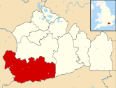
Elstead is a civil parish in Surrey, England with shops, houses and cottages spanning the north and south sides of the River Wey; development is concentrated on two roads that meet at a central green. It includes Pot Common its southern neighbourhood. Hamlets in the parish, marginally separated from the village centre, are Charleshill and Elstead Common, both rich in woodland. Elstead lies between Farnham and Godalming on the B3001 road about 2.2 miles (3.6 km) west of the A3 Milford interchange.

Contents

History

Elstead's relative prosperity over the centuries can be partly attributed to the existence of the availability of a site for a watermill and a bridge over the river;[ citation needed ] parts of the bridge are dated to around 1300. [2]

The first known reference to Elstead is in the 1128 foundation charter for Waverley Abbey (sometimes spelt Waverly), where it was called Helestede. The church of St James was built around ten years later. It still contains 13th-century windows and some 14th-century timbers [3] and is a Grade II* listed building. [4]

Elstead Old Bridge, built circa 1300 Elstead Bridge DSC 1620.jpg
Elstead Old Bridge, built circa 1300

In the 14th century, the Scheduled ancient monument bridge was built over the River Wey. Today this old bridge, strengthened by Surrey County Council in 1993, takes the westward traffic; eastward traffic takes the new bridge alongside. [2]

Elstead had a forge built in 1686 which is now an office. [5] [6]

Elstead Mill, now a pub restaurant, was occupied by Oliver Cromwell’s ‘roundhead’ army during the English Civil War but subsequently burnt down. [7] The present structure is described in its listing as being the result of several re-buildings from the 16th century. [8]

There were two other pub restaurants in 2021, The Woolpack and The Golden Fleece, reflecting the early dependence on the local wool trade, also in 2021 three cafe's and a fish & chip shop. [9]

During the 18th and 19th centuries, Elstead was known for the quality and quantity of carrots grown there, with daily shipments by train from nearby Milford Station up to London's Covent Garden market during the growing season. This is attributed to the light sandy soils in the village which are excellent for carrot growing.

In 1997 a millennium oak was planted at the southern apex of the village green under the auspices of the afternoon WI. [10]

Geography

Panorama of the first village green: at the junction of the B3001 and Thursley Road. North is to the centre. By the church is a smaller green. A Panorama of Elstead Village Green March 2014.jpg
Panorama of the first village green: at the junction of the B3001 and Thursley Road. North is to the centre. By the church is a smaller green.
Hankley Common World War II battlements Atlantic Wall Training, Hankley Common, Large Breech.JPG
Hankley Common World War II battlements

Elstead is surrounded by woods and heathland, including Royal Common, Ockley Common, Elstead Common and Hankley Common, which is used by the British Army for training purposes and by others as a filming location. Much of the heathland area has environmental protection for rare birds, insects and reptiles.

Thundry Meadow, close to Elstead, is a Site of Special Scientific Interest (SSI) and is an important breeding area for the dragonfly and damselfly.

The area around the village has several large farms and much of the land is used for grazing for horses and cattle.

Elstead is within the Green Belt and is in an Area of Outstanding Natural Beauty. It is a popular destination for walkers and cyclists.

Charleshill

The western hamlet Charleshill, is on the opposite (left) bank of the River Wey on the B3001 to Farnham, half of the hamlet being in Tilford. Its public house is The Donkey originally called The Half-way House. The pub was converted from two small cottages in 1850, which at that time were owned by Farnham United Brewery. It acquired the nickname of "The Donkey", as before the days of motor traffic, donkeys were kept tethered outside the Inn to help horses and carts up the hill; it officially became named this in 1947. [11]

Demography and housing

2011 Census Homes
Output areaDetachedSemi-detachedTerracedFlats and apartmentsCaravans/temporary/mobile homesshared between households [1]
(Civil Parish)52132913968340

The average level of accommodation in the region composed of detached houses was 28%, the average for apartments was 22.6%.

2011 Census Key Statistics
Output areaPopulationHouseholds% Owned outright% Owned with a loanhectares [1]
(Civil Parish)2,5571,08544.5%29.1%1,104

The proportion of households in the civil parish who owned their home outright compares to the regional average of 35.1%. The proportion who owned their home with a loan compares to the regional average of 32.5%. The remaining % is made up of rented dwellings (plus a negligible % of households living rent-free).

Sports and facilities

Elstead marathon.The adult five mile race at the river Wey bridge Elstead Marathon 2014 from the bridge.jpg
Elstead marathon.The adult five mile race at the river Wey bridge

The Elstead Village Tennis Club was formed in 1989 and now has five floodlit all weather courts and a clubhouse with parking. [12]

Elstead Cricket Club, founded in the 1880s, [13] are based in the self-built pavilion on the Thursley Road recreation ground.

Elstead Royal British Legion has a club house. [14] There is a bowling green, an activity hall, and an outbuilding used as a commercial cafe.

The village hall plays host to the Elstead Badminton Club every Tuesday evening. [15]

Elstead Sharks are the junior football club and the Elstead Marathon has been held for over 100 years. [16] [17]

Elstead pancake race is held on a convenient day, near to Shrove Tuesday. [18]

Elstead Paper Boat Race is held every year in early July. Boats built to hold children and adults race on The Moat, a pond on Elstead Common.

Notable residents

Related Research Articles

<span class="mw-page-title-main">Godalming</span> Town and civil parish in Surrey, England

Godalming is a market town and civil parish in southwest Surrey, England, around 30 miles (49 km) southwest of central London. It is in the Borough of Waverley, at the confluence of the Rivers Wey and Ock. The civil parish covers 3.74 sq mi (9.7 km2) and includes the settlements of Farncombe, Binscombe and Aaron's Hill. Much of the area lies on the strata of the Lower Greensand Group and Bargate stone was quarried locally until the Second World War.

<span class="mw-page-title-main">Borough of Waverley</span> Non-metropolitan district and Borough in England

The Borough of Waverley is a local government district with borough status in Surrey, England. The council is based in the town of Godalming. The borough also contains the towns of Farnham and Haslemere and numerous villages, including the large village of Cranleigh, and surrounding rural areas. At the 2021 Census, the population of the borough was 128,200. The borough is named after Waverley Abbey, near Farnham. Large parts of the borough are within the Surrey Hills Area of Outstanding Natural Beauty.

<span class="mw-page-title-main">Shalford, Surrey</span> Village in England

Shalford is a village and civil parish in the Guildford district, in Surrey, England on the A281 Horsham road immediately south of Guildford. It has a railway station which is between Guildford and Dorking on the Reading to Gatwick Airport line. In 2011 the parish had a population of 4142.

<span class="mw-page-title-main">Farncombe</span> Human settlement in England

Farncombe, historically Fernecome, is a village and peripheral settlement of Godalming in Waverley, Surrey, England and is approximately 0.8 miles (1.3 km) north-east of the Godalming centre, separated by common land known as the Lammas Lands. The village of Compton lies 1.8 miles (3 km) to the northwest and Bramley 2 miles (3 km) to the east; whilst Charterhouse School is to the west. Loseley Park, in the hamlet of Littleton, lies 1 mile (1.6 km) to the north of the village.

<span class="mw-page-title-main">Shackleford</span> Human settlement in England

Shackleford is a village and civil parish in the Borough of Guildford, Surrey, England centred to the west of the A3 between Guildford and Petersfield 32 miles (51 km) southwest of London and 5.2 miles (8.4 km) southwest of Guildford. Shackleford includes the localities of Eashing, Hurtmore, Norney and Gatwick.

<span class="mw-page-title-main">Tilford</span> Village in Surrey, England

Tilford is a village and civil parish centred at the point where the two branches of the River Wey merge in Surrey, England, 3 miles (4.8 km) south-east of Farnham. It has half of Charleshill, Elstead in its east, a steep northern outcrop of the Greensand Ridge at Crooksbury Hill on Crooksbury Common in the north and Farnham Common (woodland) Nature Reserve in the west, which has the Rural Life Living Museum. As the Greensand Ridge in its western section is in two parts, the Greensand Way has a connecting spur here to its main route running east–west to the south.

<span class="mw-page-title-main">Frensham</span> Village in Surrey, England

Frensham is a village in Surrey, England, next to the A287 road, 13 miles (20.9 km) WSW of Guildford, the county town. Frensham lies on the right bank of the River Wey, only navigable to canoes, shortly before its convergence with the north branch. Farnham is the nearest town, 3.5 miles (5.6 km) to the north.

<span class="mw-page-title-main">Churt</span> Village in Surrey, England

Churt is a village and civil parish in the borough of Waverley in Surrey, England, about 5.5 miles (8.9 km) south of the town of Farnham on the A287 road towards Hindhead. A clustered settlement is set in areas acting as its green buffers, which include the Devil's Jumps. The west of the village slopes down to the steep edge of Whitmore Vale, which is mostly in Headley, Hampshire; at the foot of this bank is a steeply cut brook which defines the Hampshire border. There are forests and heathland by and atop the Greensand Ridge, and the hamlet of Crosswater is in the north of the parish.

<span class="mw-page-title-main">Frensham Common</span> Common near Frensham, Surrey, England

Frensham Common is a large Site of Special Scientific Interest (SSSI) heathland of 373 hectares which includes two lakes; it is owned and operated by the National Trust.

<span class="mw-page-title-main">Moor Park, Farnham</span>

For the school in the UK see More House School, Frensham

<span class="mw-page-title-main">Compton, Waverley</span> Human settlement in England

Compton is a former village and today a semi-rural suburb centred 1 mile (1.6 km) ESE of Farnham in the Waverley district of Surrey, England and connected to Farnham by two direct urban single carriageways and green space footpaths along the Wey which in part marks the northern boundary of the area together with the A31. The area relies on Farnham for most of its modern amenities and its eastern part is rural whereas its western part is urban, with a divide where the Wey flows between the two south-eastwards.

<span class="mw-page-title-main">River Wey</span> River in southern England

The River Wey is a main tributary of the River Thames in south east England. Its two branches, one of which rises near Alton in Hampshire and the other in West Sussex to the south of Haslemere, join at Tilford in Surrey. Once combined, the flow is eastwards then northwards via Godalming and Guildford to meet the Thames at Weybridge. Downstream the river forms the backdrop to Newark Priory and Brooklands. The Wey and Godalming Navigations were built in the 17th and 18th centuries, to create a navigable route from Godalming to the Thames.

<span class="mw-page-title-main">Bourne Wood</span> Area of predominantly coniferous woodland just south of Farnham, Surrey, England

Bourne Wood is an area of predominantly coniferous woodland just south of Farnham, Surrey, England; the area is often used as a film location. Near to another area also used as a film location, locally it was known as The Clumps, and was called this until Forestry England changed the name in the 1950s when fire breaks were introduced. Charles Darwin may have written about the area in Appendices of Natural Selection, describing the trees in clumps. A promontory (rise) above a large heathland clearing provides views over the surrounding woodland. Much of the wood was formerly heathland at the western end of the Greensand Ridge that was developed privately during the 20th century as commercial conifer plantations. This part of the wood has been purchased by the Royal Society for the Protection of Birds and is being restored mainly to heath, with retention of some woodland of wildlife significance, as Farnham Heath nature reserve. Their aim is to benefit scarce heathland species such as nightjar, woodlark, Dartford warbler and tree pipit as well as species such as sand lizard.

<span class="mw-page-title-main">Oxenford Farm</span>

Oxenford Farm is a former abbey farm, a dependency of Waverley Abbey in the civil parish of Witley, Surrey, England, with several listed buildings around a courtyard, including three by Augustus Pugin.

<span class="mw-page-title-main">St Edmund Church, Godalming</span> Church in Surrey , United Kingdom

St Edmund's Church is the Roman Catholic parish church of Godalming, a town in the English county of Surrey. It was built in 1906 to the design of Frederick Walters and is a Grade II listed building. The church stands on a "dramatic hillside site" on the corner of Croft Road just off Flambard Way close to the centre of the town.

<span class="mw-page-title-main">Meadrow Unitarian Chapel</span> Church in Surrey , United Kingdom

Meadrow Unitarian Chapel is a Unitarian chapel in the Farncombe area of Godalming, Surrey, England. It is part of the London District and South Eastern Provincial Assembly of Unitarian and Free Christian Churches, one of 16 districts within the General Assembly of Unitarian and Free Christian Churches, the umbrella organisation for British Unitarians.

<span class="mw-page-title-main">Godalming Friends Meeting House</span> Quaker meeting house in Surrey, England

Godalming Friends Meeting House is a Friends meeting house in the ancient town of Godalming in the English county of Surrey. One of many Nonconformist places of worship in the town, it dates from 1748 but houses a congregation whose roots go back nearly a century earlier. Decline set in during the 19th century and the meeting house passed out of Quaker use for nearly 60 years, but in 1926 the cause was reactivated and since then an unbroken history of Quaker worship has been maintained. Many improvements were carried out in the 20th century to the simple brick-built meeting house, which is Grade II-listed in view of its architectural and historical importance.

<span class="mw-page-title-main">Salvation Army Hall</span> Church in Surrey , United Kingdom

The former Salvation Army Hall in Godalming, Surrey, England, now an office building known as Aurum House, has been used by three religious groups since its construction c. 1830. The ancient town in the English county of Surrey has a long and diverse history of Protestant Nonconformity, and three Nonconformst denominations are represented: at first it served Congregationalists, but when they built a larger chapel in the town it passed to the Methodist Church. In the 20th century it was occupied by The Salvation Army, but it closed in 2012 and was redeveloped for commercial use. The building has been listed at Grade II for its architectural and historical importance.

<span class="mw-page-title-main">Godalming Congregational Church</span> Church in Surrey , United Kingdom

The building formerly known as Godalming Congregational Church was the Congregational chapel serving the ancient town of Godalming, in the English county of Surrey, between 1868 and 1977. It superseded an earlier chapel, which became Godalming's Salvation Army hall, and served a congregation which could trace its origins to the early 18th century. The "imposing suite of buildings", on a major corner site next to the Town Bridge over the River Wey, included a schoolroom and a manse, and the chapel had a landmark spire until just before its closure in 1977. At that time the congregation transferred to the nearby Methodist chapel, which became a joint Methodist and United Reformed church with the name Godalming United Church. The former chapel then became an auction gallery before being converted into a restaurant; then in 2018 the premises were let to the Cotswold Company to be converted into a furniture and home accessories showroom. In 1991 the former chapel was listed at Grade II for its architectural and historical importance.

References

  1. 1 2 3 Key Statistics; Quick Statistics: Population Density Archived 11 February 2003 at the Wayback Machine United Kingdom Census 2011 Office for National Statistics Retrieved 21 November 2013
  2. 1 2 Historic England. "Details from listed building database (1005921)". National Heritage List for England . Retrieved 17 June 2012.
  3. History of Elstead Church Archived 24 August 2007 at the Wayback Machine
  4. Historic England. "Details from listed building database (1188415)". National Heritage List for England . Retrieved 17 June 2012.
  5. Historic England. "Forge Cottage (Grade II) (1044421)". National Heritage List for England.
  6. "How it all started". Elstead Lighting. 3 May 2023. Retrieved 2 September 2023.
  7. "The Mill at Elstead, Godalming - Fuller's Pub and Restaurant Elstead". www.millelstead.co.uk. Retrieved 31 March 2021.
  8. Historic England. "Details from listed building database (1044454)". National Heritage List for England . Retrieved 17 June 2012.
  9. "Food & Drink – Elstead Village" . Retrieved 31 March 2021.
  10. Farnham Herald 1997
  11. History and the Donkey Archived 25 February 2012 at the Wayback Machine
  12. "About EVTC | Elstead Village Tennis Club" . Retrieved 30 May 2020.
  13. "StackPath". Archived from the original on 19 June 2018.
  14. "Royal British Legion Branches in Surrey - Surrey - The Royal British Legion". counties.britishlegion.org.uk. Retrieved 30 May 2020.
  15. "Elstead Badminton Club - Waverley Borough Council". www.waverley.gov.uk. Archived from the original on 13 March 2015. Retrieved 13 January 2022.
  16. "ELSTEAD ONLINE | the 102nd Elstead Marathon". www.surreycommunity.info. Archived from the original on 20 January 2015. Retrieved 13 January 2022.
  17. "Elstead 'marathon' - Friday 5th July". Waverley Harriers Running Club. 9 July 2013. Retrieved 30 May 2020.
  18. Live, Surrey (17 February 2010). "Pancake tossers brave the rain and cold". getsurrey. Retrieved 30 May 2020.
  19. Live, Surrey (21 December 2010). "No base in the borough for Surrey Heath MP". SurreyLive. Retrieved 8 December 2022.
  20. Peddy, Chris (3 April 2024). "Paris 2024: Team GB's first male Olympic sport climber Toby Roberts has sights on gold". BBC Sport . Retrieved 7 April 2024.