This article needs additional citations for verification .(December 2013) |
| Thursley | |
|---|---|
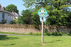 Thursley village green and village sign | |
 Thursley Location within Surrey | |
| Area | 19.85 km2 (7.66 sq mi) |
| Population | 651 (Civil Parish 2011) [1] |
| • Density | 33/km2 (85/sq mi) |
| OS grid reference | SU9040 |
| Civil parish |
|
| District | |
| Shire county | |
| Region | |
| Country | England |
| Sovereign state | United Kingdom |
| Post town | Godalming |
| Postcode district | GU8 |
| Dialling code | 01252 |
| Police | Surrey |
| Fire | Surrey |
| Ambulance | South East Coast |
| UK Parliament | |
Thursley is a village and civil parish in southwest Surrey, west of the A3 between Milford and Hindhead. An associated hamlet is Bowlhead Green. To the east is Brook. In the south of the parish rises the Greensand Ridge, in this section reaching its escarpment near Punch Bowl Farm and the Devil's Punch Bowl, Hindhead.


