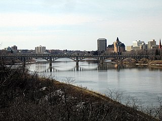
The South Saskatchewan River is a major river in Canada that flows through the provinces of Alberta and Saskatchewan.

The Bow River is a river in Alberta, Canada. It begins within the Canadian Rocky Mountains and winds through the Alberta foothills onto the prairies, where it meets the Oldman River, the two then forming the South Saskatchewan River. These waters ultimately flow through the Nelson River into Hudson Bay. The Bow River runs through the city of Calgary, taking in the Elbow River at the historic site of Fort Calgary near downtown. The Bow River pathway, developed along the river's banks, is considered a part of Calgary's self-image.
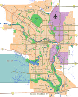
Fish Creek Park is an urban provincial park that preserves the valley of Fish Creek in the southern part of Calgary, Alberta, Canada. It is bordered on three sides by the city, and on the west by the territory of the Tsuu T’ina Nation (Sarcee), a First Nation.

The Elbow River is a river in southern Alberta, Canada. It flows from the Canadian Rockies to the city of Calgary, where it merges into the Bow River.
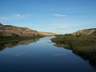
The Red Deer River is a river in Alberta and a small portion of Saskatchewan, Canada. It is a major tributary of the South Saskatchewan River and is part of the larger Saskatchewan-Nelson system that empties into Hudson Bay.

Alberta Provincial Highway No. 47, commonly referred to as Highway 47, is a north–south highway located in west–central Alberta, Canada that stretches from Highway 16, approximately 10 km (6.2 mi) west of Edson, to Highway 40, approximately 6 km (3.7 mi) south of Robb.

The Brazeau River is a river in western Alberta, Canada. It is a major tributary of the North Saskatchewan River.
Mercoal, a former coal mining town, is located in the Yellowhead County of western Alberta, Canada. It was one of several communities along the historic Coal Branch segment of the Grand Trunk Pacific Railway, which included Embarras, Robb, Coalspur, Coal Valley, Cadomin, Luscar, and Mountain Park. At its peak in the late 1940s and early 1950s the town had over 800 residents. Mercoal declined after the mines closed in 1959, and it is now essentially a ghost town with only a small number of summer residences remaining. It is situated on Highway 40, 70 km southwest of Edson, 8 km (5 mi) west of Coalspur.

Cadomin is a hamlet in the west-central Alberta, Canada within Yellowhead County. It is located along the McLeod River in the foothills of the Rocky Mountains, approximately 50 kilometres (31 mi) south of Hinton near the Bighorn Highway. It is served by a spur of the Canadian National Railway.

The McLeod River is a river in west-central Alberta, Canada. It forms in the foothills of the Canadian Rockies, and is a major tributary of the Athabasca River.

The Fiddle River is a medium-sized tributary of the Athabasca River, flowing into the river near the east gate of Jasper National Park in Alberta, Canada. The Fiddle River forms at the base of Fiddle Pass, with meltwater from Mount Bryant, Mount Gregg, Mount Sir Harold Mitchel, and Mount Barry. The river flows in a general northeast direction before its confluence with the Athabasca. The Fiddle River parallels the road to the popular Miette Hotsprings for a portion of its course.

The Miette River is a short river in Jasper National Park, Alberta, Canada. It flows south-southwest through the Rocky Mountains before draining into the Athabasca River.

Embarras is a locality in Yellowhead County, Alberta, Canada. It takes its name from the Embarras River. 'Embarrass' is French for 'barrier', probably in reference to the piles of driftwood that often clog the shallow, winding river.
Coalspur is a nearly abandoned coal-mining and railroad town in Yellowhead County, Alberta. It is situated on Highway 47 beside the Embarras River in the foothills of the Canadian Rockies.
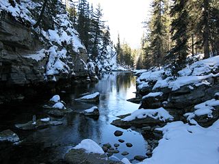
The Maligne River is a medium-sized river in the Canadian Rockies. It runs through parts of Jasper National Park in Alberta, Canada. The Maligne is a major tributary of the Athabasca River. The river takes from the French word for malignant or wicked. It is theorised that a Belgian priest voyageur created this name in reference to the current of the river near its confluence with the Athabasca River.
The Ram River is a river rising in the Alberta Rocky Mountains. It flows eastward, taking on the North Ram River, before joining the North Saskatchewan River near the Town of Rocky Mountain House. The name Ram Rivulet appears on a David Thompson map of 1814. A ram is a male Rocky Mountain Sheep.
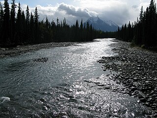
The Whirlpool River is a short river in Jasper National Park, Alberta, Canada. It is an early tributary of the Athabasca River.

The Gregg River is a short river in west-central Alberta, Canada. The river is named after John James Gregg (1840–1941), a prospector and trapper prominent in the area.

The Edson River is a minor river in west-central Alberta, Canada. The river, like the nearby town of Edson, is named for Edson Joseph Chamberlin (1852–1924), a Vice-President and General Manager of the Grand Trunk Pacific Railway. Chamberlain also acted as the President of the Grand Trunk Railway.

The Alberta Coal Branch is the name given to a segment of the Canadian National Railway and the region through which it passes. It is located within Yellowhead County in west-central Alberta, Canada.


