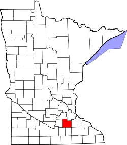
Epsom | |
---|---|
Coordinates: 44°15′44″N93°03′22″W / 44.26222°N 93.05611°W Coordinates: 44°15′44″N93°03′22″W / 44.26222°N 93.05611°W | |
Country | United States |
State | Minnesota |
County | Rice County |
Township | Richland Township |
Elevation | 1,119 ft (341 m) |
Time zone | UTC-6 (Central (CST)) |
• Summer (DST) | UTC-5 (CDT) |
ZIP code | 55946 |
Area code(s) | 507 |
GNIS feature ID | 654695 [1] |
Epsom is an unincorporated community in Richland Township, Rice County, Minnesota, United States.
The community is located along Rice County Road 26 (Larson Avenue) near its junction with 230th Street East.
State Highway 60 (MN 60) is also in the immediate area. The North Fork of the Zumbro River flows through the community.
Nearby places include Kenyon, Nerstrand, Faribault, Ruskin, and Moland.
Epsom is located within ZIP code 55946, based in Kenyon. The boundary line between Rice and Goodhue counties is near Epsom.
Rice County is a county located in the south central portion of the U.S. state of Minnesota. As of the 2010 census, the population was 64,142. Its county seat is Faribault.
The Leech Lake Indian Reservation is an Indian reservation located in the north-central Minnesota counties of Cass, Itasca, Beltrami, and Hubbard. The reservation forms the land base for the federally recognized Leech Lake Band of Ojibwe, one of six bands comprising the Minnesota Chippewa Tribe, organized in 1934. The Leech Lake Reservation has the highest population of any reservation in Minnesota, with a resident population of 10,660 indicated by the 2010 United States census.
Webster is an unincorporated community in Webster Township, Rice County, Minnesota, United States.
Minnesota State Highway 246 (MN 246) is a 18.221-mile-long (29.324 km) highway in southeast Minnesota, which runs from its intersection with State Highway 3 in the city of Northfield and continues south and east to its eastern terminus at its intersection with State Highway 56 in Holden Township near Kenyon.
Moland is an unincorporated community in Rice and Steele counties in the U.S. state of Minnesota.
Ruskin is an unincorporated community in Rice County, Minnesota, United States.
Ryan is an unincorporated community in Belle Creek Township, Goodhue County, Minnesota, United States.
Warsaw is an unincorporated community and census-designated place (CDP) in Warsaw Township, Rice County, Minnesota, United States. As of the 2010 census, its population was 627.
Hazelwood is an unincorporated community in Webster Township, Rice County, Minnesota, United States.
Little Rock is an unincorporated community in Buckman Township, Morrison County, Minnesota, United States. There are approximately 1200 people living in Little Rock. The community is located along State Highway 25 near its junction with Morrison County Road 26, Nature Road. Nearby places include Buckman, Royalton, Rice, and Pierz. Bunker Hill Creek flows through the community.
Veseli is an unincorporated community in Wheatland Township, Rice County, Minnesota, United States. The community was incorporated in 1889. It was named after Veselí, in the Czech Republic, a city whence its early settlers came. Veseli was one of the four largest communities in Minnesota originally settled by Czech immigrants.
Bombay is an unincorporated community in Goodhue County, Minnesota, United States.
Skyberg is an unincorporated community in Kenyon Township, Goodhue County, Minnesota, United States.
Prairieville is an unincorporated community in Rice County, Minnesota, United States, east of Faribault.
Millersburg is an unincorporated community in Forest Township, Rice County, Minnesota, United States.
Rice Lake is an unincorporated community in Stockholm Township, Wright County, Minnesota, United States. The community is located along Wright County Road 30 near Morrison Avenue SW.
Opole is an unincorporated community in Brockway Township, Stearns County, Minnesota, United States. The community is located along Stearns County Road 17 near 125th Avenue. Stearns County Road 3 is also in the immediate area. Nearby places include Holdingford, St. Stephen, and Rice.
Vawter is an unincorporated community in Morrison County, Minnesota, United States, near Little Falls and Royalton. The community is located along 103rd Street near Morrison County Road 35, Iris Road. Vawter is located within Bellevue Township and Little Falls Township. The Crane Meadows National Wildlife Refuge and the Rice–Skunk Lake Wildlife Management Area are both nearby.
Merton is an unincorporated community in Merton Township, Steele County, Minnesota, United States, near Medford and Owatonna. The community is located near the junction of Steele County Roads 8 and 9. Other nearby routes include Steele County Roads 10, 12, and 37. Medford Creek and Rush Creek both flow nearby.
Thor is an unincorporated community in Lee Township, Aitkin County, Minnesota, United States. The community is located along Aitkin County Road 4 near the junction with 275th Place. Nearby places include Aitkin, Glen, East Lake, McGregor, and Rice Lake National Wildlife Refuge.
This article about a location in Rice County, Minnesota is a stub. You can help Wikipedia by expanding it. |