Wheatland Township, Rice County, Minnesota

Last updated
Wheatland Township, Minnesota
USA Minnesota location map.svg
Red pog.svg
Wheatland Township, Minnesota
Location within the state of Minnesota
Usa edcp location map.svg
Red pog.svg
Wheatland Township, Minnesota
Wheatland Township, Minnesota (the United States)
Coordinates: 44°29′17″N93°27′29″W / 44.48806°N 93.45806°W / 44.48806; -93.45806 Coordinates: 44°29′17″N93°27′29″W / 44.48806°N 93.45806°W / 44.48806; -93.45806
Country United States
State Minnesota
County Rice
Area
  Total34.7 sq mi (89.8 km2)
  Land33.8 sq mi (87.5 km2)
  Water0.9 sq mi (2.3 km2)
Elevation
1,070 ft (326 m)
Population
 (2000)
  Total1,358
  Density40.2/sq mi (15.5/km2)
Time zone UTC-6 (Central (CST))
  Summer (DST) UTC-5 (CDT)
FIPS code 27-69826 [1]
GNIS feature ID0665977 [2]

Wheatland Township is a township located in the northwest corner of Rice County, Minnesota, United States. The population was 1,358 at the 2000 census.

Contents

The unincorporated communities of Veseli and Wheatland are both located within Wheatland Township. The city of Lonsdale is located within the township geographically but is a separate entity.

Geography

According to the United States Census Bureau, the township has a total area of 34.7 square miles (89.7 km2), of which 33.8 square miles (87.5 km2) is land and 0.9 square mile (2.3 km2) (2.51%) is water.

Communities

The city of Lonsdale is located at the southeast corner of the township but is a separate entity. Lonsdale was platted by the railroad when it was constructed in 1902. Originally, the railroad was supposed to go through the community of Veseli, named after a town in the Czech Republic, and spelled Wessely in the early years, but the route was changed at the last minute. Veseli did not have a paved road to the community until 1970, but has had an amateur baseball team, the Veseli Warriors, since the 1940s.

The township was originally populated by a small French Canadian group that was replaced by immigrants from southern Bohemia starting as early as 1860.

The community of Wheatland is located at the northeast corner of Cody Lake, along the southern border of Wheatland Township.

Demographics

As of the census [1] of 2000, there were 1,358 people, 437 households, and 370 families residing in the township. The population density was 40.2 inhabitants per square mile (15.5/km2). There were 444 housing units at an average density of 13.1/sq mi (5.1/km2). The racial makeup of the township was 99.04% White, 0.15% African American, 0.15% Native American, 0.22% Asian, and 0.44% from two or more races. Hispanic or Latino of any race were 0.59% of the population.

There were 437 households, out of which 48.5% had children under the age of 18 living with them, 74.4% were married couples living together, 5.5% had a female householder with no husband present, and 15.3% were non-families. 11.2% of all households were made up of individuals, and 4.6% had someone living alone who was 65 years of age or older. The average household size was 3.11 and the average family size was 3.36.

In the township the population was spread out, with 33.7% under the age of 18, 6.0% from 18 to 24, 31.6% from 25 to 44, 21.3% from 45 to 64, and 7.4% who were 65 years of age or older. The median age was 34 years. For every 100 females, there were 113.2 males. For every 100 females age 18 and over, there were 111.5 males.

The median income for a household in the township was $54,286, and the median income for a family was $60,074. Males had a median income of $39,861 versus $29,063 for females. The per capita income for the township was $20,402. About 2.5% of families and 3.6% of the population were below the poverty line, including 1.1% of those under age 18 and 12.7% of those age 65 or over.

Notable person

Related Research Articles

<span class="mw-page-title-main">Rice County, Minnesota</span> County in Minnesota, United States

Rice County is a county located in the south central portion of the U.S. state of Minnesota. As of the 2020 census, the population was 67,097. Its county seat is Faribault.

<span class="mw-page-title-main">Wheatland, Indiana</span> Town in Indiana, United States

Wheatland is a town in Steen Township, Knox County, Indiana, United States. The population was 480 at the 2010 census.

<span class="mw-page-title-main">Wheatland, Iowa</span> City in Iowa, United States

Wheatland is a city in Clinton County, Iowa, United States. The population was 775 at the time of the 2020 census.

<span class="mw-page-title-main">Gustin Township, Michigan</span> Civil township in Michigan, United States

Gustin Township is a civil township of Alcona County in the U.S. state of Michigan. The population was 795 at the 2010 census.

Fredonia Township is a civil township of Calhoun County in the U.S. state of Michigan located southwest of the city of Marshall. It is part of the Battle Creek Metropolitan Statistical Area. The population was 1,626 at the 2010 census.

<span class="mw-page-title-main">Wheatland Township, Hillsdale County, Michigan</span> Civil township in Michigan, United States

Wheatland Township is a civil township of Hillsdale County in the U.S. state of Michigan. The population was 1,224 at the 2020 census.

<span class="mw-page-title-main">Fremont Township, Isabella County, Michigan</span> Civil township in Michigan, United States

Fremont Township is a civil township of Isabella County in the U.S. state of Michigan. The population was 1,358 at the 2000 census.

<span class="mw-page-title-main">Rolland Township, Michigan</span> Civil township in Michigan, United States

Rolland Township is a civil township of Isabella County in the U.S. state of Michigan. The population was 1,210 at the 2000 census.

<span class="mw-page-title-main">West Ishpeming, Michigan</span> Census-designated place & unincorporated community in Michigan, United States

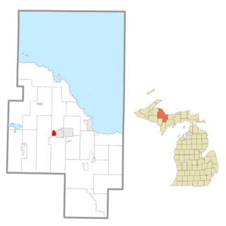
West Ishpeming is an unincorporated community in Marquette County in the U.S. state of Michigan. It is also a census-designated place (CDP) for statistical purposes and has no legal status as an incorporated municipality. The population was 2,552 at the 2010 census. The community is located mostly within Ishpeming Township with a small portion extending south into Tilden Township. The city of Ishpeming borders to the east.

Wheatland Township is a civil township of Sanilac County in the U.S. state of Michigan. The population was 488 at the 2010 census.

<span class="mw-page-title-main">Lonsdale, Minnesota</span> City in Minnesota, United States

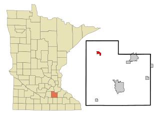
Lonsdale is a city in Rice County, Minnesota, United States. The population was 4,686 at the 2020 census. A fast growing exurb of the Minneapolis-Saint Paul metropolitan area, Lonsdale is located 40 miles south of downtown Minneapolis.

Beatty Township is a township in Saint Louis County, Minnesota, United States. Beatty Township bears the name of a family of pioneer settlers. The population was 372 at the 2010 census.

Clinton Township is a township in Saint Louis County, Minnesota, United States. Clinton Township was named for Clinton Markell, a prominent settler. The population was 1,015 at the 2010 census.

Morse Township is a township in Saint Louis County, Minnesota, United States. The population was 1,213 at the 2010 census.

Frankford Township is a township in Mower County, Minnesota, United States. The population was 358 at the 2000 census. The largest town located partially within the township is Grand Meadow, with a population of 945 people. The eastern half of Grand Meadow is in Frankford Township and the western half is in Grand Meadow Township. All other areas of the township are unincorporated. There was a village called Frankford on Deer Creek in the far eastern part of the township near Fillmore County. It almost became the county seat but lost this distinction to Austin.

<span class="mw-page-title-main">Stevens Township, Bradford County, Pennsylvania</span> Township in Pennsylvania, United States

Stevens Township is a township in Bradford County, Pennsylvania, United States. The population was 437 at the 2010 census.

<span class="mw-page-title-main">West Manheim Township, York County, Pennsylvania</span> Township in Pennsylvania, United States

West Manheim Township is a township in York County, Pennsylvania, United States, just north of the Mason-Dixon Line. The population was 9,052 at the 2020 census. The community is a suburb of Baltimore and part of its Designated Market Area.

<span class="mw-page-title-main">Wheatland, Kenosha County, Wisconsin</span> Town in Wisconsin, United States

Wheatland is a town in Kenosha County, Wisconsin, United States. The population was 3,391 at the 2020 census. The census-designated place of Powers Lake is located partially in the town. The unincorporated communities of Lily Lake, New Munster, and Slades Corners are also located in the town.

<span class="mw-page-title-main">Wheatland, Vernon County, Wisconsin</span> Town in Vernon County, Wisconsin, United States

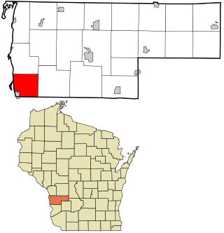
Wheatland is a town in Vernon County, Wisconsin, United States. The population was 533 at the 2000 census. The unincorporated communities of Red Mound, and Victory are located in Wheatland.

Wheatland Township is a civil township of Mecosta County in the U.S. state of Michigan. The population was 1,474 at the 2000 census.

References

  1. 1 2 "U.S. Census website". United States Census Bureau . Retrieved 2008-01-31.
  2. "US Board on Geographic Names". United States Geological Survey. 2007-10-25. Retrieved 2008-01-31.