Wheatland | |
|---|---|
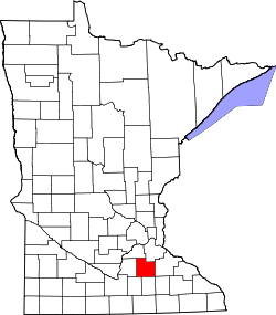
 Wheatland Location of the community of Wheatland within Wheatland Township, Rice County  Wheatland Wheatland (the United States) | |
| Coordinates: 44°27′53″N93°29′01″W / 44.46472°N 93.48361°W | |
| Country | United States |
| State | Minnesota |
| County | Rice County |
| Township | Wheatland Township |
| Elevation | 1,053 ft (321 m) |
| Time zone | UTC-6 (Central (CST)) |
| • Summer (DST) | UTC-5 (CDT) |
| ZIP code | 56069 |
| Area code | 507 |
| GNIS feature ID | 655007 [1] |
Wheatland is an unincorporated community in Wheatland Township, Rice County, Minnesota, United States.
The community is located along Union Lake Trail, near its junctions with Jennings Avenue and Kent Avenue.
Nearby places include Lonsdale, Veseli, Montgomery, New Prague, and Millersburg.
| Census | Pop. | Note | %± |
|---|---|---|---|
| 1900 | 135 | — | |
| 1910 | 85 | −37.0% | |
| U.S. Decennial Census [2] | |||