Lonsdale, Minnesota

Last updated

City of Lonsdale
City
Lonsdale, Minnesota 5.jpg
Downtown Lonsdale
Motto: 
Preserving Our Heritage To Better Our Future
Rice County Minnesota Incorporated and Unincorporated areas Lonsdale Highlighted.svg
Location in the state of Minnesota, USA
Coordinates: 44°28′40″N93°25′21″W / 44.47778°N 93.42250°W / 44.47778; -93.42250
CountryUnited States
State Minnesota
County Rice
Incorporated 1903
Area
[1]
  Total2.66 sq mi (6.88 km2)
  Land2.63 sq mi (6.81 km2)
  Water0.03 sq mi (0.06 km2)
Elevation
[2]
1,135 ft (346 m)
Population
 (2020)
  Total4,686
  Density1,781.07/sq mi (687.70/km2)
Time zone UTC-4 (CST)
  Summer (DST) UTC-5 (CST)
ZIP code
55046
Area code 507
FIPS code 27-38150 [3]
GNIS feature ID2395762 [2]
Website www.lonsdale.govoffice.com

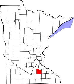
Lonsdale is a city in Rice County, Minnesota, United States. The population was 4,686 at the 2020 census, with a 2024 estimate of 5,112. A fast growing exurb of the Minneapolis-Saint Paul metropolitan area, Lonsdale is located 40 miles south of downtown Minneapolis.

Contents

History

Prior to the American Civil War, a number of families of Czech descent had begun migrating to south central Minnesota from Bohemia. In 1878, a small settlement of Norwegian farmers built a Lutheran church slightly to the southeast of present day Lonsdale. [4] They called the area Trondhjem, after the name of the city in Norway from which they had descended. In 1891, a proposed new railroad from Mankato to Farmington was reported in the New Prague Times. However, construction of this railroad was never initiated due to an economic downturn.

It was the Chicago, Milwaukee and St. Paul Railway that proceeded with plans for their existing branch line from Wells to Mankato, to begin constructing trackage northeastward into Farmington. The extension of this line would bring the possibility of development, population growth and job opportunities to towns along the prospective line such as Cleveland, Le Sueur Center, Veseli and New Market. But the businesses of the Veseli area favored the construction of a spur line of the Minneapolis & St. Louis Railway (M & St. L) from New Prague instead.

In July and August 1901, the Chicago, Milwaukee, and St. Paul Railway created their right-of-way with the purchase of a 100 foot wide strip of land that ran through the Trondhjem settlement and was therefore also a few miles south of Veseli. At the end of 1901, landowner Thomas Wilby entered into an agreement with the Milwaukee Land Company to develop 40 acres of his property. But the contract stipulated that he must first convey land to the Chicago, Milwaukee, and St. Paul Railway that was necessary to build a train depot. The Milwaukee Land Company would then survey and plot the remaining acres of Wilby's land in order to establish a village. By January 1902, a total of 80 acres had been plotted as a new town site. On July 16, 1902 a grand opening of the town of Lonsdale was held as lots were auctioned for sale. Businessman Martin Benzik purchased several of these lots, and constructed the first buildings in Lonsdale: a saloon, a hotel and a livery stable.

The railroad tracks were laid in town on August 1, 1902, and a 20,000 bushel grain elevator was opened on the other side of the railroad tracks from the depot. To be closer to the railway, some former residents of Veseli placed their homes on skids and pulled them to Lonsdale, using steam tractors. In May 1903, Martin Benzik and other businessmen petitioned for incorporation of the land, known as the Village of Lonsdale. A public election was set for July 1, 1903, and with a vote of 24-0 in favor of incorporation, the city of Lonsdale was born. The initial population of the city was 84 people.

The building of the Catholic Church of the Immaculate Conception was completed by the fall of 1904, a rectory was built alongside the church in 1907, and the Catholic school was built in 1912. Also in 1907, the city water tank was built, and the public school house was constructed in 1908. Calvary Hill Cemetery was established south of Lonsdale in 1910. Several theories exist as to how Lonsdale got its name, but it remains a mystery. One theory is that the town was named after the surveyor from the railroad. Another possibility is that it was named for another place named Lonsdale, either in the United States or England.

Geography

According to the United States Census Bureau, the city has a total area of 2.77 square miles (7.17 km2); 2.73 square miles (7.07 km2) is land and 0.04 square miles (0.10 km2) is water. [5]

Minnesota State Highway 19 serves as a main route in the city.

Lonsdale is six miles (10 km) from Interstate 35.

Nearby lakes

Nearby places include Montgomery, Veseli, Webster, and Little Chicago.

Demographics

Historical population
CensusPop.Note
1910 271
1920 45969.4%
1930 50810.7%
1940 5457.3%
1950 510−6.4%
1960 5416.1%
1970 62215.0%
1980 1,16086.5%
1990 1,2527.9%
2000 1,49119.1%
2010 3,674146.4%
2020 4,68627.5%
2024 (est.)5,1129.1%
U.S. Decennial Census

2010 census

As of the census [6] of 2010, there were 3,674 people, 1,277 households, and 976 families living in the city. The population density was 1,345.8 inhabitants per square mile (519.6/km2). There were 1,370 housing units at an average density of 501.8 per square mile (193.7/km2). The racial makeup of the city was 96.5% White, 0.4% African American, 0.3% Native American, 0.8% Asian, 0.3% Pacific Islander, 0.3% from other races, and 1.4% from two or more races. Hispanic or Latino of any race were 1.7% of the population.

There were 1,277 households, of which 49.4% had children under the age of 18 living with them, 64.4% were married couples living together, 6.7% had a female householder with no husband present, 5.3% had a male householder with no wife present, and 23.6% were non-families. 16.6% of all households were made up of individuals, and 4.6% had someone living alone who was 65 years of age or older. The average household size was 2.87 and the average family size was 3.27.

The median age in the city was 29.5 years. 34.2% of residents were under the age of 18; 5.8% were between the ages of 18 and 24; 39.2% were from 25 to 44; 15.9% were from 45 to 64; and 4.9% were 65 years of age or older. The gender makeup of the city was 51.1% male and 48.9% female.

2000 census

As of the census [3] of 2000, there were 1,491 people, 560 households, and 394 families living in the city. The population density was 1,127.3 inhabitants per square mile (435.3/km2). There were 577 housing units at an average density of 436.2 per square mile (168.4/km2). The racial makeup of the city was 98.66% White, 0.20% African American, 0.40% Native American, 0.13% Asian, and 0.60% from two or more races. Hispanic or Latino of any race were 0.34% of the population.

There were 560 households, out of which 39.3% had children under the age of 18 living with them, 58.9% were married couples living together, 6.8% had a female householder with no husband present, and 29.5% were non-families. 23.9% of all households were made up of individuals, and 9.6% had someone living alone who was 65 years of age or older. The average household size was 2.62 and the average family size was 3.12.

In the city, the population was spread out, with 28.4% under the age of 18, 9.5% from 18 to 24, 33.3% from 25 to 44, 16.6% from 45 to 64, and 12.3% who were 65 years of age or older. The median age was 32 years. For every 100 females, there were 99.6 males. For every 100 females age 18 and over, there were 95.6 males.

The median income for a household in the city was $50,054, and the median income for a family was $58,676. Males had a median income of $37,800 versus $25,607 for females. The per capita income for the city was $20,368. About 4.6% of families and 6.1% of the population were below the poverty line, including 4.1% of those under age 18 and 18.8% of those age 65 or over.

Education

Residents of the Lonsdale area are served by two public school districts and one Catholic school. They include:

Tri-City United Public Schools - ISD # 2905

New Prague Public Schools - ISD # 721

Archdiocese of Saint Paul and Minneapolis

Parks and recreation

City parks

Recreation

Related Research Articles

<span class="mw-page-title-main">Allerton, Iowa</span> City in Iowa, United States

Allerton is a city in Wayne County, Iowa. The population was 430 at the time of the 2020 census.

<span class="mw-page-title-main">Clinton, Minnesota</span> Village in Minnesota, United States

Clinton is a city in Big Stone County, Minnesota, United States. The city was named for New York Governor DeWitt Clinton. The population was 386 at the 2020 census.

<span class="mw-page-title-main">Carlton, Minnesota</span> City in Minnesota, United States

Carlton is a city in Carlton County, Minnesota, United States. The population was 948 at the 2020 census. It is the county seat of Carlton County. The town sits on the northwestern edge of Jay Cooke State Park.

<span class="mw-page-title-main">Hayfield, Minnesota</span> City in Minnesota, United States

Hayfield is a city in Dodge County, Minnesota, United States. The population was 1,340 at the 2010 census.

<span class="mw-page-title-main">Mabel, Minnesota</span> City in Minnesota, United States

Mabel is a city in Fillmore County, Minnesota, United States. The population was 780 at the 2010 census.

<span class="mw-page-title-main">Montgomery, Minnesota</span> City in Minnesota, United States

Montgomery is a city in Le Sueur County, Minnesota, United States, 45 miles south of Minneapolis. It was named after Richard Montgomery, an Irish-American soldier who served as a major general in the Continental Army during the Revolutionary War. The population was 2,956 at the 2010 census.

<span class="mw-page-title-main">Watkins, Minnesota</span> City in Minnesota, United States

Watkins is a city in Meeker County, Minnesota, United States. The population was 962 at the 2010 census.

<span class="mw-page-title-main">Currie, Minnesota</span> City in Minnesota, United States

Currie is a city in Murray County, Minnesota, United States. The population was 233 at the 2010 census. Lake Shetek State Park is nearby. The city is known as the "Gateway to Lake Shetek". Currie is notable for its tourism, cuisine, and recreational opportunities. It is home to Lakeside Hideaway and the End-O-Line Railroad Park & Museum, and is the headquarters of Schmitz Grain. Along with the census-designated area The Lakes, Minnesota, the Currie area has a population of close to 1,000.

Trondhjem Township is a township in Otter Tail County, Minnesota, United States. The population was 171 at the 2000 census.

<span class="mw-page-title-main">Denham, Minnesota</span> City in Minnesota, United States

Denham is a city in Pine County, Minnesota, United States. The population was 37 at the 2020 census.

<span class="mw-page-title-main">Benson, Minnesota</span> City in Minnesota, United States

Benson is a city in Swift County, Minnesota, United States, along the Chippewa River. The population was 3,240 at the 2010 census. It is the county seat.

<span class="mw-page-title-main">Albertville, Minnesota</span> City in Minnesota, United States

Albertville is a city in Wright County, Minnesota, United States. The City is a Northwest suburb of the Minneapolis- St Paul “Twin Cities” metropolitan area. The population was 7,896 at the 2020 census.

Wheatland Township is a township located in the northwest corner of Rice County, Minnesota, United States. The population was 1,358 at the 2000 census.

<span class="mw-page-title-main">Reeder, North Dakota</span> City in North Dakota, United States

Reeder is a city in Adams County, North Dakota, United States. The population was 125 at the 2020 census.

<span class="mw-page-title-main">Ellendale, North Dakota</span> City in North Dakota, United States

Ellendale is a city in Dickey County, North Dakota, United States. It is the capital city of Dickey County. The population was 1,125 at the 2020 census. Ellendale was founded in 1882. Ellendale is the home of Trinity Bible College, located on the former campus of the North Dakota State Normal and Industrial School and the Ellendale Opera House currently under renovation.

<span class="mw-page-title-main">South Milwaukee, Wisconsin</span> City in Wisconsin, United States

South Milwaukee is a city in Milwaukee County, Wisconsin, United States. The population was 20,795 at the 2020 census.

<span class="mw-page-title-main">Spring Lake Park, Minnesota</span> City in Minnesota, United States

Spring Lake Park is a city in Anoka and Ramsey counties in the state of Minnesota. The population was 6,412 at the 2010 census. The city is located mainly within Anoka County. Minnesota State Highways 47 and 65 and County Highway 10 are three of the main routes in the city.

<span class="mw-page-title-main">Granite Falls, Minnesota</span> City in Minnesota, United States

Granite Falls is a city located mostly in Yellow Medicine County, Minnesota, of which it is the county seat with a small portion in Chippewa County, Minnesota. The population was 2,737 at the 2020 census. The Andrew John Volstead House, a National Historic Landmark (NHL), is located in Granite Falls. Another NHL located in Granite Falls is the Julian A. Weaver House.

<span class="mw-page-title-main">New Prague, Minnesota</span> City in Minnesota, United States

New Prague is a city in Scott and Le Sueur counties in the state of Minnesota. The population was 8,162 at the 2020 census.

<span class="mw-page-title-main">Sparta, Wisconsin</span> Place in Wisconsin, United States

Sparta is a city in and the county seat of Monroe County, Wisconsin, United States, along the La Crosse River. The population was 10,025 at the 2020 census.

References

  1. "2020 U.S. Gazetteer Files". United States Census Bureau. Retrieved July 24, 2022.
  2. 1 2 U.S. Geological Survey Geographic Names Information System: Lonsdale, Minnesota
  3. 1 2 "U.S. Census website". United States Census Bureau . Retrieved January 31, 2008.
  4. "Historic Trondhjem Church".
  5. "US Gazetteer files 2010". United States Census Bureau. Archived from the original on January 25, 2012. Retrieved November 13, 2012.
  6. "U.S. Census website". United States Census Bureau . Retrieved November 13, 2012.