Warsaw | |
|---|---|
 | |
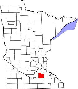
 Warsaw Location of the community of Warsaw within Warsaw Township, Rice County | |
| Coordinates: 44°14′58″N93°23′38″W / 44.24944°N 93.39389°W | |
| Country | United States |
| State | Minnesota |
| County | Rice County |
| Township | Warsaw Township |
| Area | |
• Total | 1.91 sq mi (4.93 km2) |
| • Land | 0.86 sq mi (2.24 km2) |
| • Water | 1.04 sq mi (2.70 km2) |
| Elevation | 1,001 ft (305 m) |
| Population (2020) | |
• Total | 644 |
| • Density | 745.37/sq mi (287.89/km2) |
| Time zone | UTC-6 (Central (CST)) |
| • Summer (DST) | UTC-5 (CDT) |
| ZIP code | 55087 |
| Area code | 507 |
| GNIS feature ID | 653792 [2] |
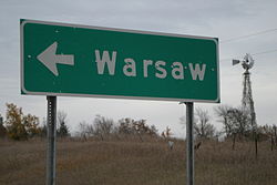
Warsaw is an unincorporated community and census-designated place (CDP) in Warsaw Township, Rice County, Minnesota, United States. As of the 2010 census, its population was 627. [3]
Contents
The community is located east of Morristown and west of Faribault.
Warsaw is located at the junction of State Highway 60 (MN 60) and Rice County Road 13 (Farwell Avenue) on the west side of Cannon Lake.